URGENT URGENT URGENT URGENT U.P. Breaking News Bulletin – 4-29-18 – 3 p.m. ET 2 p.m. CT
Firefighters Continue Battle: Dozens of Upper Peninsula wildfires that includes building and vehicles – and more

By Greg Peterson
U.P. Breaking News
Owner, News Director
906-273-2433
(Upper Peninsula of Michigan) – As some areas of the U.P. are under a flood warning, by Sunday afternoon state and local firefighters have already responded to over two dozen wildfires fires and two involve burning structures.
Also destroyed this weekend were a Chippewa County home/garage and Stephenson, MI dairy barn.

Courtesy: Stephenson Fire Department
As we published this numerous fires were being reported including:
At 2:38 p.m. Sunday another wildfire involving a vehicle was reported in Alger County at on Carlson Road near Shingleton, MI
A grass fire has spread to vehicle and it sounds like it is spreading rapidly,” the 911 dispatcher told firefighters from the Munising Township Volunteer Fire Department.
At 2:41 p.m. ET Sunday, a grass fire near trailers was reported at the Zeba Trailer Park. Someone was burning debris and “it got away from him,” another dispatcher stated to DNR firefighters.
“A grass fire is heading toward the trailers,” a dispatcher told the L’Anse Township Volunteer Fire Department.
About 2 p.m. ET, a camper fire in a remote area off N.5 Road that spread to grass and burned about one and a half acres of hardwoods. The fire is now out however, the wildfire was reported burning out of control in Escanaba Township.
A resident near the blaze called 911 – and her son took an ATV to confirm what was burning.
“She can see the black smoke from her home” told dispatcher told responding firefighters. The woman’s son reported a “camper on fire and it spread to the woods.”
The caller could see “smoke and debris flying in the air.” At 2:55 p.m., the fire was reported knock down.
A few hours earlier in Alger County firefighters were called to 2787 Old U.S.-41 – where a shed was destroyed by a grass wildfire that triggered a response from the Mathias Township Volunteer Fire Department and Rock River Township Volunteer Fire Department had tanker support and was on standby.
On Saturday afternoon a large cattle barn was destroyed by fire at the Pleasant View Dairy Farm located at N8480 Meintz Rd in Stephenson Township, MI. Stillnoword ifall the anmimals surved as many people frantically tried to save animals in the burning barn.
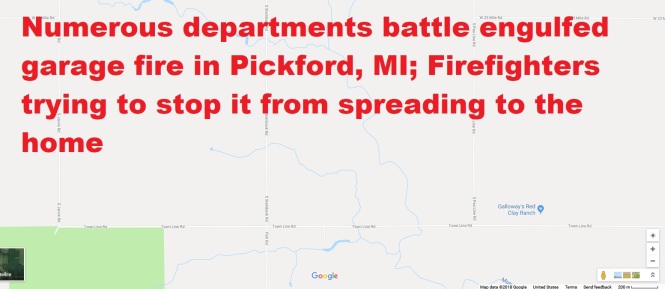
Early Saturday, five fire departments in the eastern U.P. fought a house and garage fire at destroyed the residence at 1088 W. Townline Road – occupied by 45-year-old Linda May Roe and family.
So far this weekend, there have been dozens of wildfires reported in Menominee, Alger, Delta and Schoolcraft counties. The fires have been fought by DNR Fire Suppression teas plus dozens of volunteers firefighters from several townships and cities.
In one of spring’s ironies, Flood Warnings and Advisories have been issued for those who live along the Sturgeon River near Chassell and the Menominee River that forms the state line in Menominee and Dickinson counties.
Chassell area under Sturgeon River flood warnings through Tuesday .
Plus the Menominee River a flood warning affects Dickinson and Menominee counties in U.P. and the WI border counties of Florence and Marinette.
Flood Statement
National Weather Service Marquette MI
1134 AM EDT Sun Apr 29 2018…The Flood Warning continues for the following rivers in Upper
Michigan…Sturgeon River near Chassell affecting Houghton County
.River levels have stabilized on the Sturgeon River near Chassell
as the current level remains just below flood stage at 10.1 feet.
Temperatures will rise rapidly this afternoon into early this week, allowing
snowmelt runoff to increase and river levels to rise again. There is still
ample snowpack in parts of the basin, especially on north aspects and
in heavily wooded areas, which will melt quickly through mid week. Additionally,
some rainfall will occur by mid week, which will also increase the flood threat.PRECAUTIONARY/PREPAREDNESS ACTIONS…
Safety message…Even 6 inches of fast moving flood water can knock
you off your feet…and a depth of 2 feet will float your car. Never
try to walk…swim…or drive through such swift water. If you come
upon flood waters…stop…turn around and go another way.additional weather and river information is available at
http://www.weather.gov/mqtThe next statement will be issued by late this evening.
&&
MIC061-300534-
/O.CON.KMQT.FL.W.0001.000000T0000Z-180501T2200Z/
/CLLM4.1.SM.180427T1100Z.180428T0000Z.180428T0116Z.UU/
1134 AM EDT Sun Apr 29 2018The Flood Warning continues for
The Sturgeon River near Chassell.
* until Tuesday evening.
* At 11:00 AM Sunday the stage was 10.1 feet and steady.
* Flood stage is 10.5 feet.
* At 10.5 feet…The river begins to overflow onto Sturgeon River
Road…Rajala Road…and Aho Road.
Flood Statement National Weather Service Green Bay WI 1030 AM CDT Sun Apr 29 2018 …The Flood Advisory continues for the Menominee River… Menominee River near Vulcan affecting Dickinson…Menominee and Marinette Counties Menominee River near McAllister affecting Menominee and Marinette Counties Synoptic conditions continue to support high flows on area rivers and streams. PRECAUTIONARY/PREPAREDNESS ACTIONS… Although below flood stage, flows are above normal and could be a hazard to boaters and other recreational interests along the river. && MIC043-109-WIC075-301849- /O.CON.KGRB.FL.Y.0011.000000T0000Z-180430T1849Z/ /VLCM4.N.SM.000000T0000Z.000000T0000Z.000000T0000Z.OO/ 1030 AM CDT Sun Apr 29 2018 The Flood Advisory continues for The Menominee River near Vulcan * At 10:00 AM Sunday the stage was 9.9 feet. * Flood stage is 15.0 feet. * The river is forecast to reach a maximum stage of 10.0 feet this afternoon. * Impacts at 12.0 feet. There is some minor flooding of adjacent farmland and wooded lowland. High flows will continue. * Impacts at 9.0 feet. There is lowland flooding along the river. && LAT…LON 4580 8784 4568 8772 4547 8775 4550 8787 4573 8790 $$
Flood Statement National Weather Service Green Bay WI 1030 AM CDT Sun Apr 29 2018 …The Flood Advisory continues for the Menominee River… Menominee River near Vulcan affecting Dickinson…Menominee and Marinette Counties Menominee River near McAllister affecting Menominee and Marinette Counties Synoptic conditions continue to support high flows on area rivers and streams. PRECAUTIONARY/PREPAREDNESS ACTIONS… Although below flood stage, flows are above normal and could be a hazard to boaters and other recreational interests along the river. && MIC109-WIC075-301849- /O.CON.KGRB.FL.Y.0012.000000T0000Z-180430T1849Z/ /MCAW3.N.SM.000000T0000Z.000000T0000Z.000000T0000Z.OO/ 1030 AM CDT Sun Apr 29 2018 The Flood Advisory continues for The Menominee River near McAllister * At 9:15 AM Sunday the stage was 13.6 feet. * Flood stage is 15.0 feet. * The river is forecast to reach a maximum stage of 13.6 feet this afternoon. * Impacts at 12.0 feet. Which is bankfull stage…there is minor flooding of wooded lowland. High flows will continue. && LAT…LON 4535 8763 4519 8771 4510 8759 4508 8760 4516 8783 4535 8769 $$
Flood Statement National Weather Service Green Bay WI 930 AM CDT Sun Apr 29 2018 …The Flood Advisory continues for the Menominee River… Menominee River near Kingsford affecting Dickinson…Florence and Marinette Counties Menominee River near Big Quinnesec Falls Dam affecting Dickinson…Menominee…Florence and Marinette Counties Synoptic conditions continue to support high flows on area rivers and streams. PRECAUTIONARY/PREPAREDNESS ACTIONS… Although below flood stage, flows are above normal and could be a hazard to boaters and other recreational interests along the river. && MIC043-109-WIC037-075-301411- /O.CON.KGRB.FL.Y.0014.000000T0000Z-180430T1411Z/ /BGQW3.N.SM.000000T0000Z.000000T0000Z.000000T0000Z.OO/ 930 AM CDT Sun Apr 29 2018 The Flood Advisory continues for The Menominee River near Big Quinnesec Falls Dam * At 9:10 AM Sunday the flow was 5363 cfs. * Impacts at 5000 cfs. While flooding is not expected…rivers flows are high or expected to increase. Recreational interests should monitor the river. Property owners adjacent to the river should consider protecting shoreline equipment including docks piers and boats. && LAT…LON 4588 8811 4579 8790 4572 8790 4579 8819 $$
Flood Statement National Weather Service Green Bay WI 930 AM CDT Sun Apr 29 2018 …The Flood Advisory continues for the Menominee River… Menominee River near Kingsford affecting Dickinson…Florence and Marinette Counties Menominee River near Big Quinnesec Falls Dam affecting Dickinson…Menominee…Florence and Marinette Counties Synoptic conditions continue to support high flows on area rivers and streams. PRECAUTIONARY/PREPAREDNESS ACTIONS… Although below flood stage, flows are above normal and could be a hazard to boaters and other recreational interests along the river. && MIC043-WIC037-075-301411- /O.CON.KGRB.FL.Y.0013.000000T0000Z-180430T1411Z/ /KFDM4.N.SM.000000T0000Z.000000T0000Z.000000T0000Z.OO/ 930 AM CDT Sun Apr 29 2018 The Flood Advisory continues for The Menominee River near Kingsford * At 9:10 AM Sunday the flow was 4877 cfs. * Impacts at 8000 cfs. Flows at this rate downstream from the Kingsford dam may impact some shoreline structures.