URGENT URGENT URGENT URGENT U.P. Breaking News Bulletin with Wild Blizzard Tales – 4-15-18 – 10:50 p.m. ET
Amazing photos – and THANK YOU to all out there risking their lives for our safety – many recues.

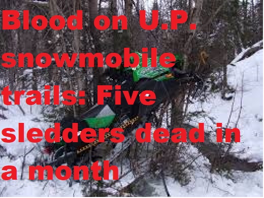
Storm Menominee County E-611

Storm Menominee County E-611
Wild photos as major cyclonic blizzard is pounding the U.P. for another 24 hours – but SUMMER is a coming and we have unusual stories like the brave U.P. man enjoying life, feeling alive in a wheelchair, who tried to take a ride (yeah, not recommended but I’d do it if in a wheelchair)
By Greg Peterson
U.P. Breaking News
Owner, News Director
906-273-2433
(Upper Peninsula of Michigan) – An epic blizzard will continue pounding the Upper Peninsula of Michigan until Monday night with another half foot in a cyclonic snowstorm that has left several feet of snow closed major highways, caused hundreds of wrecks and even more sliding off into snowbanks.
All U.P. schools will be closed on Monday along with most activities. Do not venture out in this storm.
See the wild blizzard photos that people have posted on Facebook and amazing photos from Menominee County E-911. Roads and highways were closed across the U.P. including C.R. 577 in Menominee Township.
There has been at least one death – fatal ORV wreck in Ishpeming – and many evacuated from neighboring homes in Escanaba this morning as winds whipped blaze destroyed two-story home – no one hurt.
Despite criticism that will come, I thought a man in his wheelchair who tried to literally “ride” out the storm was brave and feeling happy (he actually took a ride) – probably just feeling alive. Yes, he got stuck. Yes Gogebic County officials had to carry him back into the home and dislodge the wheel chair. Man is fine – probably still getting scolded.
***A HUGE HUGE HUGE thank you to all the Michigan State Police, all U.P. deputy sheriff’s, police officers, paramedics, snowplow drivers, EMTs, firefighters every where, first responders, Corrections Officers, Michigan DNR officials like conservation officers and everyone out there risking their lives to rescue many and protect us during major storm!!!
Cars have rolled, many mutli-vehicle accidents, roads signs destroyed by cars that are badly wreck – at least two incidents involved losing the entire tires.
Even tow trucks and snowplows have gotten stuck.
At 9:50 p.m. Sunday Night, new warnings were issued by the Marquette National Weather Service Office in Negaunee Township (scroll down below photos).


Brenda Beach Photo

Storm Menominee County E-611

Storm Menominee County E-611
Storm Menominee County E-611

Storm Menominee County E-611

Storm Menominee County E-611
Storm Menominee County E-611 7


URGENT – WINTER WEATHER MESSAGE
National Weather Service Marquette MI
949 PM EDT Sun Apr 15 2018
MIZ007-013-014-085-161000-
/O.CON.KMQT.WS.W.0009.000000T0000Z-180417T0000Z/
Luce-Delta-Southern Schoolcraft-Northern Schoolcraft-
Including the cities of Newberry, Escanaba, Gladstone,
Manistique, and Seney
949 PM EDT Sun Apr 15 2018
…WINTER STORM WARNING REMAINS IN EFFECT UNTIL 8 PM EDT MONDAY…
* WHAT…Snow and mixed precipitation expected. Additional snow
accumulations of 1 to 3 inches are expected tonight with another
2 to 5 inches Monday as the snow intensity increases again. The
light snow tonight will mix with light freezing rain or
freezing drizzle, leading to a light glaze of ice.
* WHERE…Luce, Delta, Southern Schoolcraft and Northern
Schoolcraft Counties.
* WHEN…Until 8 PM EDT Monday.
* ADDITIONAL DETAILS…Travel will be very difficult, especially
on those roads not plowed. As a result, travel is strongly
discouraged.
PRECAUTIONARY/PREPAREDNESS ACTIONS…
A Winter Storm Warning means significant amounts of snow, sleet
and ice will make travel very hazardous or impossible.
&&
$$
URGENT – WINTER WEATHER MESSAGE
National Weather Service Marquette MI
949 PM EDT Sun Apr 15 2018
MIZ004>006-161000-
/O.CON.KMQT.WS.W.0009.000000T0000Z-180417T0000Z/
Baraga-Marquette-Alger-
Including the cities of L`Anse, Gwinn, Marquette, Grand Marais,
and Munising
949 PM EDT Sun Apr 15 2018
…WINTER STORM WARNING REMAINS IN EFFECT UNTIL 8 PM EDT MONDAY…
* WHAT…Snow and blowing snow along with mixed precipitation
expected. Additional snow accumulations of 1 to 3 inches are
expected tonight with another 3 to 6 inches possible Monday. The
snow will also mix with light freezing drizzle at times tonight.
Although the snow and blowing snow has diminished tonight,
expect it to increase again on Monday. However, the snow
intensity on Monday is not expected to be as heavy as what has
occurred today.
* WHERE…Baraga, Marquette and Alger Counties.
* WHEN…Until 8 PM EDT Monday.
* ADDITIONAL DETAILS…Travel will be very difficult to
impossible, especially on those roads not plowed. As a result,
travel is strongly discouraged. Winds gusting as high as 35 mph
will cause areas of blowing and drifting snow, leading to very
low visibility at times.
PRECAUTIONARY/PREPAREDNESS ACTIONS…
A Winter Storm Warning means significant amounts of snow, sleet
and ice will make travel very hazardous or impossible.
&&
$$
URGENT – WINTER WEATHER MESSAGE
National Weather Service Marquette MI
949 PM EDT Sun Apr 15 2018
MIZ001>003-009-084-161000-
/O.CON.KMQT.WS.W.0009.000000T0000Z-180416T1200Z/
Keweenaw-Ontonagon-Northern Houghton-Gogebic-Southern Houghton-
Including the cities of Copper Harbor, Ontonagon, Houghton,
Hancock, Ironwood, Kenton, and Sidnaw
949 PM EDT Sun Apr 15 2018 /849 PM CDT Sun Apr 15 2018/
…WINTER STORM WARNING REMAINS IN EFFECT UNTIL 8 AM EDT /7 AM
CDT/ MONDAY…
* WHAT…Snow and blowing snow expected. Additional snow
accumulations of 2 to 4 inches are expected by sunrise Monday.
Additional light to moderate snow is possible on Monday.
* WHERE…Keweenaw, Ontonagon, Northern Houghton, Gogebic and
Southern Houghton Counties.
* WHEN…Until 8 AM EDT /7 AM CDT/ Monday.
* ADDITIONAL DETAILS…Travel will be very difficult, especially
on those roads not plowed. As a result, travel is strongly
discouraged. Winds gusting as high as 35 mph will cause areas of
blowing and drifting snow, leading to very low visibility at
times. The strongest winds and most significant blowing snow
will be over the Keweenaw Peninsula.
PRECAUTIONARY/PREPAREDNESS ACTIONS…
A Winter Storm Warning for snow and blowing snow means severe
winter weather conditions will make travel very hazardous or
impossible. If you must travel, keep an extra flashlight, food
and water in your vehicle in case of an emergency.
&&
$$
URGENT – WINTER WEATHER MESSAGE
National Weather Service Duluth MN
901 PM CDT Sun Apr 15 2018
…HEAVY SNOW AND STRONG WINDS ACROSS NORTHWEST WISCONSIN AND
PORTIONS OF MINNESOTA THROUGH TONIGHT…
.An early spring storm system continues to affect the Northland
impacting all of northwest Wisconsin and parts of northeast and
east central Minnesota. Satellite and radar imagery indicate a
continued trend for moderate to heavy snowfall into this evening,
with winds becoming favorable for lake-enhanced bands of snow to
develop, mainly along the South Shore. Snowfall rates have
exceeded an inch per hour at times and these rates will continue
into the evening hours. In addition, low visibility is expected
because of strong northeast winds that will accompany the falling
snow. The wind and snow will combine to produce blizzard
conditions into tonight in parts of northwest Wisconsin from
Superior east towards Bayfield and Ashland, resulting in near
impossible travel conditions. Winds will gradually decrease after
midnight tonight resulting in improving visibility.
WIZ004-161200-
/O.CON.KDLH.WS.W.0012.000000T0000Z-180416T1200Z/
Iron-
Including the city of Hurley
901 PM CDT Sun Apr 15 2018
…WINTER STORM WARNING REMAINS IN EFFECT UNTIL 7 AM CDT MONDAY…
* WHAT…Heavy snow. Additional snow accumulations of 2 to 6
inches, with localized amounts up to 7 inches, are expected.
The lower amounts will occur in southern Iron County.
* WHERE…Iron County.
* WHEN…Until 7 AM CDT Monday.
* ADDITIONAL DETAILS…Plan on difficult travel conditions.
Expect significant reductions in visibility at times.
PRECAUTIONARY/PREPAREDNESS ACTIONS…
A Winter Storm Warning for snow means severe winter weather
conditions will make travel very hazardous or impossible. If you
must travel, keep an extra flashlight, food and water in your
vehicle in case of an emergency. The latest road conditions for
Minnesota can be found at 511mn.org, and for Wisconsin at
511wi.gov, or by calling 511 in either state.
&&
$