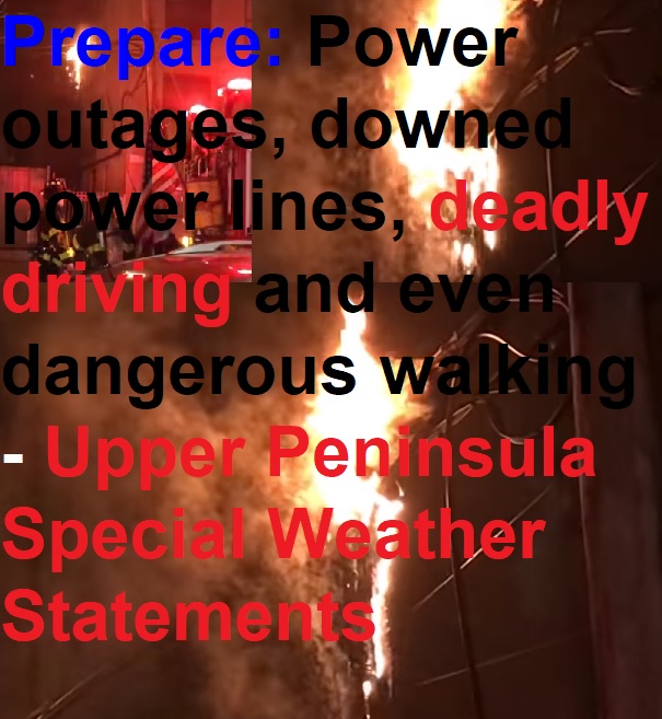
Winter Weather Advisory
URGENT - WINTER WEATHER MESSAGE
National Weather Service Marquette MI
1126 AM EST Thu Jan 11 2018

MIZ006-120030-
/O.CON.KMQT.WW.Y.0003.180111T1900Z-180112T1700Z/
Alger-
Including the cities of Grand Marais and Munising
1126 AM EST Thu Jan 11 2018

...WINTER WEATHER ADVISORY REMAINS IN EFFECT FROM 2 PM THIS
AFTERNOON TO NOON EST FRIDAY...

* WHAT...Snow and blowing snow expected. Plan on slippery road
  conditions, especially this evening as rapidly falling
  temperatures late this afternoon quickly create icy conditions.
  In addition, areas of poor visibility are expected tonight.
  Total snow accumulations of 3 to 5 inches are expected.

* WHERE...Alger County.

* WHEN...From 2 PM this afternoon to noon EST Friday.

* ADDITIONAL DETAILS...Winds gusting as high as 40 mph will
  cause areas of blowing and drifting snow tonight.

PRECAUTIONARY/PREPAREDNESS ACTIONS...

A Winter Weather Advisory for snow and blowing snow means periods
of snow and blowing snow will cause primarily travel
difficulties. Be prepared for snow covered roads and limited
visibilities, and use caution while driving.

$$
URGENT - WINTER WEATHER MESSAGE
National Weather Service Marquette MI
1126 AM EST Thu Jan 11 2018

MIZ004-084-120030-
/O.CON.KMQT.WW.Y.0003.000000T0000Z-180112T0600Z/
Baraga-Southern Houghton-
Including the cities of L`Anse, Kenton, and Sidnaw
1126 AM EST Thu Jan 11 2018

...WINTER WEATHER ADVISORY REMAINS IN EFFECT UNTIL 1 AM EST
FRIDAY...

* WHAT...Snow and blowing snow occurring. Plan on slippery road
  conditions, especially during the evening commute as rapidly
  falling temperatures quickly create icy conditions this
  afternoon. Additional snow accumulations of 3 to 5 inches are
  expected this afternoon and evening.

* WHERE...Baraga and Southern Houghton Counties.

* WHEN...Until 1 AM EST Friday. The most hazardous conditions are
  expected late this afternoon into early evening.

* ADDITIONAL DETAILS...Winds gusting as high as 30 mph will
  cause patchy blowing and drifting snow.

PRECAUTIONARY/PREPAREDNESS ACTIONS...

A Winter Weather Advisory for snow and blowing snow means periods
of snow and blowing snow will cause primarily travel
difficulties. Be prepared for snow covered roads and limited
visibilities, and use caution while driving.

$$
URGENT - WINTER WEATHER MESSAGE
National Weather Service Marquette MI
1126 AM EST Thu Jan 11 2018

MIZ010-120000-
/O.CON.KMQT.WW.Y.0003.000000T0000Z-180112T0000Z/
Iron-
Including the city of Iron River
1026 AM CST Thu Jan 11 2018

...WINTER WEATHER ADVISORY REMAINS IN EFFECT UNTIL 6 PM CST THIS
EVENING...

* WHAT...Snow occurring. Plan on slippery road conditions as
  rapidly falling temperatures this afternoon quickly create icy
  conditions. Additional snow accumulations of 1 to 3 inches are
  expected.

* WHERE...Iron County.

* WHEN...Until 6 PM CST this evening.

* ADDITIONAL DETAILS...Be prepared for reduced visibilities at
  times.

PRECAUTIONARY/PREPAREDNESS ACTIONS...

A Winter Weather Advisory for snow means periods of snow will
cause primarily travel difficulties. Be prepared for snow covered
roads and limited visibilities, and use caution while driving.

$$
URGENT - WINTER WEATHER MESSAGE
National Weather Service Marquette MI
1126 AM EST Thu Jan 11 2018

MIZ005-120030-
/O.CON.KMQT.WW.Y.0003.180111T1700Z-180112T1100Z/
Marquette-
Including the cities of Gwinn and Marquette
1126 AM EST Thu Jan 11 2018

...WINTER WEATHER ADVISORY REMAINS IN EFFECT UNTIL 6 AM EST
FRIDAY...

* WHAT...Snow and blowing snow expected. Light rain late this
  morning will transition to snow by early afternoon, then fall
  moderately at times during the remainder of the afternoon. The
  snow will then transition to light to moderate lake effect snow
  tonight. Plan on slippery road conditions, especially during the
  evening commute as rapidly falling temperatures quickly create
  icy conditions this afternoon. Total snow accumulations of 2 to
  4 inches this afternoon and tonight are expected, with
  localized amounts up to 5 inches across the high terrain north
  of Negaunee and Ishpeming.

* WHERE...Marquette County.

* WHEN...Until 6 AM EST Friday. The most hazardous conditions are
  expected late this afternoon into early evening.

* ADDITIONAL DETAILS...Winds gusting as high as 35 mph will cause
  areas of blowing and drifting snow tonight along the Lake
  Superior shore.

PRECAUTIONARY/PREPAREDNESS ACTIONS...

A Winter Weather Advisory for snow and blowing snow means periods
of snow and blowing snow will cause primarily travel
difficulties. Be prepared for snow covered roads and limited
visibilities, and use caution while driving.

$$
Hazardous Weather Outlook
National Weather Service Marquette MI
517 AM EST Thu Jan 11 2018

LSZ162-240>251-263>267-121030-
Lake Superior west of a line from Saxon Harbor WI to Grand
Portage MN beyond 5NM-Saxon Harbor WI to Black River MI-
Black River to Ontonagon MI-
Ontonagon to Upper Entrance of Portage Canal MI-
Upper Entrance of Portage Canal to Eagle River MI-
Eagle River to Manitou Island MI-
Manitou Island to Point Isabelle MI-
Point Isabelle to Lower Entrance of Portage Canal MI-
Lower Entrance of Portage Canal To Huron Islands MI Including
Keweenaw and Huron Bays-Huron Islands to Marquette MI-
Marquette to Munising MI-Munising to Grand Marais MI-
Grand Marais to Whitefish Point MI-
Lake Superior from Saxon Harbor WI to Upper Entrance to Portage
Canal MI 5NM off shore to the US/Canadian border including Isle
Royale National Park-
Lake Superior from Upper Entrance to Portage Canal to Manitou
Island MI 5NM off shore to the US/Canadian Border-
Lake Superior West of Line from Manitou Island to Marquette MI
Beyond 5NM from shore-
Lake Superior East of a line from Manitou Island to Marquette MI
and West of a line from Grand Marais MI to the US/Canadian Border
Beyond 5NM from shore-
Lake Superior from Grand Marais MI to Whitefish Point MI 5NM off
shore to the US/Canadian border-
517 AM EST Thu Jan 11 2018 /417 AM CST Thu Jan 11 2018/

This Hazardous Weather Outlook is for portions of Eastern Lake
Superior...Central Lake Superior and Western Lake Superior.

.DAY ONE...Today and Tonight

North gales of 35 to 45 knots will develop from west to east on
today. Heavy freezing spray will also develop. Gales will end
from west to east tonight. See the latest marine weather product
and open lake forecast for further details.

.DAYS TWO THROUGH SEVEN...Friday through Wednesday

Heavy freezing spray will be possible at times over eastern Lake
Superior Friday afternoon through Saturday morning. See the
latest marine weather product and open lake forecast for further
details.

.SPOTTER INFORMATION STATEMENT...

The need for weather spotter reports is not anticipated at this
time.

$$
Hazardous Weather Outlook
National Weather Service Marquette MI
517 AM EST Thu Jan 11 2018

MIZ001>007-009>014-084-085-121030-
Keweenaw-Ontonagon-Northern Houghton-Baraga-Marquette-Alger-Luce-
Gogebic-Iron-Dickinson-Menominee-Delta-Southern Schoolcraft-
Southern Houghton-Northern Schoolcraft-
517 AM EST Thu Jan 11 2018 /417 AM CST Thu Jan 11 2018/

This Hazardous Weather Outlook is for portions of western Upper
Michigan and central Upper Michigan.

.DAY ONE...Today and Tonight

Freezing rain and snow will change to all snow west late this
morning. Over the central, rain will change to freezing rain and
snow, then all snow from west to east this afternoon and early
evening as temperatures rapidly fall. Blowing snow will also
develop, especially near Lake Superior. Snow will diminish from
west to east tonight. Snow accumulations are expected, heaviest
west. See the latest winter weather statement for complete
details.

Waves on Lake Superior to as high as 14 feet through tonight may
cause minor beach erosion and flooding where ice has not built up
along the shore.

.DAYS TWO THROUGH SEVEN...Friday through Wednesday

Moderate lake enhanced snow is possible Friday through Saturday
near Lake Superior.

Moderate to heavy lake enhanced snow is possible Monday and
Monday night near Lake Superior.

.SPOTTER INFORMATION STATEMENT...

Weather spotters are encouraged to submit reports of snow and ice
accumulation to the National Weather Service in Marquette via
phone or on Facebook or Twitter.

$$
Hazardous Weather Outlook
National Weather Service La Crosse WI
1022 AM CST Thu Jan 11 2018

IAZ008>010-018-019-MNZ079-086>088-094>096-WIZ017-029-032>034-041-
121200-
Mitchell-Howard-Winneshiek-Floyd-Chickasaw-Wabasha-Dodge-Olmsted-
Winona-Mower-Fillmore-Houston-Taylor-Clark-Buffalo-Trempealeau-
Jackson-La Crosse-
1022 AM CST Thu Jan 11 2018

This Hazardous Weather Outlook is for portions of southeast
Minnesota, northeast Iowa, and western and north central
Wisconsin.

.DAY ONE...This Afternoon and Tonight

2 to 5 inches of snow is expected. Northwest winds gusting to 35
mph will cause some blowing and drifting snow in open and
unsheltered areas. Plan on slippery driving conditions. A Winter
Weather Advisory is in effect through the afternoon.

Wind chills will range from 15 to 30 below tonight.

.DAYS TWO THROUGH SEVEN...Friday through Thursday

On Sunday afternoon and night, some light snow accumulations are
likely.

Wind chills will range from 15 to 30 below Saturday and Sunday
night, and 20 to 35 below Monday night.

.SPOTTER INFORMATION STATEMENT...

Snow amounts would be appreciated today.

.EMERGENCY MANAGEMENT COORDINATION...

No webinar is scheduled.

$$
Gale Warning
URGENT - MARINE WEATHER MESSAGE
National Weather Service Marquette MI
1034 AM EST Thu Jan 11 2018

LSZ243>245-264-112345-
/O.CON.KMQT.GL.W.0005.000000T0000Z-180112T0900Z/
/O.CON.KMQT.UP.W.0003.000000T0000Z-180112T1500Z/
Upper Entrance of Portage Canal to Eagle River MI-
Eagle River to Manitou Island MI-
Manitou Island to Point Isabelle MI-
Lake Superior from Upper Entrance to Portage Canal to Manitou
Island MI 5NM off shore to the US/Canadian Border-
1034 AM EST Thu Jan 11 2018

...GALE WARNING REMAINS IN EFFECT UNTIL 4 AM EST FRIDAY...
...HEAVY FREEZING SPRAY WARNING REMAINS IN EFFECT UNTIL 10 AM EST
FRIDAY...

A Heavy Freezing Spray Warning remains in effect until 10 AM EST
Friday.

* TIMING...Expect heavy freezing spray to occur until 10 AM EST
  Friday.

A Gale Warning remains in effect until 4 AM EST Friday.

* WIND AND WAVES DURING THE GALE WARNING...Expect sustained
  winds of up to 31 knots from the north, with gusts up to 44
  knots. The largest expected significant waves will be 12 feet
  with a maximum wave height of up to 17 feet possible.

* TIMING...The maximum winds are expected around 7 PM EST
  Thursday with the largest waves expected around 11 PM EST
  Thursday.

Please see the latest marine forecasts for more detailed
information.

PRECAUTIONARY/PREPAREDNESS ACTIONS...

A Heavy Freezing Spray Warning means heavy freezing spray is
expected to rapidly accumulate on vessels. These conditions can
be extremely hazardous to navigation. It is recommended that
mariners not trained to operate in these conditions or vessels
not properly equipped to do so, remain in port or avoid the
warning area.

A Gale Warning means winds of 34 to 47 knots are imminent or
occurring. Operating a vessel in gale conditions requires
experience and properly equipped vessels. It is highly
recommended that mariners without the proper experience seek safe
harbor prior to the onset of gale conditions.

&&

$$
URGENT - MARINE WEATHER MESSAGE
National Weather Service Marquette MI
1034 AM EST Thu Jan 11 2018

LSZ248>250-112345-
/O.CON.KMQT.GL.W.0005.180111T2100Z-180112T1200Z/
/O.CON.KMQT.UP.W.0003.180111T2100Z-180112T1800Z/
Huron Islands to Marquette MI-Marquette to Munising MI-
Munising to Grand Marais MI-
1034 AM EST Thu Jan 11 2018

...GALE WARNING REMAINS IN EFFECT FROM 4 PM THIS AFTERNOON TO
7 AM EST FRIDAY...
...HEAVY FREEZING SPRAY WARNING REMAINS IN EFFECT FROM 4 PM THIS
AFTERNOON TO 1 PM EST FRIDAY...

A Heavy Freezing Spray Warning remains in effect from 4 PM this
afternoon to 1 PM EST Friday.

* TIMING...Expect heavy freezing spray to occur from 4 PM this
  afternoon to 1 PM EST Friday.

A Gale Warning remains in effect from 4 PM this afternoon to 7 AM
EST Friday.

* WIND AND WAVES DURING THE GALE WARNING...Expect sustained
  winds of up to 30 knots from the north, with gusts up to 41
  knots. The largest expected significant waves will be 14 feet
  with a maximum wave height of up to 20 feet possible.

* TIMING...The maximum winds are expected around 12 AM EST
  Friday with the largest waves expected around 2 AM EST Friday.

Please see the latest marine forecasts for more detailed
information.

PRECAUTIONARY/PREPAREDNESS ACTIONS...

A Heavy Freezing Spray Warning means heavy freezing spray is
expected to rapidly accumulate on vessels. These conditions can
be extremely hazardous to navigation. It is recommended that
mariners not trained to operate in these conditions or vessels
not properly equipped to do so, remain in port or avoid the
warning area.

A Gale Warning means winds of 34 to 47 knots are imminent or
occurring. Operating a vessel in gale conditions requires
experience and properly equipped vessels. It is highly
recommended that mariners without the proper experience seek safe
harbor prior to the onset of gale conditions.

&&

$$
URGENT - MARINE WEATHER MESSAGE
National Weather Service Marquette MI
1034 AM EST Thu Jan 11 2018

LSZ242-263-112345-
/O.CON.KMQT.GL.W.0005.000000T0000Z-180112T0600Z/
/O.CON.KMQT.UP.W.0003.000000T0000Z-180112T1500Z/
Ontonagon to Upper Entrance of Portage Canal MI-
Lake Superior from Saxon Harbor WI to Upper Entrance to Portage
Canal MI 5NM off shore to the US/Canadian border including Isle
Royale National Park-
1034 AM EST Thu Jan 11 2018

...GALE WARNING REMAINS IN EFFECT UNTIL 1 AM EST FRIDAY...
...HEAVY FREEZING SPRAY WARNING REMAINS IN EFFECT UNTIL 10 AM EST
FRIDAY...

A Heavy Freezing Spray Warning remains in effect until 10 AM EST
Friday.

* TIMING...Expect heavy freezing spray to occur until 10 AM EST
  Friday.

A Gale Warning remains in effect until 1 AM EST Friday.

* WIND AND WAVES DURING THE GALE WARNING...Expect sustained
  winds of up to 29 knots from the north, with gusts up to 43
  knots. The largest expected significant waves will be 10 feet
  with a maximum wave height of up to 15 feet possible.

* TIMING...The maximum winds are expected around 11 AM EST
  Thursday with the largest waves expected around 9 PM EST
  Thursday.

Please see the latest marine forecasts for more detailed
information.

PRECAUTIONARY/PREPAREDNESS ACTIONS...

A Heavy Freezing Spray Warning means heavy freezing spray is
expected to rapidly accumulate on vessels. These conditions can
be extremely hazardous to navigation. It is recommended that
mariners not trained to operate in these conditions or vessels
not properly equipped to do so, remain in port or avoid the
warning area.

A Gale Warning means winds of 34 to 47 knots are imminent or
occurring. Operating a vessel in gale conditions requires
experience and properly equipped vessels. It is highly
recommended that mariners without the proper experience seek safe
harbor prior to the onset of gale conditions.

&&

$$
URGENT - MARINE WEATHER MESSAGE
National Weather Service Marquette MI
1034 AM EST Thu Jan 11 2018

LSZ265-266-112345-
/O.CON.KMQT.GL.W.0005.180111T1800Z-180112T1200Z/
/O.CON.KMQT.UP.W.0003.180111T2100Z-180112T1800Z/
Lake Superior West of Line from Manitou Island to Marquette MI
Beyond 5NM from shore-
Lake Superior East of a line from Manitou Island to Marquette MI
and West of a line from Grand Marais MI to the US/Canadian Border
Beyond 5NM from shore-
1034 AM EST Thu Jan 11 2018

...GALE WARNING REMAINS IN EFFECT UNTIL 7 AM EST FRIDAY...
...HEAVY FREEZING SPRAY WARNING REMAINS IN EFFECT FROM 4 PM THIS
AFTERNOON TO 1 PM EST FRIDAY...

A Gale Warning remains in effect until 7 AM EST Friday.

* WIND AND WAVES DURING THE GALE WARNING...Expect sustained
  winds of up to 30 knots from the north, with gusts up to 45
  knots. The largest expected significant waves will be 14 feet
  with a maximum wave height of up to 20 feet possible.

* TIMING...The maximum winds are expected around 12 AM EST
  Friday with the largest waves expected around 2 AM EST Friday.

A Heavy Freezing Spray Warning remains in effect from 4 PM this
afternoon to 1 PM EST Friday.

* TIMING...Expect heavy freezing spray to occur from 4 PM this
  afternoon to 1 PM EST Friday.

Please see the latest marine forecasts for more detailed
information.

PRECAUTIONARY/PREPAREDNESS ACTIONS...

A Gale Warning means winds of 34 to 47 knots are imminent or
occurring. Operating a vessel in gale conditions requires
experience and properly equipped vessels. It is highly
recommended that mariners without the proper experience seek safe
harbor prior to the onset of gale conditions.

A Heavy Freezing Spray Warning means heavy freezing spray is
expected to rapidly accumulate on vessels. These conditions can
be extremely hazardous to navigation. It is recommended that
mariners not trained to operate in these conditions or vessels
not properly equipped to do so, remain in port or avoid the
warning area.

&&

$$
URGENT - MARINE WEATHER MESSAGE
National Weather Service Marquette MI
1034 AM EST Thu Jan 11 2018

LSZ251-267-112345-
/O.CON.KMQT.UP.W.0003.180111T2100Z-180112T1800Z/
/O.CON.KMQT.GL.W.0005.180112T0000Z-180112T1200Z/
Grand Marais to Whitefish Point MI-
Lake Superior from Grand Marais MI to Whitefish Point MI 5NM off
shore to the US/Canadian border-
1034 AM EST Thu Jan 11 2018

...HEAVY FREEZING SPRAY WARNING REMAINS IN EFFECT FROM 4 PM THIS
AFTERNOON TO 1 PM EST FRIDAY...
...GALE WARNING REMAINS IN EFFECT FROM 7 PM THIS EVENING TO 7 AM
EST FRIDAY...

A Heavy Freezing Spray Warning remains in effect from 4 PM this
afternoon to 1 PM EST Friday.

* TIMING...Expect heavy freezing spray to occur from 4 PM this
  afternoon to 1 PM EST Friday.

A Gale Warning remains in effect from 7 PM this evening to 7 AM
EST Friday.

* WIND AND WAVES DURING THE GALE WARNING...Expect sustained
  winds of up to 26 knots from the north, with gusts up to 37
  knots. The largest expected significant waves will be 10 feet
  with a maximum wave height of up to 14 feet possible.

* TIMING...The maximum winds are expected around 8 PM EST
  Thursday with the largest waves expected around 2 AM EST
  Friday.

Please see the latest marine forecasts for more detailed
information.

PRECAUTIONARY/PREPAREDNESS ACTIONS...

A Heavy Freezing Spray Warning means heavy freezing spray is
expected to rapidly accumulate on vessels. These conditions can
be extremely hazardous to navigation. It is recommended that
mariners not trained to operate in these conditions or vessels
not properly equipped to do so, remain in port or avoid the
warning area.

A Gale Warning means winds of 34 to 47 knots are imminent or
occurring. Operating a vessel in gale conditions requires
experience and properly equipped vessels. It is highly
recommended that mariners without the proper experience seek safe
harbor prior to the onset of gale conditions.

&&

$$
URGENT - MARINE WEATHER MESSAGE
National Weather Service Marquette MI
1034 AM EST Thu Jan 11 2018

LSZ162-112345-
/O.CON.KMQT.GL.W.0005.000000T0000Z-180112T0000Z/
/O.CON.KMQT.UP.W.0003.000000T0000Z-180112T1500Z/
Lake Superior west of a line from Saxon Harbor WI to Grand
Portage MN beyond 5NM-
1034 AM EST Thu Jan 11 2018 /934 AM CST Thu Jan 11 2018/

...GALE WARNING REMAINS IN EFFECT UNTIL 7 PM EST /6 PM CST/ THIS
EVENING...
...HEAVY FREEZING SPRAY WARNING REMAINS IN EFFECT UNTIL 10 AM EST
/9 AM CST/ FRIDAY...

A Heavy Freezing Spray Warning remains in effect until 10 AM EST
/9 AM CST/ Friday.

* TIMING...Expect heavy freezing spray to occur until 10 AM EST
  /9 AM CST/ Friday.

A Gale Warning remains in effect until 7 PM EST /6 PM CST/ this
evening.

* WIND AND WAVES DURING THE GALE WARNING...Expect sustained
  winds of up to 26 knots from the north, with gusts up to 37
  knots. The largest expected significant waves will be 8 feet
  with a maximum wave height of up to 12 feet possible.

* TIMING...The maximum winds are expected around 11 AM EST
  Thursday with the largest waves expected around 1 PM EST
  Thursday.

Please see the latest marine forecasts for more detailed
information.

PRECAUTIONARY/PREPAREDNESS ACTIONS...

A Heavy Freezing Spray Warning means heavy freezing spray is
expected to rapidly accumulate on vessels. These conditions can
be extremely hazardous to navigation. It is recommended that
mariners not trained to operate in these conditions or vessels
not properly equipped to do so, remain in port or avoid the
warning area.

A Gale Warning means winds of 34 to 47 knots are imminent or
occurring. Operating a vessel in gale conditions requires
experience and properly equipped vessels. It is highly
recommended that mariners without the proper experience seek safe
harbor prior to the onset of gale conditions.

&&

$$
 Chloe surrender