Marquette National Weather Service updates warning this morning – Black Ice in some areas; 10 inches of snow with major blowing and drifting, dangerous driving; Western Lake Superior gusts nearly 50 mph, waves 15-feet

URGENT URGENT  – Just updated from NWS – U.P. Breaking News and Weather Bulletin: – 4-13-18 – 4:47 a.m. ET

New NWS special snowstorm statements issued this morning: U.P. Winter winds down with a weekend punch – lots of  black ice, snow, wind, waves and slippery driving

NWS Graphic 2

By Greg Peterson
U.P. Breaking News
Owner, News Director
906-273-2433

(Upper Peninsula of Michigan including Lake Superior) – A major snowstorm will pass through the U.P. this weekend – making driving hazardous with heavy, drifting and blowing snow.
Black ice is a danger the entire weekend including this morning.
A large storm system is moving through the Great Lakes this weekend.
And you would not want to be out in western Lake Superior with 15-foot waves and gusts to nearly 50 mph.

Important NWS Marquette links:
https://www.weather.gov/mqt/
Winter Storm Watch in effect from Saturday, April 14, 7:00 PM CDT until Monday, April 16, 1:00 AM CDT
Winter Storm Watch in effect from tonight Fri., April 13, 8:00 PM EDT until Sat., April 14, 2:00 PM EDT
Winter Storm Warning
Winter Storm Watch
Special Weather Statement
Gale Warning
NWS Marquette Spring 2018 Weather Presentations
Michigan Severe Weather Awareness Week April 8-14

Winter Storm Watch

URGENT - WINTER WEATHER MESSAGE
National Weather Service Marquette MI
427 AM EDT Fri Apr 13 2018

MIZ012-131630-
/O.UPG.KMQT.WS.A.0006.180414T0000Z-180414T1800Z/
/O.NEW.KMQT.WW.Y.0022.180414T0000Z-180414T1200Z/
/O.NEW.KMQT.WS.A.0007.180415T0000Z-180416T0600Z/
Menominee-
Including the city of Menominee
327 AM CDT Fri Apr 13 2018

...WINTER WEATHER ADVISORY IN EFFECT FROM 7 PM THIS EVENING TO
7 AM CDT SATURDAY...
...WINTER STORM WATCH IN EFFECT FROM SATURDAY EVENING THROUGH
LATE SUNDAY NIGHT...

* WHAT...Snow expected tonight. Total snow accumulations of 1 to 3
  inches, with localized amounts up to 5 inches, are expected
  tonight. Saturday night through Sunday evening, heavy snow is
  possible. Total snow accumulations of 8 inches or more are
  possible. The snow may mix with freezing rain Sunday night,
  leading to a light glaze of ice.

* WHERE...Menominee County.

* WHEN...For the Winter Weather Advisory, from 7 PM this evening
  to 7 AM CDT Saturday. For the Winter Storm Watch, from
  Saturday evening through late Sunday night.

* ADDITIONAL DETAILS...Plan on slippery road conditions and
  reduced visibilities at times tonight. Plan on difficult travel
  conditions Saturday night through Sunday night. Winds gusting
  as high as 35 mph could cause areas of blowing and drifting
  snow.

PRECAUTIONARY/PREPAREDNESS ACTIONS...

A Winter Weather Advisory for snow means periods of snow will
cause primarily travel difficulties. Expect snow covered roads
and limited visibilities, and use caution while driving.

A Winter Storm Watch means there is potential for significant
snow, sleet or ice accumulations that may impact travel. Continue
to monitor the latest forecasts.
URGENT - WINTER WEATHER MESSAGE
National Weather Service Marquette MI
427 AM EDT Fri Apr 13 2018

MIZ007-010-085-131630-
/O.NEW.KMQT.WS.A.0007.180415T0000Z-180416T0600Z/
Luce-Iron-Northern Schoolcraft-
Including the cities of Newberry, Iron River, and Seney
427 AM EDT Fri Apr 13 2018 /327 AM CDT Fri Apr 13 2018/

...WINTER STORM WATCH IN EFFECT FROM SATURDAY EVENING THROUGH
LATE SUNDAY NIGHT...

* WHAT...Heavy snow possible. Total snow accumulations of 8 or
  more inches are possible. The snow may mix with freezing rain
  from Seney eastward Sunday night, which may create a thin glaze
  of ice.

* WHERE...Luce, Iron and Northern Schoolcraft Counties.

* WHEN...From Saturday evening through late Sunday night.

* ADDITIONAL DETAILS...Plan on difficult travel conditions.
  Winds gusting as high as 35 mph could cause patchy blowing and
  drifting snow.

PRECAUTIONARY/PREPAREDNESS ACTIONS...

A Winter Storm Watch means there is potential for significant
snow, sleet or ice accumulations that may impact travel. Continue
to monitor the latest forecasts.

Winter Storm Watch

URGENT – WINTER WEATHER MESSAGE
National Weather Service Marquette MI
406 PM EDT Thu Apr 12 2018

MIZ011>014-131000-
/O.NEW.KMQT.WS.A.0006.180414T0000Z-180414T1800Z/
Dickinson-Menominee-Delta-Southern Schoolcraft-
Including the cities of Iron Mountain, Menominee, Escanaba,
Gladstone, and Manistique
406 PM EDT Thu Apr 12 2018 /306 PM CDT Thu Apr 12 2018/

…WINTER STORM WATCH heavy IN EFFECT FROM FRIDAY EVENING THROUGH
SATURDAY AFTERNOON…

* WHAT…Heavy snow possible. Total snow accumulations of 6 inches
or more are possible. The most snow will occur south of US-2.
The snow may mix with rain and sleet early on Friday evening.

* WHERE…Dickinson, Menominee, Delta and Southern Schoolcraft
Counties.

* WHEN…From Friday evening through Saturday afternoon.

* ADDITIONAL DETAILS…Plan on difficult travel conditions.
Significant reductions in visibility are possible due to blowing
and drifting snow.

PRECAUTIONARY/PREPAREDNESS ACTIONS…

A Winter Storm Watch means there is potential for significant
snow, sleet or ice accumulations that may impact travel. Continue
to monitor the latest forecasts.
JLA

Special Weather Statement

Special Weather Statement
National Weather Service Marquette MI
428 PM EDT Thu Apr 12 2018

MIZ011>014-131000-
Dickinson-Menominee-Delta-Southern Schoolcraft-
Including the cities of Iron Mountain, Menominee, Escanaba,
Gladstone, and Manistique
428 PM EDT Thu Apr 12 2018 /328 PM CDT Thu Apr 12 2018/

…ANOTHER SYSTEM MAY BRING MORE SNOW LATER THIS WEEKEND…

After the first system producing the potential heavy snow over
south central Upper Michigan Friday into Saturday morning exits
later Saturday, expect another round of moderate to heavy snow to
return to the area Saturday night through Sunday night as a strong
low pressure system lifts across the Great Lakes. Expect snow
amounts Saturday night through Sunday night to range from 5 to 10
inches, heaviest across the east half of Upper Michigan. Locally
higher amounts may occur. The most snow will fall late Saturday
night through Sunday evening. There is still uncertainty on the
track of the storm and these snow totals for Saturday night into
Sunday night may change in the coming days. In addition to the
snow, there could be areas of blowing and drifting snow,
especially later in the weekend.

Please continue to monitor later statements and forecasts for the
latest details concerning this late season winter weather.
URGENT – MARINE WEATHER MESSAGE
National Weather Service Marquette MI
1033 PM EDT Thu Apr 12 2018

LMZ221-248-250-131045-
/O.CON.KMQT.GL.W.0020.180413T1800Z-180415T1200Z/
Green Bay North of line from Cedar River MI to Rock Island
Passage-Seul Choix Point to Point Detour MI-
5NM East of a line from Fairport MI to Rock Island Passage-
1033 PM EDT Thu Apr 12 2018

…GALE WARNING REMAINS IN EFFECT FROM 2 PM FRIDAY TO 8 AM EDT
SUNDAY…

A Gale Warning remains in effect from 2 PM Friday to 8 AM EDT
Sunday.

* WIND AND WAVES DURING THE GALE WARNING…Expect sustained
winds of up to 31 knots from the northeast, with gusts up to
42 knots. The largest expected significant waves will be 10
feet with a maximum wave height of up to 15 feet possible.

* TIMING…The maximum winds are expected around 10 AM EDT
Saturday with the largest waves expected around 10 PM EDT
Saturday.

Please see the latest marine forecasts for more detailed
information.

PRECAUTIONARY/PREPAREDNESS ACTIONS…

A Gale Warning means winds of 34 to 47 knots are imminent or
occurring. Operating a vessel in gale conditions requires
experience and properly equipped vessels. It is highly
recommended that mariners without the proper experience seek safe
harbor prior to the onset of gale conditions.

Special Weather Statement
National Weather Service Marquette MI
428 PM EDT Thu Apr 12 2018

MIZ001>007-009-010-084-085-131000-
Keweenaw-Ontonagon-Northern Houghton-Baraga-Marquette-Alger-Luce-
Gogebic-Iron-Southern Houghton-Northern Schoolcraft-
Including the cities of Copper Harbor, Ontonagon, Houghton,
Hancock, L`Anse, Gwinn, Marquette, Grand Marais, Munising,
Newberry, Ironwood, Iron River, Kenton, Sidnaw, and Seney
428 PM EDT Thu Apr 12 2018 /328 PM CDT Thu Apr 12 2018/

…ACTIVE WINTER WEATHER INTO THE WEEKEND…

A narrow swath of heavy wet snow is expected to develop over
portions of southern Upper Michigan Friday into Friday night out
ahead of a strong deepening low over the central Plains. It still
looks like the heavier snow will stay south of north central Upper
Michigan. Expect snow amounts Friday into Saturday morning to
range from less than 1 inch on the Keweenaw, to 1 to 3 inches
along the rest of Lake Superior, including at Ironwood, Marquette
and Munising, and to 2 to 6 inches over south central Upper
Michigan, heaviest south of US-2. This first round of snow will
end on Saturday.

Another round of moderate to heavy snow is expected Saturday night
through Sunday night as the main low pressure system lifts across
the Great Lakes. Expect snow amounts Saturday night through Sunday
night to range from 5 to 10 inches, heaviest across the east half
of Upper Michigan. Locally higher amounts may occur. The most snow
will fall late Saturday night through Sunday evening. There is
still uncertainty on the track of the storm and these snow totals
may change in the coming days. In addition to the snow, there
could be significant blowing and drifting snow, especially closer
to Lake Superior late in the weekend.

Please continue to monitor later statements and forecasts for the
latest details concerning this late season winter weather.

NWS Graphic 1NWS Graphic 2

Snowy U.P. roads start first weekend of Nov. 2017 off with vehicle rollovers and deer wrecks – and now a special delivery leaves a western U.P. post office damaged

U.P. Breaking News Bulletin and Traffic Advisory

11-4-17 11:30 a.m. CT

Car reportedly plows into Wakefield Post Office at 409 Hancock St. in the western U. P.

Roads remain slippery:

By Greg Peterson

U.P. Breaking News

News Director/Co-owner

1-906-273-2433

Police are on the scene in Wakefield, MI.

One person was in the vehicle and apparently was not seriously injured.

Beacon Ambulance is responding along with police.

This is one of several accidents reported this morning – including roll overs and car/deer wrecks – across the U.P.  The wrecks are due largely because of the slippery conditions from the snow.

4 p.m. Updated 2017 Heavy Lake Effect Snow through Friday Across Upper Peninsula Snow Belts – Storm Heading Across U.P. From West to East: Blowing Snow, Severe Wind Chill, Biting Winds Will Make For Treacherous Driving

1-3-16 URGENT UPDATED STORM WARNINGS:

Hazardous Weather Conditions: National Weather Service Office Negaunee, MI

Lake Effect Snow Warning

Hazardous Weather Outlook

Special Weather Statement

Heavy Freezing Spray Warning

Lake Effect Snow Advisory Jan. 3, 2017 – 9 p.m. EST until Jan. 4, 2017 8 p.m. EST

Heavy Lake Effect Snow Will Make Driving Pointless Around the Snow Belt Areas – Tonight to 7 p.m. Wednesday, Jan. 4, 2017

Snow: Up to a foot

Lake Superior: 13-foot waves

Winds: 25 MPH

Windchill: 25 below

Upper Peninsula Counties: Keweenaw, Ontonagon, Houghton, Baraga, Marquette, Alger, Luce, Gogebic, Iron, Dickinson, Menominee, Delta, Schoolcraft

Then it Will Slam Eastern U.P. on Thursday/Friday

Lake Effect Snow Warning Continues in Hurley, Wisconsin – Iron County, WI – Gogebic Range

By Greg Peterson
U.P. Breaking News
Owner, News Director / 1-906-273-2433

(Upper Peninsula of Michigan) – If you need to get something done today like groceries, you should probably do it before 8 p.m. as the lake-effect snow machine kicks into high gear in the usual snow belt areas.

Snow totals will likely widely vary – and strong winds will create double-digit wind-chills and harsh blowing snow. If you haven’t put that spare blanket, emergency kit, supplies in your car in case you go off the road.

U.P. Breaking News estimates there have been more than 300 rollovers across the U.P. this winter – and more than triple that have slid off the road and needed a wrecker. All never thought it could happened when they left for their destination.

Please check on the elderly and those with special needs and issues.

Remember to help anyone who needs it – even those with substance issues – everyone needs to be indoors tonight. This is a night to show humanity, compassion – and tomorrow.
We have now had two reports of people dying in the snow in the region – and you mix alcohol and its for sure deadly.


URGENT - WINTER WEATHER MESSAGE
NATIONAL WEATHER SERVICE MARQUETTE MI
348 PM EST TUE JAN 3 2017

...MODERATE TO HEAVY LAKE EFFECT SNOW DEVELOPING THIS EVENING AND
TONIGHT...

MIZ001>003-040500-
/O.CON.KMQT.LE.W.0001.170104T0000Z-170107T0500Z/
KEWEENAW-ONTONAGON-NORTHERN HOUGHTON-
INCLUDING THE CITIES OF...COPPER HARBOR...ONTONAGON...HOUGHTON...
HANCOCK
348 PM EST TUE JAN 3 2017

...LAKE EFFECT SNOW WARNING REMAINS IN EFFECT FROM 7 PM THIS
EVENING TO MIDNIGHT EST FRIDAY NIGHT...

HAZARDOUS WEATHER...

 * MODERATE TO HEAVY LAKE EFFECT SNOW WILL DEVELOP LATE THIS EVENING
   AND WILL CONTINUE THROUGH FRIDAY. THE HEAVIEST SNOW IS EXPECTED
   THIS EVENING INTO WEDNESDAY MORNING.

 * WINDS GUSTING 25 TO 40 MPH...STRONGEST TONIGHT INTO WEDNESDAY
   MORNING...WILL LEAD TO BLOWING AND DRIFTING SNOW.

 * TOTAL SNOWFALL THROUGH FRIDAY OF 1 TO 2 FEET IS EXPECTED NEAR
   LAKE SUPERIOR...GREATEST BETWEEN MASS CITY AND SOUTH RANGE.
   FARTHER INLAND...NEAR BRUCE CROSSING AND PAULDING...TOTAL
   ACCUMULATIONS OF 4 TO 8 INCHES ARE EXPECTED.

IMPACTS...

 * ROADS WILL BECOME SNOW COVERED AND SLIPPERY.

 * BLOWING SNOW WILL REDUCE VISIBILITIES.

PRECAUTIONARY/PREPAREDNESS ACTIONS...

 * A LAKE EFFECT SNOW WARNING MEANS SIGNIFICANT AMOUNTS OF LAKE-
   EFFECT SNOW ARE FORECAST THAT WILL MAKE TRAVEL VERY HAZARDOUS
   OR IMPOSSIBLE.

 * PREPARE... PLAN... AND STAY INFORMED. VISIT
   WWW.WEATHER.GOV/MQT

&&

$$

URGENT - WINTER WEATHER MESSAGE
NATIONAL WEATHER SERVICE MARQUETTE MI
348 PM EST TUE JAN 3 2017

...MODERATE TO HEAVY LAKE EFFECT SNOW DEVELOPING THIS EVENING AND
TONIGHT...

MIZ006-007-085-040500-
/O.CON.KMQT.LE.W.0001.170104T0600Z-170106T1200Z/
ALGER-LUCE-NORTHERN SCHOOLCRAFT-
INCLUDING THE CITIES OF...GRAND MARAIS...MUNISING...NEWBERRY...
SENEY
348 PM EST TUE JAN 3 2017

...LAKE EFFECT SNOW WARNING REMAINS IN EFFECT FROM 1 AM WEDNESDAY
TO 7 AM EST FRIDAY...

HAZARDOUS WEATHER...

 * MODERATE TO HEAVY LAKE EFFECT SNOW WILL DEVELOP LATE TONIGHT AND
   WILL CONTINUE INTO EARLY FRIDAY. THE HEAVIEST SNOW IS EXPECTED
   TOWARD DAYBREAK WEDNESDAY INTO WEDNESDAY AFTERNOON.

 * WINDS GUSTING 25 TO 35 MPH...STRONGEST LATE TONIGHT AND
   WEDNESDAY...WILL LEAD TO BLOWING AND DRIFTING SNOW.

 * TOTAL SNOWFALL THROUGH EARLY FRIDAY IS EXPECTED TO REACH OR
   EXCEED A FOOT NEAR LAKE SUPERIOR FROM NEAR MUNISING THROUGH
   NORTHERN LUCE COUNTY. 6 TO 10 INCHES OF SNOW IS EXPECTED FARTHER
   INLAND FROM NEWBERRY TO STEUBEN TO CHATHAM. NEAR TRENARY...EXPECT
   2 TO 5 INCHES.

IMPACTS...

 * ROADS WILL BECOME SNOW COVERED AND SLIPPERY.

 * BLOWING SNOW WILL REDUCE VISIBILITIES.

PRECAUTIONARY/PREPAREDNESS ACTIONS...

 * A LAKE EFFECT SNOW WARNING MEANS SIGNIFICANT AMOUNTS OF LAKE-
   EFFECT SNOW ARE FORECAST THAT WILL MAKE TRAVEL VERY HAZARDOUS
   OR IMPOSSIBLE.

 * PREPARE... PLAN... AND STAY INFORMED. VISIT
   WWW.WEATHER.GOV/MQT

&&

$$

URGENT - WINTER WEATHER MESSAGE
NATIONAL WEATHER SERVICE MARQUETTE MI
348 PM EST TUE JAN 3 2017

...MODERATE TO HEAVY LAKE EFFECT SNOW DEVELOPING THIS EVENING AND
TONIGHT...

MIZ009-040500-
/O.CON.KMQT.LE.W.0001.170104T0000Z-170105T1800Z/
GOGEBIC-
INCLUDING THE CITY OF...IRONWOOD
248 PM CST TUE JAN 3 2017

...LAKE EFFECT SNOW WARNING REMAINS IN EFFECT FROM 6 PM THIS
EVENING TO NOON CST THURSDAY...

HAZARDOUS WEATHER...

 * MODERATE TO HEAVY LAKE EFFECT SNOW WILL DEVELOP LATE THIS EVENING
   AND WILL CONTINUE INTO THURSDAY. THE HEAVIEST SNOW IS EXPECTED
   LATE THIS EVENING INTO WEDNESDAY MORNING.

 * WINDS GUSTING 25 TO 35 MPH WILL LEAD TO BLOWING AND DRIFTING
   SNOW.

 * TOTAL SNOWFALL THROUGH THURSDAY MORNING OF 8 TO 15 INCHES IS
   EXPECTED NEAR LAKE SUPERIOR...GREATEST NORTH OF WAKEFIELD AND
   BESSEMER. ONLY 2 TO 5 INCHES OF SNOW IS EXPECTED INLAND FROM
   MARENISCO TO WATERSMEET.

IMPACTS...

 * ROADS WILL BECOME SNOW COVERED AND SLIPPERY.

 * BLOWING SNOW WILL REDUCE VISIBILITIES.

PRECAUTIONARY/PREPAREDNESS ACTIONS...

 * A LAKE EFFECT SNOW WARNING MEANS SIGNIFICANT AMOUNTS OF LAKE-
   EFFECT SNOW ARE FORECAST THAT WILL MAKE TRAVEL VERY HAZARDOUS
   OR IMPOSSIBLE.

 * PREPARE... PLAN... AND STAY INFORMED. VISIT
   WWW.WEATHER.GOV/MQT
HAZARDOUS WEATHER OUTLOOK
NATIONAL WEATHER SERVICE MARQUETTE MI
351 PM EST TUE JAN 3 2017

LSZ162-240>251-263>267-042100-
LAKE SUPERIOR WEST OF A LINE FROM SAXON HARBOR WI TO GRAND
PORTAGE MN BEYOND 5NM-SAXON HARBOR WI TO BLACK RIVER MI-
BLACK RIVER TO ONTONAGON MI-
ONTONAGON TO UPPER ENTRANCE OF PORTAGE CANAL MI-
UPPER ENTRANCE OF PORTAGE CANAL TO EAGLE RIVER MI-
EAGLE RIVER TO MANITOU ISLAND MI-
MANITOU ISLAND TO POINT ISABELLE MI-
POINT ISABELLE TO LOWER ENTRANCE OF PORTAGE CANAL MI-
LOWER ENTRANCE OF PORTAGE CANAL TO HURON ISLANDS MI INCLUDING
KEWEENAW AND HURON BAYS-HURON ISLANDS TO MARQUETTE MI-
MARQUETTE TO MUNISING MI-MUNISING TO GRAND MARAIS MI-
GRAND MARAIS TO WHITEFISH POINT MI-
LAKE SUPERIOR FROM SAXON HARBOR WI TO UPPER ENTRANCE TO PORTAGE
CANAL MI 5NM OFF SHORE TO THE US/CANADIAN BORDER INCLUDING ISLE
ROYALE NATIONAL PARK-
LAKE SUPERIOR FROM UPPER ENTRANCE TO PORTAGE CANAL TO MANITOU
ISLAND MI 5NM OFF SHORE TO THE US/CANADIAN BORDER-
LAKE SUPERIOR WEST OF LINE FROM MANITOU ISLAND TO MARQUETTE MI
BEYOND 5NM FROM SHORE-
LAKE SUPERIOR EAST OF A LINE FROM MANITOU ISLAND TO MARQUETTE MI
AND WEST OF A LINE FROM GRAND MARAIS MI TO THE US/CANADIAN BORDER
BEYOND 5NM FROM SHORE-
LAKE SUPERIOR FROM GRAND MARAIS MI TO WHITEFISH POINT MI 5NM OFF
SHORE TO THE US/CANADIAN BORDER-
351 PM EST TUE JAN 3 2017 /251 PM CST TUE JAN 3 2017/

THIS HAZARDOUS WEATHER OUTLOOK IS FOR PORTIONS OF EASTERN LAKE
SUPERIOR...CENTRAL LAKE SUPERIOR AND WESTERN LAKE SUPERIOR.

.DAY ONE...TONIGHT

NORTHWEST GALES TO 35 KNOTS AND HEAVY FREEZING SPRAY ARE EXPECTED
TONIGHT. SEE THE GALE WARNING AND LAKE SUPERIOR FORECAST FOR MORE
INFORMATION.

HEAVY FREEZING SPRAY IS EXPECTED TONIGHT. SEE HEAVY FREEZING SPRAY
WARNING FOR MORE INFORMATION.

.DAYS TWO THROUGH SEVEN...WEDNESDAY THROUGH MONDAY

NORTHWEST GALES TO 35 KNOTS ARE EXPECTED OVER CENTRAL AND EASTERN
LAKE SUPERIOR WEDNESDAY. SEE THE GALE WARNING AND LAKE SUPERIOR
FORECAST FOR MORE INFORMATION.

HEAVY FREEZING SPRAY IS EXPECTED WEDNESDAY INTO THURSDAY. SEE THE HEAVY
FREEZING SPRAY WARNING FOR MORE INFORMATION.

.SPOTTER INFORMATION STATEMENT...

THE NEED FOR WEATHER SPOTTER REPORTS IS NOT ANTICIPATED AT THIS
TIME.

$$

HAZARDOUS WEATHER OUTLOOK
NATIONAL WEATHER SERVICE MARQUETTE MI
351 PM EST TUE JAN 3 2017

MIZ001>007-009>014-084-085-042100-
KEWEENAW-ONTONAGON-NORTHERN HOUGHTON-BARAGA-MARQUETTE-ALGER-LUCE-
GOGEBIC-IRON-DICKINSON-MENOMINEE-DELTA-SOUTHERN SCHOOLCRAFT-
SOUTHERN HOUGHTON-NORTHERN SCHOOLCRAFT-
351 PM EST TUE JAN 3 2017 /251 PM CST TUE JAN 3 2017/

THIS HAZARDOUS WEATHER OUTLOOK IS FOR PORTIONS OF WESTERN UPPER
MICHIGAN AND CENTRAL UPPER MICHIGAN.

.DAY ONE...TONIGHT

MODERATE TO HEAVY LAKE EFFECT SNOW WILL DEVELOP IN NORTHWEST WIND
FAVORED SNOWBELTS LATE TONIGHT. SEE THE LAKE EFFECT SNOW WARNINGS
AND ADVISORIES FOR MORE INFORMATION.

.DAYS TWO THROUGH SEVEN...WEDNESDAY THROUGH MONDAY

MODERATE TO HEAVY LAKE EFFECT SNOW WILL CONTINUE IN NORTHWEST TO
WEST-NORTHWEST WIND FAVORED SNOWBELTS NEAR LAKE SUPERIOR WEDNESDAY
INTO SATURDAY NIGHT. SEE THE LAKE EFFECT SNOW WARNINGS AND
ADVISORIES FOR MORE INFORMATION.

WAVES BUILDING TO 9 TO 13 FEET ALONG THE LAKE SUPERIOR SHORELINE
EAST OF MARQUETTE AND ALONG THE NORTHERN SHORE OF THE KEEWEENAW
PENINSULA MAY LEAD TO MINOR BEACH EROSION ON WEDNESDAY.

WIND CHILL READINGS MAY DROP AS LOW AS 15 TO 25 BELOW ZERO OVER THE
INLAND WEST EARLY EACH DAY THURSDAY THROUGH SATURDAY.

.SPOTTER INFORMATION STATEMENT...

WEATHER SPOTTERS ARE ENCOURAGED TO SUBMIT REPORTS TO THE NATIONAL
WEATHER SERVICE IN MARQUETTE. THE PUBLIC MAY ALSO SUBMIT REPORTS AT
OUR WEBPAGE...FACEBOOK PAGE...OR ON TWITTER.

URGENT - MARINE WEATHER MESSAGE
NATIONAL WEATHER SERVICE MARQUETTE MI
353 PM EST TUE JAN 3 2017

LSZ264-040500-
/O.EXT.KMQT.UP.W.0001.170104T0600Z-170105T1500Z/
/O.CON.KMQT.GL.W.0001.170104T0600Z-170104T1800Z/
LAKE SUPERIOR FROM UPPER ENTRANCE TO PORTAGE CANAL TO MANITOU
ISLAND MI 5NM OFF SHORE TO THE US/CANADIAN BORDER-
353 PM EST TUE JAN 3 2017

...HEAVY FREEZING SPRAY WARNING NOW IN EFFECT FROM 1 AM WEDNESDAY
TO 10 AM EST THURSDAY...
...GALE WARNING REMAINS IN EFFECT FROM 1 AM TO 1 PM EST
WEDNESDAY...

THE HEAVY FREEZING SPRAY WARNING IS NOW IN EFFECT FROM 1 AM
WEDNESDAY TO 10 AM EST THURSDAY.

* TIMING: EXPECT HEAVY FREEZING SPRAY TO OCCUR FROM 1 AM
  WEDNESDAY TO 10 AM EST THURSDAY.

A GALE WARNING REMAINS IN EFFECT FROM 1 AM TO 1 PM EST WEDNESDAY.

* WIND AND WAVES DURING THE GALE WARNING: EXPECT SUSTAINED WINDS
  OF UP TO 33 KNOTS FROM THE NORTH...WITH GUSTS UP TO 39 KNOTS.
  THE LARGEST EXPECTED SIGNIFICANT WAVES WILL BE 13 FEET WITH A
  MAXIMUM WAVE HEIGHT OF UP TO 18 FEET POSSIBLE.

* TIMING: THE MAXIMUM WINDS ARE EXPECTED AROUND 8 AM EST
  WEDNESDAY WITH THE LARGEST WAVES EXPECTED AROUND 11 AM EST
  WEDNESDAY.

PLEASE SEE THE LATEST MARINE FORECASTS FOR MORE DETAILED
INFORMATION.

PRECAUTIONARY/PREPAREDNESS ACTIONS...

A HEAVY FREEZING SPRAY WARNING MEANS HEAVY FREEZING SPRAY IS
EXPECTED TO RAPIDLY ACCUMULATE ON VESSELS. THESE CONDITIONS CAN
BE EXTREMELY HAZARDOUS TO NAVIGATION. IT IS RECOMMENDED THAT
MARINERS NOT TRAINED TO OPERATE IN THESE CONDITIONS OR VESSELS
NOT PROPERLY EQUIPPED TO DO SO...REMAIN IN PORT OR AVOID THE
WARNING AREA.

A GALE WARNING MEANS WINDS OF 34 TO 47 KNOTS ARE IMMINENT OR
OCCURRING. OPERATING A VESSEL IN GALE CONDITIONS REQUIRES
EXPERIENCE AND PROPERLY EQUIPPED VESSELS. IT IS HIGHLY
RECOMMENDED THAT MARINERS WITHOUT THE PROPER EXPERIENCE SEEK SAFE
HARBOR PRIOR TO THE ONSET OF GALE CONDITIONS.

&&

$$

URGENT - MARINE WEATHER MESSAGE
NATIONAL WEATHER SERVICE MARQUETTE MI
353 PM EST TUE JAN 3 2017

LSZ266-267-040500-
/O.CON.KMQT.GL.W.0001.170104T0900Z-170104T2100Z/
/O.CON.KMQT.UP.W.0001.170104T0900Z-170105T1500Z/
LAKE SUPERIOR EAST OF A LINE FROM MANITOU ISLAND TO MARQUETTE MI
AND WEST OF A LINE FROM GRAND MARAIS MI TO THE US/CANADIAN BORDER
BEYOND 5NM FROM SHORE-
LAKE SUPERIOR FROM GRAND MARAIS MI TO WHITEFISH POINT MI 5NM OFF
SHORE TO THE US/CANADIAN BORDER-
353 PM EST TUE JAN 3 2017

...GALE WARNING REMAINS IN EFFECT FROM 4 AM TO 4 PM EST
WEDNESDAY...
...HEAVY FREEZING SPRAY WARNING REMAINS IN EFFECT FROM 4 AM
WEDNESDAY TO 10 AM EST THURSDAY...

A HEAVY FREEZING SPRAY WARNING REMAINS IN EFFECT FROM 4 AM
WEDNESDAY TO 10 AM EST THURSDAY.

* TIMING: EXPECT HEAVY FREEZING SPRAY TO OCCUR FROM 4 AM
  WEDNESDAY TO 10 AM EST THURSDAY.

A GALE WARNING REMAINS IN EFFECT FROM 4 AM TO 4 PM EST WEDNESDAY.

* WIND AND WAVES DURING THE GALE WARNING: EXPECT SUSTAINED WINDS
  OF UP TO 34 KNOTS FROM THE NORTH...WITH GUSTS UP TO 40 KNOTS.
  THE LARGEST EXPECTED SIGNIFICANT WAVES WILL BE 14 FEET WITH A
  MAXIMUM WAVE HEIGHT OF UP TO 21 FEET POSSIBLE.

* TIMING: THE MAXIMUM WINDS ARE EXPECTED AROUND 11 AM EST
  WEDNESDAY WITH THE LARGEST WAVES EXPECTED AROUND 3 PM EST
  WEDNESDAY.

PLEASE SEE THE LATEST MARINE FORECASTS FOR MORE DETAILED
INFORMATION.

PRECAUTIONARY/PREPAREDNESS ACTIONS...

A HEAVY FREEZING SPRAY WARNING MEANS HEAVY FREEZING SPRAY IS
EXPECTED TO RAPIDLY ACCUMULATE ON VESSELS. THESE CONDITIONS CAN
BE EXTREMELY HAZARDOUS TO NAVIGATION. IT IS RECOMMENDED THAT
MARINERS NOT TRAINED TO OPERATE IN THESE CONDITIONS OR VESSELS
NOT PROPERLY EQUIPPED TO DO SO...REMAIN IN PORT OR AVOID THE
WARNING AREA.

A GALE WARNING MEANS WINDS OF 34 TO 47 KNOTS ARE IMMINENT OR
OCCURRING. OPERATING A VESSEL IN GALE CONDITIONS REQUIRES
EXPERIENCE AND PROPERLY EQUIPPED VESSELS. IT IS HIGHLY
RECOMMENDED THAT MARINERS WITHOUT THE PROPER EXPERIENCE SEEK SAFE
HARBOR PRIOR TO THE ONSET OF GALE CONDITIONS.


URGENT - WINTER WEATHER MESSAGE NATIONAL WEATHER SERVICE MARQUETTE MI 1117 AM EST TUE JAN 3 2017 ...MODERATE TO HEAVY LAKE EFFECT SNOW DEVELOPING THIS EVENING AND TONIGHT... MIZ001>003-040030- /O.CON.KMQT.LE.W.0001.170104T0000Z-170107T0500Z/ KEWEENAW-ONTONAGON-NORTHERN HOUGHTON- INCLUDING THE CITIES OF...COPPER HARBOR...ONTONAGON...HOUGHTON... HANCOCK 1117 AM EST TUE JAN 3 2017 ...LAKE EFFECT SNOW WARNING REMAINS IN EFFECT FROM 7 PM THIS EVENING TO MIDNIGHT EST FRIDAY NIGHT... HAZARDOUS WEATHER... * MODERATE TO HEAVY LAKE EFFECT SNOW WILL DEVELOP THIS EVENING AND WILL CONTINUE THROUGH FRIDAY. THE HEAVIEST SNOW IS EXPECTED THIS EVENING INTO WEDNESDAY MORNING. * WINDS GUSTING 25 TO 40 MPH...STRONGEST TONIGHT INTO WEDNESDAY MORNING...WILL LEAD TO BLOWING AND DRIFTING SNOW. * TOTAL SNOWFALL THROUGH FRIDAY OF 1 TO 2 FEET IS EXPECTED NEAR LAKE SUPERIOR...GREATEST BETWEEN MASS CITY AND SOUTH RANGE. FARTHER INLAND...NEAR BRUCE CROSSING AND PAULDING...TOTAL ACCUMULATIONS OF 4 TO 8 INCHES ARE EXPECTED. IMPACTS... * ROADS WILL BECOME SNOW COVERED AND SLIPPERY. * BLOWING SNOW WILL REDUCE VISIBILITIES. PRECAUTIONARY/PREPAREDNESS ACTIONS... * A LAKE EFFECT SNOW WARNING MEANS SIGNIFICANT AMOUNTS OF LAKE- EFFECT SNOW ARE FORECAST THAT WILL MAKE TRAVEL VERY HAZARDOUS OR IMPOSSIBLE. * PREPARE... PLAN... AND STAY INFORMED. VISIT WWW.WEATHER.GOV/MQT && $$

URGENT - WINTER WEATHER MESSAGE
NATIONAL WEATHER SERVICE MARQUETTE MI
1117 AM EST TUE JAN 3 2017

...MODERATE TO HEAVY LAKE EFFECT SNOW DEVELOPING THIS EVENING AND
TONIGHT...

MIZ006-007-085-040030-
/O.CON.KMQT.LE.W.0001.170104T0600Z-170106T1200Z/
ALGER-LUCE-NORTHERN SCHOOLCRAFT-
INCLUDING THE CITIES OF...GRAND MARAIS...MUNISING...NEWBERRY...
SENEY
1117 AM EST TUE JAN 3 2017

...LAKE EFFECT SNOW WARNING REMAINS IN EFFECT FROM 1 AM WEDNESDAY
TO 7 AM EST FRIDAY...

HAZARDOUS WEATHER...

 * MODERATE TO HEAVY LAKE EFFECT SNOW WILL DEVELOP TONIGHT AND WILL
   CONTINUE INTO EARLY FRIDAY. THE HEAVIEST SNOW IS EXPECTED LATE
   TONIGHT AND WEDNESDAY.

 * WINDS GUSTING 25 TO 35 MPH...STRONGEST LATE TONIGHT AND
   WEDNESDAY...WILL LEAD TO BLOWING AND DRIFTING SNOW.

 * TOTAL SNOWFALL THROUGH INTO EARLY FRIDAY IS EXPECTED TO REACH
   OR EXCEED A FOOT NEAR LAKE SUPERIOR FROM NEAR MUNISING
   THROUGH NORTHERN LUCE COUNTY. 6 TO 10 INCHES OF SNOW IS
   EXPECTED FARTHER INLAND FROM NEWBERRY TO STEUBEN TO CHATHAM.
   NEAR TRENARY...EXPECT 2 TO 5 INCHES.

IMPACTS...

 * ROADS WILL BECOME SNOW COVERED AND SLIPPERY.

 * BLOWING SNOW WILL REDUCE VISIBILITIES.

PRECAUTIONARY/PREPAREDNESS ACTIONS...

 * A LAKE EFFECT SNOW WARNING MEANS SIGNIFICANT AMOUNTS OF LAKE-
   EFFECT SNOW ARE FORECAST THAT WILL MAKE TRAVEL VERY HAZARDOUS
   OR IMPOSSIBLE.

 * PREPARE... PLAN... AND STAY INFORMED. VISIT
   WWW.WEATHER.GOV/MQT

&&

$$

URGENT - WINTER WEATHER MESSAGE
NATIONAL WEATHER SERVICE MARQUETTE MI
1117 AM EST TUE JAN 3 2017

...MODERATE TO HEAVY LAKE EFFECT SNOW DEVELOPING THIS EVENING AND
TONIGHT...

MIZ009-040030-
/O.CON.KMQT.LE.W.0001.170104T0000Z-170105T1800Z/
GOGEBIC-
INCLUDING THE CITY OF...IRONWOOD
1017 AM CST TUE JAN 3 2017

...LAKE EFFECT SNOW WARNING REMAINS IN EFFECT FROM 6 PM THIS
EVENING TO NOON CST THURSDAY...

HAZARDOUS WEATHER...

 * MODERATE TO HEAVY LAKE EFFECT SNOW WILL DEVELOP THIS EVENING
   AND WILL CONTINUE INTO THURSDAY. THE HEAVIEST SNOW IS
   EXPECTED THIS EVENING INTO WEDNESDAY MORNING.

 * WINDS GUSTING 25 TO 35 MPH WILL LEAD TO BLOWING AND DRIFTING
   SNOW.

 * TOTAL SNOWFALL THROUGH THURSDAY MORNING OF 8 TO 15 INCHES IS
   EXPECTED NEAR LAKE SUPERIOR...GREATEST NORTH OF WAKEFIELD AND
   BESSEMER. ONLY 2 TO 5 INCHES OF SNOW IS EXPECTED INLAND FROM
   MARENISCO TO WATERSMEET.

IMPACTS...

 * ROADS WILL BECOME SNOW COVERED AND SLIPPERY.

 * BLOWING SNOW WILL REDUCE VISIBILITIES.

PRECAUTIONARY/PREPAREDNESS ACTIONS...

 * A LAKE EFFECT SNOW WARNING MEANS SIGNIFICANT AMOUNTS OF LAKE-
   EFFECT SNOW ARE FORECAST THAT WILL MAKE TRAVEL VERY HAZARDOUS
   OR IMPOSSIBLE.

 * PREPARE... PLAN... AND STAY INFORMED. VISIT
   WWW.WEATHER.GOV/MQT

&&

$$

URGENT - WINTER WEATHER MESSAGE
NATIONAL WEATHER SERVICE GAYLORD MI
1031 AM EST TUE JAN 3 2017

MIZ008-032345-
/O.CON.KAPX.LE.W.0001.170104T0900Z-170105T1700Z/
CHIPPEWA-
INCLUDING THE CITY OF...SAULT STE. MARIE
1031 AM EST TUE JAN 3 2017

...LAKE EFFECT SNOW WARNING REMAINS IN EFFECT FROM 4 AM WEDNESDAY
TO NOON EST THURSDAY...

* HEAVIER LAKE EFFECT SNOWS WILL DEVELOP AFTER 4 AM WEDNESDAY
  AND THEN DIMINISH AROUND NOON THURSDAY.

* THE HEAVIEST SNOWFALL RATES WILL OCCUR ON WEDNESDAY AND
  WEDNESDAY EVENING.

* WHERE SNOW SHOWERS PERSIST...TOTAL SNOW ACCUMULATIONS OF 6 TO
  12 INCHES ARE EXPECTED...PRIMARILY NORTH OF M-28. LOCALLY
  HIGHER ACCUMULATIONS ARE POSSIBLE.

* GUSTY WINDS WILL LEAD TO BLOWING SNOW. LOOK FOR SIGNIFICANT
  REDUCTIONS IN VISIBILITY AT TIMES.

* PLAN ON DIFFICULT DRIVING CONDITIONS...INCLUDING DURING THE
  MORNING COMMUTE ON WEDNESDAY.

PRECAUTIONARY/PREPAREDNESS ACTIONS...

A LAKE EFFECT SNOW WARNING MEANS SIGNIFICANT AMOUNTS OF LAKE-
EFFECT SNOW ARE FORECAST THAT WILL MAKE TRAVEL VERY HAZARDOUS OR
IMPOSSIBLE. IF YOU MUST TRAVEL...KEEP AN EXTRA FLASHLIGHT...
FOOD...AND WATER IN YOUR VEHICLE IN CASE OF AN EMERGENCY. FOR THE
LATEST ROAD CONDITIONS...GO TO THE MDOT WEBSITE AT MICHIGAN.GOV.
HAZARDOUS WEATHER OUTLOOK NATIONAL WEATHER SERVICE MARQUETTE MI 532 AM EST TUE JAN 3 2017 MIZ001>007-009>014-084-085-041045- KEWEENAW-ONTONAGON-NORTHERN HOUGHTON-BARAGA-MARQUETTE-ALGER-LUCE- GOGEBIC-IRON-DICKINSON-MENOMINEE-DELTA-SOUTHERN SCHOOLCRAFT- SOUTHERN HOUGHTON-NORTHERN SCHOOLCRAFT- 532 AM EST TUE JAN 3 2017 /432 AM CST TUE JAN 3 2017/ THIS HAZARDOUS WEATHER OUTLOOK IS FOR PORTIONS OF WESTERN UPPER MICHIGAN AND CENTRAL UPPER MICHIGAN. .DAY ONE...TODAY AND TONIGHT MODERATE TO HEAVY LAKE EFFECT SNOW WILL DEVELOP IN NORTHWEST WIND FAVORED SNOWBELTS THIS EVENING AND TONIGHT. SEE THE LAKE EFFECT SNOW WARNINGS AND ADVISORIES FOR MORE INFORMATION. .DAYS TWO THROUGH SEVEN...WEDNESDAY THROUGH MONDAY MODERATE TO HEAVY LAKE EFFECT SNOW WILL CONTINUE IN NORTHWEST TO WEST-NORTHWEST WIND FAVORED SNOWBELTS NEAR LAKE SUPERIOR WEDNESDAY INTO SATURDAY NIGHT. SEE THE LAKE EFFECT SNOW WARNINGS AND ADVISORIES FOR MORE INFORMATION. WAVES BUILDING TO 9 TO 13 FEET ALONG THE LAKE SUPERIOR SHORELINE EAST OF MARQUETTE MAY LEAD TO MINOR BEACH EROSION ON WEDNESDAY. WIND CHILL READINGS MAY DROP AS LOW AS 15 TO 25 BELOW ZERO OVER THE INLAND WEST EARLY EACH DAY THURSDAY THROUGH SATURDAY. .SPOTTER INFORMATION STATEMENT... WEATHER SPOTTERS ARE ENCOURAGED TO SUBMIT REPORTS TO THE NATIONAL WEATHER SERVICE IN MARQUETTE. THE PUBLIC MAY ALSO SUBMIT REPORTS AT OUR WEBPAGE...FACEBOOK PAGE...OR ON TWITTER.
URGENT - WINTER WEATHER MESSAGE
NATIONAL WEATHER SERVICE MARQUETTE MI
1117 AM EST TUE JAN 3 2017

...MODERATE TO HEAVY LAKE EFFECT SNOW DEVELOPING THIS EVENING AND
TONIGHT...

MIZ004-084-040030-
/O.CON.KMQT.LE.Y.0001.170104T0200Z-170105T0000Z/
BARAGA-SOUTHERN HOUGHTON-
INCLUDING THE CITIES OF...L`ANSE...KENTON...SIDNAW
1117 AM EST TUE JAN 3 2017

...LAKE EFFECT SNOW ADVISORY REMAINS IN EFFECT FROM 9 PM THIS
EVENING TO 7 PM EST WEDNESDAY...

HAZARDOUS WEATHER...

 * MODERATE LAKE EFFECT SNOW WILL DEVELOP LATE THIS EVENING AND
   WILL CONTINUE THROUGH MUCH OF WEDNESDAY.

 * WINDS GUSTING UP TO 25 MPH WILL LEAD TO PATCHY BLOWING AND
   DRIFTING SNOW.

 * TOTAL SNOWFALL THROUGH WEDNESDAY OF 6 TO 10 INCHES IS
   EXPECTED OVER THE HIGHER TERRAIN NEAR HERMAN AND ALSO NEAR
   NISULA. ELSEWHERE...EXPECT 3 TO 5 INCHES.

IMPACTS...

 * ROADS WILL BECOME SNOW COVERED AND SLIPPERY.

 * PATCHY BLOWING SNOW WILL REDUCE VISIBILITIES.

PRECAUTIONARY/PREPAREDNESS ACTIONS...

 * A LAKE EFFECT SNOW ADVISORY MEANS LAKE-EFFECT SNOW IS
   FORECAST THAT WILL MAKE TRAVEL DIFFICULT IN SOME AREAS.

 * PREPARE... PLAN... AND STAY INFORMED. VISIT
   WWW.WEATHER.GOV/MQT
JLB
URGENT - MARINE WEATHER MESSAGE
NATIONAL WEATHER SERVICE MARQUETTE MI
959 AM EST TUE JAN 3 2017

LSZ264-032300-
/O.NEW.KMQT.UP.W.0001.170104T0600Z-170105T0900Z/
/O.CON.KMQT.GL.W.0001.170104T0600Z-170104T1800Z/
LAKE SUPERIOR FROM UPPER ENTRANCE TO PORTAGE CANAL TO MANITOU
ISLAND MI 5NM OFF SHORE TO THE US/CANADIAN BORDER-
959 AM EST TUE JAN 3 2017

...HEAVY FREEZING SPRAY WARNING IN EFFECT FROM 1 AM WEDNESDAY TO
4 AM EST THURSDAY...
...GALE WARNING REMAINS IN EFFECT FROM 1 AM TO 1 PM EST
WEDNESDAY...

THE NATIONAL WEATHER SERVICE IN MARQUETTE HAS ISSUED A HEAVY
FREEZING SPRAY WARNING...WHICH IS IN EFFECT FROM 1 AM WEDNESDAY
TO 4 AM EST THURSDAY.

* TIMING: EXPECT HEAVY FREEZING SPRAY TO OCCUR FROM 1 AM
  WEDNESDAY TO 4 AM EST THURSDAY.

A GALE WARNING REMAINS IN EFFECT FROM 1 AM TO 1 PM EST WEDNESDAY.

* WIND AND WAVES DURING THE GALE WARNING: EXPECT SUSTAINED WINDS
  OF UP TO 30 KNOTS FROM THE NORTH...WITH GUSTS UP TO 39 KNOTS.
  THE LARGEST EXPECTED SIGNIFICANT WAVES WILL BE 11 FEET WITH A
  MAXIMUM WAVE HEIGHT OF UP TO 16 FEET POSSIBLE.

* TIMING: THE MAXIMUM WINDS ARE EXPECTED AROUND 2 AM EST
  WEDNESDAY WITH THE LARGEST WAVES EXPECTED AROUND 10 AM EST
  WEDNESDAY.

PLEASE SEE THE LATEST MARINE FORECASTS FOR MORE DETAILED
INFORMATION.

PRECAUTIONARY/PREPAREDNESS ACTIONS...

A HEAVY FREEZING SPRAY WARNING MEANS HEAVY FREEZING SPRAY IS
EXPECTED TO RAPIDLY ACCUMULATE ON VESSELS. THESE CONDITIONS CAN
BE EXTREMELY HAZARDOUS TO NAVIGATION. IT IS RECOMMENDED THAT
MARINERS NOT TRAINED TO OPERATE IN THESE CONDITIONS OR VESSELS
NOT PROPERLY EQUIPPED TO DO SO...REMAIN IN PORT OR AVOID THE
WARNING AREA.

A GALE WARNING MEANS WINDS OF 34 TO 47 KNOTS ARE IMMINENT OR
OCCURRING. OPERATING A VESSEL IN GALE CONDITIONS REQUIRES
EXPERIENCE AND PROPERLY EQUIPPED VESSELS. IT IS HIGHLY
RECOMMENDED THAT MARINERS WITHOUT THE PROPER EXPERIENCE SEEK SAFE
HARBOR PRIOR TO THE ONSET OF GALE CONDITIONS.

URGENT - MARINE WEATHER MESSAGE
NATIONAL WEATHER SERVICE MARQUETTE MI
959 AM EST TUE JAN 3 2017

LSZ266-267-032300-
/O.NEW.KMQT.UP.W.0001.170104T0900Z-170105T1500Z/
/O.CON.KMQT.GL.W.0001.170104T0900Z-170104T2100Z/
LAKE SUPERIOR EAST OF A LINE FROM MANITOU ISLAND TO MARQUETTE MI
AND WEST OF A LINE FROM GRAND MARAIS MI TO THE US/CANADIAN BORDER
BEYOND 5NM FROM SHORE-
LAKE SUPERIOR FROM GRAND MARAIS MI TO WHITEFISH POINT MI 5NM OFF
SHORE TO THE US/CANADIAN BORDER-
959 AM EST TUE JAN 3 2017

...HEAVY FREEZING SPRAY WARNING IN EFFECT FROM 4 AM WEDNESDAY TO
10 AM EST THURSDAY...
...GALE WARNING REMAINS IN EFFECT FROM 4 AM TO 4 PM EST
WEDNESDAY...

THE NATIONAL WEATHER SERVICE IN MARQUETTE HAS ISSUED A HEAVY
FREEZING SPRAY WARNING...WHICH IS IN EFFECT FROM 4 AM WEDNESDAY
TO 10 AM EST THURSDAY.

* TIMING: EXPECT HEAVY FREEZING SPRAY TO OCCUR FROM 4 AM
  WEDNESDAY TO 10 AM EST THURSDAY.

A GALE WARNING REMAINS IN EFFECT FROM 4 AM TO 4 PM EST WEDNESDAY.

* WIND AND WAVES DURING THE GALE WARNING: EXPECT SUSTAINED WINDS
  OF UP TO 32 KNOTS FROM THE NORTH...WITH GUSTS UP TO 38 KNOTS.
  THE LARGEST EXPECTED SIGNIFICANT WAVES WILL BE 13 FEET WITH A
  MAXIMUM WAVE HEIGHT OF UP TO 19 FEET POSSIBLE.

* TIMING: THE MAXIMUM WINDS ARE EXPECTED AROUND 9 AM EST
  WEDNESDAY WITH THE LARGEST WAVES EXPECTED AROUND 12 PM EST
  WEDNESDAY.

PLEASE SEE THE LATEST MARINE FORECASTS FOR MORE DETAILED
INFORMATION.

PRECAUTIONARY/PREPAREDNESS ACTIONS...

A HEAVY FREEZING SPRAY WARNING MEANS HEAVY FREEZING SPRAY IS
EXPECTED TO RAPIDLY ACCUMULATE ON VESSELS. THESE CONDITIONS CAN
BE EXTREMELY HAZARDOUS TO NAVIGATION. IT IS RECOMMENDED THAT
MARINERS NOT TRAINED TO OPERATE IN THESE CONDITIONS OR VESSELS
NOT PROPERLY EQUIPPED TO DO SO...REMAIN IN PORT OR AVOID THE
WARNING AREA.

A GALE WARNING MEANS WINDS OF 34 TO 47 KNOTS ARE IMMINENT OR
OCCURRING. OPERATING A VESSEL IN GALE CONDITIONS REQUIRES
EXPERIENCE AND PROPERLY EQUIPPED VESSELS. IT IS HIGHLY
RECOMMENDED THAT MARINERS WITHOUT THE PROPER EXPERIENCE SEEK SAFE
HARBOR PRIOR TO THE ONSET OF GALE CONDITIONS.

URGENT - WINTER WEATHER MESSAGE
NATIONAL WEATHER SERVICE DULUTH MN
1205 PM CST TUE JAN 3 2017

...LAKE EFFECT SNOW RAMPS UP ALONG THE SOUTH SHORE TONIGHT...

.THERE WILL ONLY BE LINGERING LIGHT SNOW ACROSS FAR NORTHERN
MINNESOTA THE REST OF TODAY. GUSTY NORTHWEST WINDS WILL
DEVELOP...DRAWING DOWN COLD ARCTIC AIR AND CAUSING BLOWING AND
DRIFTING SNOW IN MORE OPEN AREAS OF THE NORTH WOODS.

LAKE EFFECT SNOW SHOWERS WILL BEGIN TO DEVELOP DOWNWIND OF LAKE
SUPERIOR ACROSS THE SOUTH SHORE IN NORTHWEST WISCONSIN LATE
TODAY...AND CONTINUE THROUGH THE MIDDLE OF THE WEEK. UP TO SEVERAL
INCHES OF SNOW ARE FORECAST FOR AREAS ALONG AND NEAR THE GOGEBIC
RANGE IN IRON COUNTY WISCONSIN.

WIZ004-040415-
/O.CON.KDLH.LE.Y.0001.170104T0000Z-170105T1200Z/
IRON-
INCLUDING THE CITY OF...HURLEY
1205 PM CST TUE JAN 3 2017

...LAKE EFFECT SNOW ADVISORY REMAINS IN EFFECT FROM 6 PM THIS
EVENING TO 6 AM CST THURSDAY...

* LOCATIONS...NORTHERN IRON COUNTY ALONG THE GOGEBIC RANGE...
  INCLUDING THE COMMUNITIES OF HURLEY.

* TIMING...TONIGHT THROUGH WEDNESDAY NIGHT.

* SNOW ACCUMULATIONS...3 TO 6 INCHES ALONG AND NEAR THE GOGEBIC
  RANGE...WITH LOCALLY HIGHER AMOUNTS POSSIBLE.

* WINDS...WEST TO NORTHWEST 5 TO 15 MPH WITH GUSTS UP TO 25 MPH.

* VISIBILITIES...AS LOW AS HALF MILE AT TIMES.

* IMPACTS...LAKE EFFECT SNOW SHOWERS WILL RESULT IN SNOW COVERED
  AND SLIPPERY ROADS...AND REDUCE VISIBILITY TO A HALF MILE AT
  TIMES.

PRECAUTIONARY/PREPAREDNESS ACTIONS...

A LAKE EFFECT SNOW ADVISORY MEANS LAKE-EFFECT SNOW IS FORECAST
THAT WILL MAKE TRAVEL DIFFICULT IN SOME AREAS. LAKE-EFFECT SNOW
SHOWERS TYPICALLY ALIGN THEMSELVES IN BANDS AND WILL LIKELY BE
INTENSE ENOUGH TO DROP SEVERAL INCHES IN LOCALIZED AREAS. USE
CAUTION WHEN TRAVELING.

Upper Peninsula Traffic Advisory from U.P. Breaking News

up-mi

U.P. Breaking News Traffic Advisory


Beware roads getting bad – arrive alive this Christmas

us 241 cr 400.jpg


U.P. Breaking News Traffic Advisory – Roads getting bad, cars sliding off – rollovers possible – be careful – 12:25 a.m. ET Saturday 12-24-16

By Greg Peterson
U.P. Breaking News
Owner, News Director – 1-906-273-24333

(Upper Peninsula of MI) – Roads are deteriorating across the Upper Peninsula on the Christmas Eve Day

Snow and falling temps have made roads slippery in many areas.

A van was reported off the road into a snowbank on U.S. 2/14 in the Delta/Menominee County line area – locations given included Apple Blossom Rd. and County Road 400.

Also a vehicle into the snowbank was reported in a very dangerous area near Marquette Mountain – specifically in Glass’s Curve on the Hill just south of the ski hill.

HAZARDOUS WEATHER OUTLOOK
NATIONAL WEATHER SERVICE MARQUETTE MI
355 PM EST FRI DEC 23 2016

MIZ001>007-009>014-084-085-242100-
KEWEENAW-ONTONAGON-NORTHERN HOUGHTON-BARAGA-MARQUETTE-ALGER-LUCE-
GOGEBIC-IRON-DICKINSON-MENOMINEE-DELTA-SOUTHERN SCHOOLCRAFT-
SOUTHERN HOUGHTON-NORTHERN SCHOOLCRAFT-
355 PM EST FRI DEC 23 2016 /255 PM CST FRI DEC 23 2016/

THIS HAZARDOUS WEATHER OUTLOOK IS FOR PORTIONS OF WESTERN UPPER
MICHIGAN AND CENTRAL UPPER MICHIGAN.

.DAY ONE...TONIGHT

SNOW WILL OVERSPREAD THE AREA FROM SOUTH TO NORTH THIS EVENING. WET
SNOW ACCUMULATIONS UP TO 2 TO 4 INCHES OVER THE SOUTH CENTRAL WILL
LEAD TO HAZARDOUS DRIVING CONDITIONS. SEE THE LATEST WINTER WEATHER
STATEMENT FOR FURTHER DETAILS.

.DAYS TWO THROUGH SEVEN...SATURDAY THROUGH THURSDAY

A LARGER STORM SYSTEM WILL AFFECT UPPER MICHIGAN WITH A WINTRY MIX
OF RAIN...FREEZING RAIN...SLEET AND SNOW LATE CHRISTMAS DAY INTO
EARLY MONDAY. THERE WILL BE STRONG GUSTY WINDS AS WELL...WHICH WILL
LINGER INTO MONDAY NIGHT AS THE MIXED PRECIPITATION TRANSITIONS TO
LAKE EFFECT SNOW SHOWERS WITH THE ARRIVAL OF COLDER AIR. THE STRONG
WINDS MAY CAUSE WAVES TO BUILD AS HIGH AS 10 FEET ALONG EXPOSED
SECTIONS OF THE GREAT LAKES SHORES...WHICH MAY RESULT IN SOME MINOR
BEACH EROSION.

.SPOTTER INFORMATION STATEMENT...

SPOTTERS ARE ENCOURAGED TO SUBMIT SNOW ACCUMULATIONS AND OCCURRENCES
OF REDUCED VISIBILITY AND ANY KNOWN ROAD CONDITIONS TO THE MARQUETTE
NATIONAL WEATHER SERVICE OFFICE. THE PUBLIC MAY PROVIDE REPORTS
THROUGH OUR WEB PAGE...OUR FACEBOOK AND TWITTER PAGES...OR BY PHONE.


URGENT - WINTER WEATHER MESSAGE
NATIONAL WEATHER SERVICE MARQUETTE MI
702 PM EST FRI DEC 23 2016

...SNOW THIS EVENING...

MIZ012>014-240600-
/O.CON.KMQT.WW.Y.0025.000000T0000Z-161224T0600Z/
MENOMINEE-DELTA-SOUTHERN SCHOOLCRAFT-
INCLUDING THE CITIES OF...MENOMINEE...ESCANABA...GLADSTONE...
MANISTIQUE
702 PM EST FRI DEC 23 2016 /602 PM CST FRI DEC 23 2016/

...WINTER WEATHER ADVISORY REMAINS IN EFFECT UNTIL 1 AM EST
/MIDNIGHT CST/ SATURDAY...

 * WET SNOW WILL DIMINISH LATE THIS EVENING...AND THE SNOW MAY MIX
   WITH OR CHANGE TO LIGHT FREEZING DRIZZLE FOR A BRIEF TIME BEFORE
   ENDING OVERNIGHT.

 * TOTAL WET SNOW ACCUMULATIONS OF 2 TO AS MUCH AS 4 INCHES ARE
   EXPECTED.

IMPACTS:

 * ROADS WILL BE SNOW COVERED...SLUSHY AND SLIPPERY THROUGH THE
   EVENING.

PRECAUTIONARY/PREPAREDNESS ACTIONS:

 * A WINTER WEATHER ADVISORY FOR SNOW MEANS PERIODS OF SNOW WILL
   CAUSE PRIMARILY TRAVEL DIFFICULTIES. BE PREPARED FOR SNOW
   COVERED ROADS AND LIMITED VISIBILITIES...AND USE CAUTION
   WHILE DRIVING.

 * PREPARE... PLAN... AND STAY INFORMED. VISIT WWW.WEATHER.GOV/MQT

$$

ROLFSON


Hazardous Weather Outlook

HAZARDOUS WEATHER OUTLOOK
NATIONAL WEATHER SERVICE MARQUETTE MI
355 PM EST FRI DEC 23 2016

MIZ001>007-009>014-084-085-242100-
KEWEENAW-ONTONAGON-NORTHERN HOUGHTON-BARAGA-MARQUETTE-ALGER-LUCE-
GOGEBIC-IRON-DICKINSON-MENOMINEE-DELTA-SOUTHERN SCHOOLCRAFT-
SOUTHERN HOUGHTON-NORTHERN SCHOOLCRAFT-
355 PM EST FRI DEC 23 2016 /255 PM CST FRI DEC 23 2016/

THIS HAZARDOUS WEATHER OUTLOOK IS FOR PORTIONS OF WESTERN UPPER
MICHIGAN AND CENTRAL UPPER MICHIGAN.

.DAY ONE...TONIGHT

SNOW WILL OVERSPREAD THE AREA FROM SOUTH TO NORTH THIS EVENING. WET
SNOW ACCUMULATIONS UP TO 2 TO 4 INCHES OVER THE SOUTH CENTRAL WILL
LEAD TO HAZARDOUS DRIVING CONDITIONS. SEE THE LATEST WINTER WEATHER
STATEMENT FOR FURTHER DETAILS.

.DAYS TWO THROUGH SEVEN...SATURDAY THROUGH THURSDAY

A LARGER STORM SYSTEM WILL AFFECT UPPER MICHIGAN WITH A WINTRY MIX
OF RAIN...FREEZING RAIN...SLEET AND SNOW LATE CHRISTMAS DAY INTO
EARLY MONDAY. THERE WILL BE STRONG GUSTY WINDS AS WELL...WHICH WILL
LINGER INTO MONDAY NIGHT AS THE MIXED PRECIPITATION TRANSITIONS TO
LAKE EFFECT SNOW SHOWERS WITH THE ARRIVAL OF COLDER AIR. THE STRONG
WINDS MAY CAUSE WAVES TO BUILD AS HIGH AS 10 FEET ALONG EXPOSED
SECTIONS OF THE GREAT LAKES SHORES...WHICH MAY RESULT IN SOME MINOR
BEACH EROSION.

.SPOTTER INFORMATION STATEMENT...

SPOTTERS ARE ENCOURAGED TO SUBMIT SNOW ACCUMULATIONS AND OCCURRENCES
OF REDUCED VISIBILITY AND ANY KNOWN ROAD CONDITIONS TO THE MARQUETTE
NATIONAL WEATHER SERVICE OFFICE. THE PUBLIC MAY PROVIDE REPORTS
THROUGH OUR WEB PAGE...OUR FACEBOOK AND TWITTER PAGES...OR BY PHONE.

$$

——–

U.P. Breaking News Traffic Advisory – Baraga County crash into gas main/fire – 3:45 a.m. ET Friday 12-23-16

The L’Anse Fire Department is responding to a report of a vehicle into a gas main on U.S.-41 – fire but no one in vehicle

For more info click on this link:

http://upbreakingnews.com/2016/12/23/upper-peninsula-traffic-advisory-from-u-p-breaking-news

The fire department has been sent to in front of Erickson’s Lumber.
“A car has struck a gas main – there is fire,” the dispatcher said.

Everyone is out of the vehicle – no injuries reported. Details of wreck were not available.

lanse-fire


superior-rd-wreck-1


Accident in Houghton County – Hurontown area – bad location and icy on hill Superior Road.

Accident is reported at a bad location on Superior Road in Houghton County – where “it is pretty icy here,” said law enforcement on the scene.

The Houghton County Road Commission has been called to the scene. So has the Hurtontown Volunteer Fire department.

The accident is on Superior Road between Boundary and Elsie

The accident was reportedly a rollover – however initial reports of injuries and entrapment turned out to be not so.

Be careful it is on the top of the hill – Superior Rd. north of Boundary Road.


up-mi


More winter weather coming – Storm for 5 to 9 inches of snow, whiteouts, blowing/drifting, and windchill of minus 25, 6-foot seas or greater: Alert for tonight, Fri., Dec. 16, 1216 for U.P. including Keweenaw – Starts at 7 p.m. ET and snows until at least Saturday night

Winter Weather Advisory for Upper Peninsula

Plus Lake-Effect Snow Alert for Keweenaw and other usual areas

snowstorm

nws-u-p-storm-advisories

By Greg Peterson
U.P. Breaking News
Owner, News Director – 906-273-2433

crash-during-storm-chippewa-county

Van and car crash on Thurs., Dec.15, 2016 on M-28 near M-123 in Chippewa County. One victim was pinned. Please use all-care driving.

https://weather.com/weather/alerts/localalerts/l/USMI0405:1:US?phenomena=WW&significance=Y&areaid=MIZ003&office=KMQT&etn=0022

https://weather.com/weather/alerts/localalerts/l/USMI0405:1:US?phenomena=LE&significance=Y&areaid=MIZ003&office=KMQT&etn=0013

Winter Weather Advisory for Houghton, Michigan

Second U.P. snowstorm tonight not fit for man nor turkey: Snow blast expected thru Thanksgiving eve – Updates as we get them

URGENT Tues. night, Nov. 22, 2016

HEY STUBBORN – I will put it in easy terms
You know that huge extra dollop of mashed potatoes you like drop on your on Thanksgiving plate – well consider that plop the same as the skies are going to do

Upper Peninsula Breaking News Public Safety, Traffic and Travel Advisory

http://www.weather.gov/crh/weatherstory?sid=mqt#.WDSguVxyyRk

National Weather Service Marquette, MI Weather Story Graphic

Last Map Update: Tue, Nov. 22, 2016 at 3:45:20 pm EST

Special Weather Statement

SPECIAL WEATHER STATEMENT
NATIONAL WEATHER SERVICE MARQUETTE MI
252 PM EST TUE NOV 22 2016

MIZ001>007-009>014-084-085-231100-
KEWEENAW-ONTONAGON-NORTHERN HOUGHTON-BARAGA-MARQUETTE-ALGER-LUCE-
GOGEBIC-IRON-DICKINSON-MENOMINEE-DELTA-SOUTHERN SCHOOLCRAFT-
SOUTHERN HOUGHTON-NORTHERN SCHOOLCRAFT-
INCLUDING THE CITIES OF...COPPER HARBOR...ONTONAGON...HOUGHTON...
HANCOCK...L`ANSE...GWINN...MARQUETTE...GRAND MARAIS...MUNISING...
NEWBERRY...IRONWOOD...IRON RIVER...IRON MOUNTAIN...MENOMINEE...
ESCANABA...GLADSTONE...MANISTIQUE...KENTON...SIDNAW...SENEY
252 PM EST TUE NOV 22 2016 /152 PM CST TUE NOV 22 2016/

A WEAKENING AREA OF LOW PRESSURE WILL MOVE INTO THE GREAT LAKES ON
WEDNESDAY. INTERMITTENT LIGHT SNOW WILL OVERSPREAD THE WESTERN U.P.
LATE TONIGHT AND THEN THE REMAINDER OF THE U.P. DURING THE DAY ON
WEDNESDAY. SLUSHY SNOWFALL ACCUMULATIONS OF ONE TO TWO INCHES WILL
BE POSSIBLE OVER THE WESTERN AND NORTH CENTRAL U.P. THROUGH WEDNESDAY
EVENING. FARTHER EAST...WHERE THE SNOW MAY MIX WITH A LITTLE
RAIN...SNOWFALL AMOUNTS WILL BE AN INCH OR LESS.

TEMPERATURES ON WEDNESDAY WILL CLIMB INTO THE MID AND UPPER 30S WHICH
SHOULD MINIMIZE TRAVEL IMPACTS. HOWEVER...PERSONS TRAVELING ON
WEDNESDAY ESPECIALLY OVER THE WESTERN U.P. SHOULD BE PREPARED FOR
SOME SLUSHY AND SLIPPERY ROAD CONDITIONS ESPECIALLY ON UNTREATED
ROADS.

Winter Weather Advisory


URGENT - WINTER WEATHER MESSAGE
NATIONAL WEATHER SERVICE DULUTH MN
1220 PM CST TUE NOV 22 2016

...WINTRY MIX WILL GRADUALLY CHANGE TO SNOW TODAY...

.AN AREA OF LOW PRESSURE WILL MOVE SLOWLY EASTWARD ACROSS THE AREA
TODAY THROUGH WEDNESDAY...BRINGING A WINTRY MIX OF PRECIPITATION
TO THE NORTHLAND. THE WINTRY MIX WILL GRADUALLY SWITCH TO ALL SNOW
AS THE DAY WEARS ON...WITH ALL SNOW BY TONIGHT. SOME RAIN MAY MIX
IN WITH THE SNOW WEDNESDAY AFTERNOON. THE SNOW LOOKS TO IMPACT
TRAVEL FOR WEDNESDAY...JUST IN TIME FOR THE THANKSGIVING HOLIDAY.

WIZ003-004-008-009-222230-
/O.CON.KDLH.WW.Y.0018.161123T0000Z-161124T0000Z/
ASHLAND-IRON-SAWYER-PRICE-
INCLUDING THE CITIES OF...ASHLAND...HURLEY...HAYWARD...PHILLIPS
1220 PM CST TUE NOV 22 2016

...WINTER WEATHER ADVISORY REMAINS IN EFFECT FROM 6 PM THIS
EVENING TO 6 PM CST WEDNESDAY...

* SNOW ACCUMULATIONS...2 TO 4 INCHES.

* WINDS...SOUTHEAST 5 TO 10 MPH WITH GUSTS UP TO 20 MPH.

* IMPACTS...VISIBILITIES MAY BE REDUCED AS WELL AS SLIPPERY
  CONDITIONS ON THE ROADWAYS.

PRECAUTIONARY/PREPAREDNESS ACTIONS...

A WINTER WEATHER ADVISORY FOR SNOW MEANS THAT ACCUMULATING SNOW
WILL CAUSE TRAVEL DIFFICULTIES. BE PREPARED FOR SNOW COVERED
ROADS AND REDUCED VISIBILITY...AND USE CAUTION WHILE DRIVING.
ALLOW EXTRA TIME TO REACH YOUR DESTINATION.
URGENT - MARINE WEATHER MESSAGE
NATIONAL WEATHER SERVICE GREEN BAY WI
919 AM CST TUE NOV 22 2016

...INCREASING SOUTHWEST WINDS AND WAVES...

.WINDS AND WAVES ARE EXPECTED TO INCREASE AS THE NEXT LOW PRESSURE
SYSTEM APPROACHES THE AREA. WAVES ALONG THE LAKESHORE WILL PEAK
WITH WINDS FROM THE SOUTHWEST THROUGHOUT WEDNESDAY.

LMZ541>543-222330-
/O.NEW.KGRB.SC.Y.0081.161123T0900Z-161124T0600Z/
ROCK ISLAND PASSAGE TO STURGEON BAY WI-
STURGEON BAY TO TWO RIVERS WI-TWO RIVERS TO SHEBOYGAN WI-
919 AM CST TUE NOV 22 2016

...SMALL CRAFT ADVISORY IN EFFECT FROM 3 AM WEDNESDAY TO MIDNIGHT
CST WEDNESDAY NIGHT...

THE NATIONAL WEATHER SERVICE IN GREEN BAY HAS ISSUED A SMALL
CRAFT ADVISORY...WHICH IS IN EFFECT FROM 3 AM WEDNESDAY TO
MIDNIGHT CST WEDNESDAY NIGHT.

* WINDS...SOUTHWEST SUSTAINED WINDS UP TO 15 TO 25 KNOTS WITH A
  FEW SLIGHTLY HIGHER GUSTS EXPECTED.

* WAVES...UP TO 4 TO 6 FEET ALONG THE LAKESHORE.

PRECAUTIONARY/PREPAREDNESS ACTIONS...

A SMALL CRAFT ADVISORY MEANS THAT WIND SPEEDS OVER 20 KNOTS OR
WAVES GREATER THAN 4 FEET ARE EXPECTED TO PRODUCE HAZARDOUS
CONDITIONS TO SMALL CRAFT. INEXPERIENCED MARINERS...ESPECIALLY
THOSE OPERATING SMALLER VESSELS SHOULD AVOID NAVIGATING IN THESE
CONDITIONS.

Issuing Office: Marquette

Source: National Weather Service

4:36 am EST, Tue Nov 22

… WET SNOW WILL LEAD TO SLIPPERY HOLIDAY TRAVEL… A LOW PRESSURE SYSTEM CROSSING THE GREAT LAKES WILL BRING WIDESPREAD RAIN AND SNOW TO MUCH OF THE UPPER GREAT LAKES REGION LATER TONIGHT THROUGH WEDNESDAY EVENING. LATEST INDICATIONS ARE THAT THIS SYSTEM WILL BE WEAKENING AS IT MOVES OVER UPPER MICHIGAN… WHICH WOULD RESULT IN TOTAL SNOW AMOUNTS LESS THAN 3 INCHES IN MOST AREAS. EVEN THOUGH SNOW AMOUNTS WILL BE LIGHT… THE SNOW WILL BE WET AND COULD STILL LEAD TO SLIPPERY TRAVEL CONDITIONS ON UNTREATED ROADS LATE TONIGHT THROUGH WEDNESDAY NIGHT. THOSE WITH TRAVEL PLANS ACROSS THE UPPER GREAT LAKES REGION SHOULD STAY TUNED TO NOAA WEATHER RADIO OR OTHER MEDIA OUTLETS FOR FURTHER UPDATES.

HAZARDOUS WEATHER OUTLOOK

Updated at 5 a.m. ET 11-22-16 Tuesday, Nov. 22,2016

HAZARDOUS WEATHER OUTLOOK
NATIONAL WEATHER SERVICE MARQUETTE MI
502 AM EST TUE NOV 22 2016

MIZ001>007-009>014-084-085-231200-
KEWEENAW-ONTONAGON-NORTHERN HOUGHTON-BARAGA-MARQUETTE-ALGER-LUCE-
GOGEBIC-IRON-DICKINSON-MENOMINEE-DELTA-SOUTHERN SCHOOLCRAFT-
SOUTHERN HOUGHTON-NORTHERN SCHOOLCRAFT-
502 AM EST TUE NOV 22 2016 /402 AM CST TUE NOV 22 2016/

THIS HAZARDOUS WEATHER OUTLOOK IS FOR PORTIONS OF WESTERN UPPER
MICHIGAN AND CENTRAL UPPER MICHIGAN.

.DAY ONE...TODAY AND TONIGHT

WET SNOW WILL MOVE INTO FAR WESTERN UPPER MICHIGAN AFTER MIDNIGHT
TONIGHT.

.DAYS TWO THROUGH SEVEN...WEDNESDAY THROUGH MONDAY

PERIODS OF WET SNOW MAY LEAD TO SLIPPERY TRAVEL WEDNESDAY AND WEDNESDAY
NIGHT OVER MUCH OF UPPER MICHIGAN. SEE THE LATEST SPECIAL WEATHER
STATEMENT FOR MORE DETAILS.

.SPOTTER INFORMATION STATEMENT...

SPOTTERS ARE ENCOURAGED TO SUBMIT SNOW ACCUMULATIONS AND ANY KNOWN
ROAD CONDITIONS IN THEIR AREAS TO THE MARQUETTE NATIONAL WEATHER
SERVICE OFFICE. THE PUBLIC MAY ALSO PROVIDE REPORTS THROUGH OUR
WEBSITE...OUR FACEBOOK AND TWITTER PAGES...OR BY PHONE.

Special Weather Statement

URGENT Tues., Nov. 22, 2016 4:40 a.m. ET


NATIONAL WEATHER SERVICE MARQUETTE MI
416 PM EST MON NOV 21 2016

MIZ001>007-009>014-084-085-221100-
KEWEENAW-ONTONAGON-NORTHERN HOUGHTON-BARAGA-MARQUETTE-ALGER-LUCE-
GOGEBIC-IRON-DICKINSON-MENOMINEE-DELTA-SOUTHERN SCHOOLCRAFT-
SOUTHERN HOUGHTON-NORTHERN SCHOOLCRAFT-
INCLUDING THE CITIES OF...COPPER HARBOR...ONTONAGON...HOUGHTON...
HANCOCK...L`ANSE...GWINN...MARQUETTE...GRAND MARAIS...MUNISING...
NEWBERRY...IRONWOOD...IRON RIVER...IRON MOUNTAIN...MENOMINEE...
ESCANABA...GLADSTONE...MANISTIQUE...KENTON...SIDNAW...SENEY
416 PM EST MON NOV 21 2016 /316 PM CST MON NOV 21 2016/

...MODERATE SNOW ACCUMULATIONS POSSIBLE LATE TUESDAY NIGHT INTO
WEDNESDAY NIGHT...

A LOW PRESSURE SYSTEM CROSSING THE GREAT LAKES WILL BRING WIDESPREAD
RAIN AND SNOW TO MUCH OF THE UPPER GREAT LAKES REGION LATE TUESDAY
NIGHT THROUGH WEDNESDAY EVENING. DEPENDING ON THE TRACK AND STRENGTH
OF THE LOW PRESSURE SYSTEM...THERE IS A POTENTIAL FOR SEVERAL INCHES
OF WET HEAVY SNOW TO OCCUR ACROSS PORTIONS OF UPPER
MICHIGAN...ESPECIALLY LATE TUESDAY NIGHT INTO WEDNESDAY NIGHT. THE
GREATEST POTENTIAL FOR MODERATE SNOWFALL ACCUMULATION IS EXPECTED
OVER THE WESTERN HALF OF UPPER MICHIGAN. THOSE WITH TRAVEL PLANS
ACROSS THE UPPER GREAT LAKES REGION THIS WEEK SHOULD STAY TUNED TO
NOAA WEATHER RADIO OR OTHER MEDIA OUTLETS FOR FURTHER UPDATES AND
STATEMENTS.

$$

KEC

Weather Updates: Share

National Weather Service

http://forecast.weather.gov/showsigwx.php?warnzone=MIZ005&warncounty=MIC103&firewxzone=MIZ005&local_place1=Marquette%20MI&product1=Civil+Emergency+Message&lat=46.5508&lon=-87.3957#.WDQQAFxyyRl

Weather Channel

https://weather.com/weather/alerts/localalerts/l/49855:4:US?phenomena=TSL&significance=S&areaid=MIZ005&office=KMQT&etn=0000

Map of National Oceanic and Atmospheric Administration

map expand icon
National Oceanic and Atmospheric Administration

Weather Forecast Service
112 Air Park Dr, Negaunee, MI 49866


U.P. Breaking News Traffic Advisory

U.P. Breaking News Traffic Advisory 11-27-16 12:27 p.m. ET:

U.S.-41 in Ishpeming Township – two cars – one rolled over.
U.S. Highway-41 at Cooper Lake Drive
Responding are the Ishpeming Township Volunteer Fire Department and paramedics with U.P. Health System – Bell and the Marquette County Rescue Squad.
Possible entrapment.

Upper Peninsula Pastor Survives Encounter with Devilish and Deadly Black Ice

pastor-on-his-way-to-church-courtesy-gwyn-fontaine

Pastor on his way to church learns black ice can be a devil. Photo courtesy Gwyn Fontaine

2016-mohawk-entrapment12016-mohawk-entrapment-2URGENT URGENT URGENT BLACK ICE WARNING!!!

11-27-16 8:57 a.m. ET
Houghton County black ice rollover accident with 4 victims – thankfully no serious injuries – minor.

Allouez Township, Michigan first responders and five other emergency crews were paged because first reports indicated entrapment. Several crews were cancelled.

The accident is reportedly on the Mohawk-Gay Road near the Copper City Road.
The accident is reportedly a rollover accident with four people involved.

“The roads are very very icy – we are going to need a sander out here asap,” said an officer at another accident

Roads are black ice in places

Accidents reported across U.P. – due to black ice but worst area seems to be Copper Country.

If you are aware of the elderly who have to walk to their vehicle for church or any reason – warn them – a fall could be disastrous

Previous:
URGENT U.P. Breaking News Bulletin – Traffic Advisory and Weather Advisory

2016-41-at-pine-calumet-wreck

11-23-16 11:20 p.m. Serious accident with entrapment in Calumet, MI
U.S. Highway 41

Numerous emergency personnel are on the scene and en route to an accident on U.S. 41 at Pine Street in Calumet, MI
A vehicle is reported to have gone off the road and collided with various objects including trees.
The 26-year-old male victim is reportedly trapped in the wreckage – victim is good shape – alert and awake – just being extricated.
The wreck was reported about 11:17 p.m. on Wed., Nov. 23, 2016 – Thanksgiving eve.
Extrication units have been called to remove the roof.

URGENT MANY WRECKS REPORTED IN PAST FEW MINUTES:
1:20 p.m. 11-23-16 ROLLOVERs/CRASHES ACROSS U.P.:

We can not keep up with these wrecks – stay off roads or be careful

These are a few:

M-35 south of Palmer – Richmond Twp – rollover/injries/One female is “walking wounded” but injured

Rollover near Wakefield – two hurt

A car into signs and more near Ingalls Bar

SUV (blue Ford Explorer) reported on roof on 1-95 southbound at/near mile marker 373 near Rudyard, MI

Another accident reported in eastern U.P. on “Gaines Highway” – vehicle off the road and into trees –  Chippewa County

1:10 p.m. 11-23-16

Blazing Bus Fire Reported: Three Fire Departments Battle Bus Fire in Delta County – everyone off the bus – M-35 shut down near Perkins, MI area

2016-bus-fire-perkins-12016-bus-fire-perkins-2

“I can see the smoke, ” said a firefighter aboard the first fire truck before arriving at the blaze.
M-35 is being shutdown to one lane – expect huge delays

Bus is said to be along M-35 about two miles south of Perkins.
The bus was reportedly a commercial or private charter carrier with no passengers on board at the time. The driver was not injured.  The bus driver is reportedly from the Laurium area.

Law enforcement en route along with the Baldwin Township Volunteer Fire Department and Tri-Township Volunteer Fire Department.

Another mutual aid call has gone out to the Brampton Township Volunteer Fire Department

Rollover with two elderly entrapped in south Marquette County CR 426 11-23-16

Update: 12:37

Elderly victims are now out of the vehicle and basically fine – not hurt or just minor injuries! Rescue Squad cancelled.

12:12 p.m.

By Greg Peterson
U.P. Breaking News
Owner, News Director
906-273-2433

South Marquette County rollover accident with numerous entrapped – CR -426 in Wells Township – Marquette County Rescue Squad being paged

The south Marquette County accident is reported on County Road 426 “near a cemetery.” That’s near Northland – and at the Wells Township Cemetery  near CR SG.

Two elderly people are still trapped.

911 officials paged the Marquette County Recuse Squad.

Forsyth EMS and and Forsyth Fire are responding along with law enforcement.
Driving remains very hazardous in many areas of the U.P. as road commissions battle heavy wet snow.

While numerous people are thought to be trapped – no actual injuries have been reported – therefor Advanced Life Support has not been rolled from Marquette – especially due to  treacherous conditions.

——-
11-22-16 8:15 a.m. ET – Accident/Injuries U.S.-41 Ishpeming, M

By Greg Peterson
U.P. Breaking News
Owner, News Director
906-273-2433

(Ishpeming, Michigan) – Stay away from U.S.-41 at Lakeshore Drive in Ishpeming for next hour as officials are investigating an accident with injuries

Assisting are numerous law enforcement agencies and the Ishpeming Fire Department, Ishpeming Police, U.P. Health System Bell Paramedics.

The Marquette County Rescuer Squad was cancelled after police determine there was not entrapment.

11-21-16 5:10 p.m. ET

URGENT rollover on U.S.-2 in Delta County

By Greg Peterson
U.P. Breaking News
Owner, News Director
906-273-2433

(Escanaba, MI) – Emergency personnel headed to rollover accident on U.S. 2 – approx 2 miles west of Escanaba.
Three callers say rollover.
Vehicle on its wheel now and back on 4 – wheels – one wheel missing – engine smoking
Driver is in shock smoking.
No Injuries now.

——-

Save

Save

Save

Save

Save

Save

Save

Upper Peninsula Breaking News Traffic Advisory

URGENT: U.P. Breaking News Traffic Advisory: 11-12-16  8:15 p.m ET

Airport Park Road near Dollar Bay, MI accident.

The one-vehicle accident is reported on Airport Park Road just north of Dollar Bay, MI involving a utility pole.

The vehicle was reportedly “wrapped around” a power or telephone  pole.” Unclear on injuries.

The Mercy Ambulance Service EMS and the Dollar Bay Township Volunteer Fire Department and First Responders are among those responding.

U.P. Breaking News URGENT – Houghton County/Keweenaw County News and Public Safety Bulletin
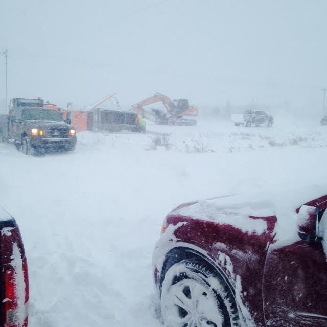
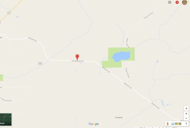
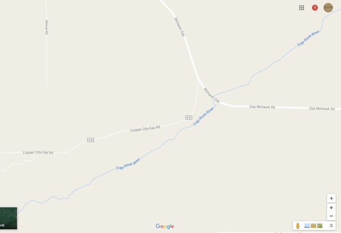
Copper City, Michigan Power Outage due to hit and run wreck 11-12-16 3 a.m.

2016-brift-inn-bar-hit-and-run

Officials are searching for a black pickup truck that crashed into a power pole about 2:40 this morning near the front of the Drift-Inn Bar in Copper City, MI.

The suspect fled the scene but police are narrowing in on the person – whose vehicle likely has heavy damage – black Chevy pickup.
Much of the area is reported without power – and the power pole is broken in half.

The suspect’s vehicle may have been located in nearby Phillipsville Location. But suspect may be fleeing/hiding on foot.


Meanwhile officials in the Copper Country may have a serious situation developing involving a man allegedly held against his will by a felon – but it remains to be seen what is happening.
We will not release information on the situation unless it is truly warranted.
But that’s why so much police activity going on.

2016-tamarac-city-wreckU.P. Breaking News Traffic Advisory: 11-11-16 6:10 p.m: Tamarack City, MI in Houghton County for two vehicle accident with injuries

Dollar Bay Township Volunteer Fire Department and EMS have been dipatched to the two-vehicle wreck on M-26.

Two people are said to be hurt.

——-

U.P. Breaking News Public Safety Advisory – Bay Mills, MI Power Outage/Transformer fire. 11-11-16 3:45 a.m. Gumshoe and S. Towering Pines Rd.
2016 Bay Mills Transformer.jpg
Strong winds have been causing power issues and trees/limbs downed across U.P. – most recently all or part of the Bay Mills community is reportedly affected by a small fire in the trees on power lines/possibly transformer issue in the area of Gumshoe Rd and S. Towering Pines Rd.
White Fish Township and Bay Mills Fire Departments have been paged.

U.P. Breaking News Traffic Advisory Ishpeming, MI

U.S.-41 and Lakeshore Dr. Accident with injuries 11-10-16 7:35 p.m.

At least a two-vehicle wreck in front of Jubilee Foods – 41/Lakeshore in Ishpeming.

One of the vehicles is a pickup that was also towing a car

U.P. Health System ambulance paramedics from Marquette were sent to treat and transport one female patient reported in and out of consciousness with back injuries.

Stay away from area for a while as traffic is tied up.

2016-rapid-river-4-vehicle-wreck

U.P. Breaking News Traffic Advisory Delta County

11-1o-16 8:20 p.m.

Three vehicle accident in Rapid River/Update on Carney Motorcycle Accident Road Closure

No injuries reported but heavy damage to at least one vehicle east of Gladstone/Rapid River on U.S. 2/41 at S.75 Road

Masonville Township Fire on scene and Michigan State Police investigating.

Meanwhile – alcohol may be a factor in the accident listed (see just below) though not sure which vehicle – in Menominee County.

The road was closed for at least 15 minutes beginning at 7:20 p.m. CT for MSP measurements. An MSP accident investigator is probing the wreck

11-10-16 4:10 p.m.

(Carney, MI) – A accident is reported involving a motorcycle with a passenger and a vehicle near the Carney/Nadeau Township Volunteer Fire Department’s fire hall on U.S.-41 south. The two victims are expected to be taken to St. Francis hospital.

Numerous police, fire and ambulance emergency officials are en-route and on scene.

First reports indicate the two people on the motorcycle were conscious and breathing – but in roadway.

Please avoid this area.

Plus in Alger County, MI on U.S.-41 – a green Dodge mini van southbound on 41 in Trenary area driving reckless including doing circles around vehicles.

11-4-16 1 p.m. Central Time – Menominee County fire near Carney, MI

carney-fire

Numerous police agencies are responding to handle traffic control on G-18 Road.

The structure fire is reported on G-18 Road just off U.S.-41.
Several fire departments are battling the fire.

No injuries have been reported.

U.P. Breaking News Traffic Advisory and Public Safety Advisory 11-1-16 12:25 a.m.

Reported Dead Bear on M-95 near Witch Lake. Michigan State Police en route.

Dead Bear reported in northbound lane of M-95 – was struck by vehicle that was reportedly driveable and reported accident but left the area.

U.P. Breaking News Traffic Advisory and Public Safety Advisory Town Hall Rd. Tree Down Skandia, MI and all communities across the U.P. 10-31-16 10:17 p.m.

High wind advisory across U.P. are causing trees to fall on roadways and more. This has created dangerous situations. Travel with care. Car/Deer accidents have also spiked in recent weeks.

Town Hall Road near Shaw Road a tree is reported down. Road commissions across the U.P. are on standby.

There are numerous advisories posted including:

Gale Warning

Small Craft Advisory

Hazardous Weather Outlook

HAZARDOUS WEATHER OUTLOOK
NATIONAL WEATHER SERVICE MARQUETTE MI
357 PM EDT MON OCT 31 2016

MIZ001>007-009>014-084-085-012000-
KEWEENAW-ONTONAGON-NORTHERN HOUGHTON-BARAGA-MARQUETTE-ALGER-LUCE-
GOGEBIC-IRON-DICKINSON-MENOMINEE-DELTA-SOUTHERN SCHOOLCRAFT-
SOUTHERN HOUGHTON-NORTHERN SCHOOLCRAFT-
357 PM EDT MON OCT 31 2016 /257 PM CDT MON OCT 31 2016/

THIS HAZARDOUS WEATHER OUTLOOK IS FOR PORTIONS OF WESTERN UPPER
MICHIGAN AND CENTRAL UPPER MICHIGAN.

.DAY ONE...TONIGHT

SOUTH WIND GUSTS TO AROUND 40 MPH ARE EXPECTED THIS NEAR LAKE
SUPERIOR.

MINOR BEACH EROSION IS POSSIBLE ALONG LAKE MICHIGAN FROM THE GARDEN
PENINSULA EASTWARD.

.DAYS TWO THROUGH SEVEN...TUESDAY THROUGH SUNDAY

WEST WINDS TO AROUND 40 MPH ARE EXPECTED TUESDAY OVER THE KEWEENAW
PENINSULA.

.SPOTTER INFORMATION STATEMENT...

THE NEED FOR WEATHER SPOTTER REPORTS IS NOT ANTICIPATED AT THIS
TIME.

$$

U.P. Breaking News Traffic Advisory and Public Safety Advisory Painesdale, MI 10-31-16 10:35 a.m.

painesdale-fire

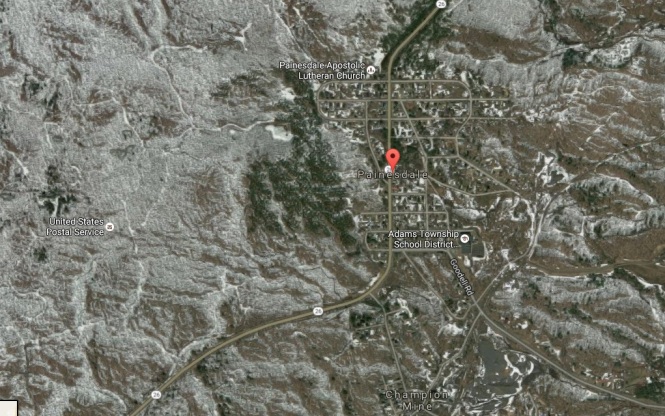
Watch for fire vehicles in and around Painesdale, MI in Houghton County.

Officials battling a fire of unknown cause and origin.

Its is reported North of M-26 along or near a powerline.

The Adams Township Fire department is trying to fight the fire – but it is unclear the cause.

U.P. Breaking News Traffic Advisory and Public Safety Advisory 10-31-16 7:30 a.m.

Hit and run drama in Marquette, MI.

Craig Street and Champion Street in city of Marquette

Apparently an elderly gentleman who lives on Craig St. has called cops to report his accidents. Heavy damage to three or more vehicles.

A small red Dodge SUV is being sought with heavy damage.

SUV hit cars on Champion St. and fled.

It was the second manhunt of morning and quick to end.

U.P. Breaking News Traffic Advisory 10-29-16 9:52 a.m.

Three vehicle accident with no injuries in Hancock

http://upbreakingnews.com/2016/10/15/upperpeninsulabreakingnewstrafficadvisory

U.S. 41/North Lincoln Dr. near Elevation St. in Hancock, MI.

Mercy ambulance was responding but apparently canceled – and police agencies on scene asking for wreckers.

U.P. Breaking News Bulletin 10-28-16 11:10 a.m.:

May get some treatment for exposure, more – but all patients well.

URGENT – 11:07 a.m. – all four patients accounted for after scary incident – all apparently doing OK for their time in Lake Michigan – may be getting some medical treatment. USCG also told it can cancel its launched helicopter response

URGENT – stand down given 11 a.m.  “all four accounted for” – S&R canceled

10-28-16 10:50 a.m.

ogantz-bay-lake-michigan

URGENT URGENT – Water rescue launched after call in Delta County at Camper’s Paradise Resort originally reported as “four overboard” in Ogontz Bay in the Rapid River/Nahma area

Numerous rescue personnel responding from several agencies including Delta County Search and Rescue.

http://upbreakingnews.com/2016/10/15/upperpeninsulabreakingnewstrafficadvisory

This is off northern Bay de Noc.

Search is for overturned 18-foot flat-bottom boat and one man

Even the USCGV has offered assistance for the call in Lake Michigan – possibly a helicopter to be launched. Officials are putting in at several boat launch sites including Nahma.

Four people were in the water – three have been recovered in good condition.

One man unaccounted for – search underway


10-27-16  7:53 A.M. K.I. Sawyer

For the second morning in a row, a vehicle has struck a utility pole and brought down lines at K.I. Sawyer – 400 block of Stratofort.

Forsyth Township Police investigating. UPPCO has been notified.

Check your clocks, again.

U.P. Breaking News Traffic Advisory 10-26-16  7:57 A.M.
Hancock Accident with injuries reported on S. Lincoln Rd and Michigan St. in Hancock, MI

Mercy Ambulance, Hancock fire department and police all on scene or en-route. Two heavily damaged vehicles – reportedly a Jeep and Subaru.

Minor injuries. Debris intersection must be washed away after vehicles moved.

Previous:

U.P. Breaking News Traffic Advisory and News Bulletin: 10-26-16 6:38 a.m.

Major Gladstone home explosion

By Greg Peterson
U.P. Breaking News
Owner, News Director – 906-273-243

A residence is reportedly in smoke and flames following a Gladstone explosion – on 715 Minnesota Ave.

The Escanaba Township Fire Department has been called for mutual aid. Rampart EMS was rolled for safety as firefighters battle the blaze. Power officials have also been notified.

Initial reports stove exploded – but that remains to be seen as police and firefighters probe the explosion on Minnesota Ave. Look out for emergency officials from all agencies.

—-

U.P. Breaking Traffic Advisory  10-16-16 12:45 a.m.
Hit and run probe in Gwinn, MI – power poles, transformer down

Update at:

http://upbreakingnews.com/2016/10/26/hit-and-run-terror-power-pole-taken-out-other-utilities-damaged-in-gwinn-k-i-sawyer-hit-and-run-manhunt-that-leads-to-car-on-hustler-st

A major manhunt and – hit and run investigation – is underway in the Gwinn, Mi area at this hour after a serious hit and run accident involving a the driver of a vehicle and a power pole.

The power pole is broken in half and the transformers are down in the street – no arching.

Forsyth Township Police are probing the accident – and the vehicle has fled the scene leaving behind a lot of damage on Jupiter St.

It appears police are searching vehicle leaking fluids allegedly driven by a K.I. Sawyer man last spotted driving toward Sporley Lake Rd.

Search for four-door purple passenger car with heavy damage.

The power pole is broken in half and the transformers are down in the street – no arching.

U.P. Breaking Traffic Advisory and News Bulletin: 10/25/16 6:29 a.m.
Injury – Car Fire Reported on Kelly Johnson Road near entrance to the Marquette County Airport.
It always good to take extra time going to make a flight, but for the next 30 minutes or more – drivers may be slowed by a reported car on fire with the driver reporting he is injured.

Responding are the Forsyth Township Fire Department and Forsyth Township First Responders plus an ambulance from U.P. Health System – Marquette.
At first report, the injury is apparently minor

Bear reported in Marquette, MI neighborhoods – but appears to be moving fast. 10-24-16 9:50 p.m ET

bear-advisory

Latest was: Rublein St between Bluff St. and Ridge St.

This is a growing issue – as man and wildlife mix.
Please stay away from this area as police are searching. Report sightings to officials but do not try to interact. Not sure where the first location it was spotted – somewhere on Michigan St., but police say it was moving fast – if its same bear

U.P. Breaking News is not going to provide addition locations unless warranted.
.

U.P. Breaking Traffic Advisory and News Bulletin – Search and Rescue launched for missing 10 year old boy in Delta County (found)

Urgent: U.P. Breaking Traffic Advisory and News Bulletin:

6:27 p.m. The boy has apparently been found safe as all units appear to be clearing

Update 6 p.m. 10-23-16
Boy Missing for almost two and a half hours as of 6 p.m.
Delta County Dispatch will not even confirm the huge search is happening – the Valley Med Flight chopper is assisting.
ALSO – Delta County Dispatch declined to release a photo. Why? Who knows but said they would call us if they decide to.

Update 10-23-16 4:55 p.m.
Chopper may be launched – they are asking Valley Med Flight to assist

Sunday Oct. 23, 2016 4:40 p.m.

By Greg Peterson

U.P. Breaking News

Owner, News Director

906-273-243

(Escanaba, MI) – Delta County Search and Rescue has been called to help find a boy who slipped away from his mother at a Wells Township motel – but could not chase him because she had several others children to tend.

Officials are meeting in the area of the the Sunset Lodge motel at 6386 N 11th in Escanaba, MI.

The boy has been missing since about 3:40 p.m. – about an hour from time of this post.

See graphics below.

Officials are gathering in a parking lot next to Upper Peninsula Concrete Pipe Company at 6480 US-2 in Escanaba.

The boy was wearing a blue T-shirt, blue jeans and black Nike tennis shoes.

The boy’s name is Aiden – and he got upset at mom and ran off.

He has a previous history of hiding in the huge concrete pipes at the plant.

Those assisting include Delta County Search and Rescue, the Delta County Sheriff’s Department and Escanaba Department of Public Safety.

10-y-o-lost-110-y-o-lost-2

U.P. Breaking News Traffic Advisory:

Sunday 10-23-16 2 a.m.

Police in the southern U.P. are reportedly investigating a one-vehicle roll over accident shortly before 2 a.m. today (Sun., Oct. 23. 2016) in the parking lot of The Buck Inn at 6696 US-2 in Wells, Michigan.

Minor injury to the male driver.

Numerous emergency vehicles responding.

U.P. Breaking Traffic Advisory and News Bulletin – Manistique River incident

10-22-16 3:25 p.m.

By Greg Peterson

U.P. Breaking News

Owner, News Director

906-273-2433

Emergency officials are responding to assist a family involved in a water incident in Germfask, MI at Northland Outfitters in the Manistique River.

Northland Outfitters is on the 800 block of M-77.

The 44-year-old mom was in a kayak that overturned in the Manistique River – and she was stranded on the far shore of the river – so her 14 and 11 year old, daughter and son respectively, called 911 and requested helped reuniting with their mom.

No injuries reported but likely the river is flowing very fast.

URGENT U.P. Breaking News Traffic Advisory/News Bulletin

Houghton, Michigan 7:30 a.m. 10-21-16
Emergency officials at scene of an accident with injuries in the city of Houghton, MI

College Avenue at Agate Street

At least two vehicles with front end damage – including pickup and car.

The Houghton Fire Department is responding to clean up routine spills connected to the wreck on the street.

Paramedics and police also on scene.

To follow this story go to:

URGENT U.P. Breaking News Traffic Advisory and News Bulletin 10-22-16 Update 5:30 a.m.

A specialized Accident Investigator (AI) from the Michigan State Police was called in from home to join the probe.

That AI – veteran MSP Trooper Andy Rigling – is now in charge of the investigation

The victim was taken to the hospital by ambulance.

It’s not clear if the accident scene has been located. Victim reportedly said he crashed his vehicle into a tree.

4:45 a.m.

Republic, Michigan crash search.

By Greg Peterson
Owner, News Director
U.P. Breaking News
906-273-2433

U.P. emergency personnel are searching for crash scene between Republic, Michigan and North Republic, Michigan at an unknown location after victim emerges at relative’s home.

A 44-year-old man reportedly involved in wreck –  showed up at at a relative’s home in Republic and collapsed – apparently from crash-related injuries.

Crash apparently happened about 5 miles away – how he made it to a relative’s home is unknown.

Claims to be only one in vehicle. Exact location of wreck not known

Numerous law enforcement and emergency personnel are on there way to North Republic

Officials are heading to the 400 block of Republic Avenue in Republic – where crash victim showed up.

Cross streets are Front St. and Fourth Street in North Republic.

fyi – there are other medical emergencies going on around U.P. – a lot of emergency people out during busy night – please drive with caution. One involves a child with medical emergency – another an assault victim – and others.
also fall trend of numerous car deer accidents continues.

——-

URGENT U.P. Breaking News Traffic Advisory and Bulletin: M-28 Chocolay Township

Update 9:50 p.m.

It began as a Marquette County Sheriff’s Deputy ran a name check on a possible passenger of a mini-van he was watching – a white mini-van.

A Chocolay township unit was requested for back up because a check showed the man was wanted on a charge of failure to appear in court for child support.

The sheriff’s department stopped the van on M-28 near Chocolay Downs.

“He’s running into the woods,” the deputy said while pulling over the vehicle and reading the license plate number.

Suspect may have fled because reportedly he has a $500 cash only bond on that warrant.

The suspect is reportedly 38-year-old local man.
U.P. Breaking News has his name – but a withholding maybe until he is in custody

The initials are J.P.A.

He has been tracked on the north side of the highway but originally fled on the south side in toward the golf course.

It appears the female driver was not wanted and the suspect took her cell phone to use for texting. She has apparently been released.

Manhunt continues.

9:10 p.m. Manhunt Update:

Police are now tracking the suspect with a K-9 westbound in the area of Lakewood Lane headed toward Lake Superior.

8:05 p.m. 10-21-16

Chocolay Township manhunt

By Greg Peterson
Owner, News Director
U.P. Breaking News
906-273-2433

A perimeter has been set up in the area of this manhunt said to be on M-28 east of Harvey – near the Chocolay Downs Golf Course.

Numerous police officers from several departments are searching for the suspect.
A K-9 has joined the search -latest said to be in general area behind Marquette fence Company – on the 1400 block of M-28 East.
Officials are back on some soggy trails looking for this man.

Not sure what he is wanted for – but it sounds like a traffic stop that ended up with warrants being discovered on an occupant – either way it is on warrants.
Not sure if new charges could be filed for fleeing and manhunt.

If you see a person fitting this description in your yard – or at your door – please call 911 for police asap. He could be wet and even out of breath.

Suspect is wearing:

White jacket

Dark colored pants

Ball cap

URGENT U.P. Breaking News Traffic Advisory and Bulletin:

10-21-16 1:15 a.m. Chocolay Township

Report at or near 680 Cherry Creek Rd. – Owner reported a burning 27-foot camper – smoke and flames reported – Now contained – Big camper very close to house.

http://upbreakingnews.com/UpperPeninsulaBreakingNewsTrafficAdvisory

BUT police on scene just reported the fire had been contained -and advised fire trucks to slow down.

Chocolay Township Police and Fire plus others responding.

South of County Road 480.

More if warranted

10-21-16 2:15 p.m.

Two vehicle T-bone type accident in Delta County.

No Injuries, two heavily damaged vehicles.

N. Lincoln Ave at 5th Avenue north in Escanaba
Rampart EMS was en route and canceled. Escanaba Department of Public Safety investigating and directing traffic.

U.P. Breaking News Traffic Advisory and Bulletin: U.S Highway 2/41 was just reopened in Menominee County after a fatal traffic accident

By Greg Peterson
Owner, News Director
U.P. Breaking News
906-273-2433

U.S Highway 2/41 was just reopened in Menominee County after a fatal traffic accident.

Menominee County law enforcement, Michigan State Police and others are helping with the probe or helped at the scene. MSP Troopers have been on the scene of this accident for several hours. No information on this accident has been released by officials.

However through our sources – we have confirmed that the accident did have at least one fatality.

The accident was apparently reported around 7:25 p.m. Central Time.
No other information is available about this accident but we are working to gather more info.

——-

10-20-16 12:15 p.m.

By Greg Peterson

U.P. Breaking News

Owner, News Director

906-273-2433

Chocolay Township Fire Department is at 25 Edgefield Drive in Harvey after the occupants called 911 and reported smoke in the basement

Police confirmed smoke in basement and shut off main breaker

No fire has been seen so far – and the cause is being investigated.

It is not a busy road but anyone going there should use care.

——-

10-19-16 6:20 p.m. Urgent

By Greg Peterson
Owner, News Director
U.P. Breaking News
906-273-2433

Update extraction canceled

A serious accident U.S. – 41 South – south of M-94

Apparently a vehicle that police had been searching for after two reports to 911 – of the pickup truck driven by a female that was swerving across the centerline with a possible sleeping driver with an infant in a car seat

Vehicle “snapped guard rail” South of M-94 by the railroad overpass.

Skandia Township Fire Department and First Responders,the Marquette County Sheriff’s Dept.,  the Marquette County Extrication Unit 131,  ambulances, and state police are among those responding. The Unit 131 was cancelled shortly after leaving its station.

Two patients may be taken to hospital

——-

9:30 A.M. 10-18-16

NUMEROUS ROADS AND HIGHWAYS REMAINED CLOSED IN MARQUETTE AND ALGER COUNTIES

Flooding has closed roads in several U.P. counties:

U.S.-41 South, M-94, Green Garden Road, and more

all updates on rescues (appear over) at:
http://upbreakingnews.com/2016/10/18/more-rain-coming-early-morning-flooding-rescues-underway-in-marquette-county-along-green-garden-roadcr-545-us-41-and-chocolay-river-is-flooding-two-people-and-dog-reported-trapped.

FLOODING RESCUE UNDERWAY – AS CHOCOLAY RIVER RISES- STAY OFF US-41 IN GREEN GARDEN ROAD/GREEN GARDEN HILL AREA OF MARQUETTE COUNTY –

2 PEOPLE AND A DOG ARE TRAPPED IN HOUSE AND RIVER WATER IS “RIPPING PRETTY GOOD”

By Greg Peterson
Owner, News Director
U.P. Breaking News
906-273-2433

URGENT URGENT URGENT – 10-18-16 4 A.M. – FLOODING/WATER RESCUES IN MARQUETTE COUNTY:

Marquette County declares emergency water rescues needed along Chocolay River in the Green Garden Rd. area – Ambulances, Rescue boats and officials are preparing for these rescues. Please check your family in these areas – and stay away from rising flood waters. Firefighters, search and rescue and firefighters are trying to rescue at least two residents and  by a boat.
Barricades are up.
County Road 545 is flooding.
Over 100 yards of pooling river surrounding the house – firefighters trying to help by wading – boats in route. The Chocolay River River is at “bridge level” and will wash the road out if it rises a couple more feet.

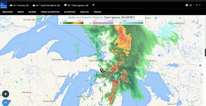
Severe Weather apparently causes lighting to strike eastern U.P. MSP Post

10-17-16 10:19 a.m.

The severe storms have caused routine calls for U.P. fire departments – until now – but likely all is OK.  Storms that rolled across the U.P. have mainly localized street flooding.

However, we just heard a report that the fire department has been sent to an eastern U.P. Michigan State Police Post – that is also connected to or shares space with the Michigan DNR.

We think it is Post 83 – St. Ignace but have decided not to bother officials since it sounds busy.
Its apparently has affected power.
If it warrants an update, we will pass it along.
Below is radar when report came in.

It appears – Detour Fire was dispatched – but is being told to have extra units stand by at their fire dept.

Also – a non emergency run for Chocolay Township Police this morning as a homeowner on Cherry Creek Rd. reported a lightening strike – no fire or smoke – just electrical small in air and wanted to be safe.
Plus we have heard calls for trees on power lines – plus a transformer fire on M-133.

MSP Post wx map.jpg

URGENT URGENT – U.P. Breaking Traffic Advisory Sunday morning 10-16-16 11:40 a.m.

Three Vehicle Accident Involving Cargo Trailer with Injuries U.S.-41 in Humboldt Township in west Marquette County, MI.

Many ambulances and police and other emergency vehicles responding.

Two minor injuries but it is a big mess.

One of the vehicle is said to be pulling a 20-foot cargo trailer. The victims received apparently minor injuries.

Two of the badly damaged vehicles are in traffic. Rear-end kind of accident – airbags deployed – wreckers needed. Nobody ejected.

Police are getting conflicting info on location of wreck U.S.-41 – near County Road FN – or near M-95.

U.P. Breaking News Boat on the Rocks Traffic Advisory Sunday morning 10-16-16 11:58 a.m.

Plus missing U.S. Coast Guard Dog – brown and white husky – believed in area – please help find! He got out from behind the gate at USCG – Station Marquette

Sailboat on rocks in Marquette off shore in Lake Superior not far from the U.S. Coast Guard Station.

Owner call Marquette Police to get damage report – however first those involved have to figure how to get the boat back in its slip – problems include know one knows extent of damage

Plus don’t forget about the missing U.S. Coast Guard Dog

Update on smoke in Marquette house at 9 a.m:

Cause of the smoke is burned food – as officials report the microwave caught on fire while the residents were making popcorn.

U.P. Breaking News Traffic Advisory Sunday morning 10-16-16 8:50 a.m.

Emergency vehicles on scene of possible structure fire on the 300 block of E. Crescent St. in Marquette with a report of smoke in the residence.

There was not a fire – just smoke.

The occupants escaped, no injuries.

The address is 316 E. Crescent St.

Ambulance, police and fire officials are on the scene.

The Marquette Board of Light and Power was also en-route and then cancelled.

“Minor situation here – we just have to ventilate – you can cancel BLP,” one Marquette fire official said.

Pine and Spruce are the cross streets.

Scroll down to see previous traffic advisories:

U.P. Breaking News Traffic Advisory 10/ /16
Upper Peninsula Breaking News Traffic Advisory 10/ /16
U.P. Breaking News Traffic Advisory and Public Safety Advisory 10/ /16
Upper Peninsula Breaking News Public Safety Advisory
Upper Peninsula Breaking News Traffic Advisory and Public Safety Advisory 10/ /16

Marquette County Traffic Advisory

Delta County Traffic Advisory

Menominee County Traffic Advisory

Baraga County Traffic Advisory

Houghton County Traffic Advisory

Luce County Traffic Advisory

Chippewa County Traffic Advisory

Mackinac County Traffic Advisory

Iron County Traffic Advisory

Dickinson County Traffic Advisory

Ontonagon County Traffic Advisory

Gogebic County Traffic Advisory

Keweenaw County Traffic Advisory

Alger County Traffic Advisory

Schoolcraft County Traffic Advisory

Update on smoke in Marquette house at 9 a.m 10-16-16:

Cause of the smoke is burned food – as officials report the microwave caught on fire while the residents were making popcorn.

U.P. Breaking News Traffic Advisory Sunday morning 10-16-16 8:50 p.m.

Emergency vehicles on scene of possible structure fire on the 300 block of E. Crescent St. in Marquette with a report of smoke in the residence.

There was not a fire – just smoke.

The occupants escaped, no injuries.

The address is 316 E. Crescent St.

Ambulance, police and fire officials are on the scene.

The Marquette Board of Light and Power was also en-route and then cancelled.

“Minor situation here – we just have to ventilate – you can cancel BLP,” one Marquette fire official said.

Pine and Spruce are the cross streets.

U.P. Breaking News Traffic Advisory Sunday morning 10-16-16  2:40 a.m

Rollover with injury Delta County/Menominee County area
U.S.-41 near LaBelle Road

About 30 miles south of Powers, MI
Rollover accident reported with one possible serious injury
Rampart EMS and others emergency officials responding
Victim breathing but unresponsive – male – possible alcohol involved

U.P. Breaking News Traffic Advisory Saturday night 10-15-16 6:40 p.m

Paradise Rd. in Portage Township in Houghton County

Single vehicle accident – car off the road and smoking – no injuries.

Watch for police and fire units.

Paradise Road near Pilgrim Road close to the school.

U.P. Breaking News Traffic Advisory and Public Safety Advisory 10-15-16 11:53 a.m

The Sault Ste. Marie International Bridge – in the eastern Upper Peninsula
Police are en-route to probe a truck hitting something related to a tollbooth – maybe the “display”

The truck has pulled into a parking lot – but this may still effect travel.
Watch for officials of all kinds – drive slow.
Don’t need another “international” incident – OK bad pun – no one hurt.

http://www.michigan.gov/mdot/0,1607,7-151-9618_48384—,00.html

U.P. Breaking News Traffic Advisory and Public Safety Advisory 10-15-16 11:40 a.m:

The DNR is headed to the Big Lake State Park Campground in Baraga County near L’Anse, MI:

Report: Two vehicles stuck “beyond” the boat launch –  unclear exactly what is happening – but on dirt or water – sounds like its going to be blocked.

Also – There have been numerous vehicle-deer accidents in past 24 hours – and recently – and even though its is an annual U.P. deer fall rut/hunters in the woods issue – it is dangerous and we urge every who doesn’t need to rush – to take extra time especially dusk, dawn and overnight but all hours beware.

Also – high winds continue causing tree, limbs and power line/utility issues – but reports have slowed in recent hours – and even one report early today of a tree belonging to the hospital in Mqt. taking down a neighbor’s fence.

http://www.uptravel.com/index.php?catid=33&member_id=5691
http://www.michigandnr.com/parksandtrails/details.aspx?id=641&type=SFCG

U.P. Breaking News Traffic Advisory and Public Safety Advisory Saturday early morning 10-15-16 12:45 a.m.
Trees and branches falling, high winds, downed power lines and moving deer are making travel hectic in some areas and even dangerous.
There are too many to list.
However – the road commission had just cleared one tree on U.S. 2 – with help from police – when another tree down was just reported not too far away.
U.S. Highway 2 near Marenisco in western U.P. – Maple tree blocking “both lanes.”
Downed power lines, trees and branches have been reported in numerous locations.

URGENT UPDATE 10-14-16 11:49 p.m.

Another tree down – now Marquette County on CR 550 – not sure exact location said to be in southbound lane – and that’s from a mine truck reporting to 911.
Police and road commission notified.

#2 location:
Tree is down and blocking the eastbound lanes of U.S. Highway 2 – in the western U.P. Near mile marker 23 in Michigan – between Wakefield and Marenisco.

10-14-16 11:40 p.m.
URGENT URGENT – Winds knocking down trees, powerlines across U.P. – now blocking US-2 near state line in western Upper Peninsula.
We have begun hearing reports of trees and limbs down in several areas.
Now, police are saying a tree is down and blocking the eastbound lanes of U.S. Highway 2 – in the western U.P. Near mile marker 23 in Michigan – between Wakefield and Marenisco, MI
Please watch for falling objects whether inside car or outside.
This mixed with deer moving earns extra driving caution

U.P. Breaking News Traffic Advisory 10-14-16 11:02 p.m.

We continue to remind people about the sharp increase in vehicle/deer accidents across the U.P. There have been another half dozens wrecks today and one just occurred in Marquette County.
Watch for police investigating this wreck near the youth home on County Rd. 553 in Marquette County.

U.P. Breaking News Traffic Advisory Delta County near Esky KFC – 10-14-16 8:30 p.m.
Pedestrian crossing road struck by vehicle on 1500 block of N Lincoln Rd in Escanaba – near the Kentucky Fried Chicken.
Victim is breathing, talking and has leg injury.

U.P. Breaking News Traffic Advisory and Public Safety Warning
10-13-16 12:40 a.m. Base area and Gwinn
Beware Vehicle with heavy damage and allegedly without one of its tires after hit and run into building
Green Toyota
Police rushing to – and in area  – to the Happy Hour Bar at #5 Stephenson Ave in Gwinn.
Maybe anywhere in area including back way to 553 toward base – and on base.
If warranted, we will pass along more info.

U.P. Breaking News Traffic Advisory Baraga County – 11:47 a.m. 10-12-16
Fire dept. now responding to meet law enforcement for vehicle in ditch – U.S.-41 about two miles “south” of L’Anse.
Watch for emergency vehicles and slow down.

U.P. Breaking News Bulletin/Traffic Advisory – 10-11-16 11:11 p.m.
Law Enforcement in Delta County just blocked all intersections to allow an Rampart ambulance to arrive unimpeded to St. Francis. The person in the ambulance is an elderly beloved member of the community – it was a serious medical call.
We do not want to release more information because to do so – would ID the person. Let’s hope doctors at St. Francis can help him – prayers.

U.P. Breaking News Traffic Advisory: 10-11-16 11:45 a.m. Menominee County
Emergency vehicles responding and on scene: Bark River area just inside Menominee County – Old U.S. 2 and 41 – one vehicle roll over with injury – Female minor injuries

U.P. Breaking News Traffic Advisories: 10-10-16 10:45 p.m.

CR 550 tree down/Deer vs. Motorcycle – deer accidents increase across U.P.

Police have been called to a possible downed tree blocking northbound lane on CR 550:
Northbound lane of County Road 550 near Wetmore Landing

Also this weekend we reminded folks about the extreme hazard of deer accidents this time a year as it has been happening all over the U.P.
Tonight a motorcycle reportedly collided with deer near Cedarville, MI. No other info available on accident. There were several today.

U.P. Breaking News Traffic Advisory Monday 10-10-16 2:24 p.m.
Avoid Wright St. if you are in a hurry.
Construction has traffic down to one lane and is causing a large back-up of traffic on Wright Street inside the city limits of Marquette at  the Marquette Township Line.
Wright St. remains open but you may prevent traffic delay headaches if you take an alternate route or allow extra time.

U.P. Breaking News Important Public Safety Advisory and Traffic Advisory.
Power issues after large tree falls in Trowbridge Park area of Marquette Township
Monday 10-10-16 11:37 a.m.
Officials are sending police to help at intersections where the power has caused the traffic lights to go out.
We understand that several main units owned by the power company have been damaged – and it may be a while before power is restored – and possibly expected intermittent trouble if you live in that area.
Also – understand an apparently unrelated – one of those slow moving huge vehicles was reported in the area

Urgent – Urgent:

U.P. Breaking News Public Safety and Traffic Advisory: in Boot Jack area of Houghton County, MI Sunday, October 9, 2016 – 2: 52 p.m.

By Greg Peterson
U.P. Breaking News
News Director
906-273-2433

Numerous fire departments
http://upbreakingnews.com/2016/10/09/fully-engulfed-house-fire-in-boot-jack-area-of-houghton-county

Emergency vehicles including several fire departments have been called to a reported fully-engulfed house fire in the area of the 45000 block of Rabbit Bay Road in the Lake Linden, MI area.

U.P. Breaking News Traffic Advisory: Streets of Ishpeming, MI Sunday, October 9, 2016 11:33 a.m.
Keep off streets – victim being rushed to Bell now – good news is good vitals – but multiple injuries from a crush incident

11:06 a.m.

A serious accident has been reported at the Tilden Mine a short while ago.

http://upbreakingnews.com/2016/10/09/one-seriously-hurt-at-tilden-mine-in-near-ishpeming-mi-sunday-morning-accident

No information is available on what happened – but apparently there is only one victim – who has received multiple serious injuries. There are not thought to be other injuries.

5 hurt in two accidents: ORV Rollovers in Delta County, MI and Iron County, WI – One victim trapped for about 7 hours underneath ORV

By Greg Peterson
U.P. Breaking News
News Director
906-273-2433

http://upbreakingnews.com/MIWIORVWreckshurt5

(Hurley, WI) – For the second time this weekend, an Upper Peninsula hospital was called on to treat a victim from a serious off-road-vehicle accident.

Another Important U.P. Breaking News Traffic Advisory 10-7-16 11:20 p.m.
In the past two weeks, we have noticed a big spike in car/deer accidents across the U.P. – at least two tonight including one was just reported on U.S. 2.
Remember its not the deer you see – its the one following it. Be extra cautious and aware – slow down if your are not in a hurry especially from dusk to dawn. But really all day.
Many Reasons:
These colder temps will trigger even more mating behavior plus with hunters now in the woods for various species – many deer are moving. Plus those setting up blinds for the Nov 15 opener.
As we reported a few weeks ago, moose are also on the move and pose a danger to drivers.
All an irony –  as the U.P. deer herd has decimated by state mismanagement – and is now estimated at less than 80,000 deer. Plus the wasting disease has been a huge issue in Wisconsin and across the Lower Peninsula – again from bad practices.

URGENT – URGENT:
U.P. Breaking News Traffic Advisory Update 11:16 P.M.
A helicopter will be landing soon either in a field or at the intersection of 426 and Cedardale roads.
Initial reports are good that the female victim with head injury who was hurt but all things seem positive.
The other three victims are “walking wounded” aka minor injuries.
Stay away from this area for at least another hour.

10-7-16 10:54 p.m.
Officials responding to an ORV accident reported in field on CR 426 (B-Road) – near Cedardale Road – in the Delta/Menominee County line area.
A helicopter is being launched as there are said to be four victims – one with a possible head injury.
Three other injuries not as serious.
Rampart Ambulance, several first responders including Cornell Township, several fire departments and numerous police are responding.
There seems to be an issue about a proper landing zone for the helicopter from U.P. Health System-Marquette that is stationed out of Escanaba.

U.P. Breaking News Traffic Advisory 10-7-16 2:25 p.m.:
2700 block of Wright St. – Marquette, MI – in hill and curve near gas company.
An awkward backing up job by a semi truck will be happening soon – and police will have to block traffic.
There are apparently two semis total and involves picking up a large piece of equipment and more.
One semi has made it in and another is coming.

U.P. Breaking News Traffic Advisory 10-6-16 4:57 p.m.:
Numerous emergency units including Rampart EMS responding to an accident at Lincoln Ave. and Ludington Street in Escanaba.
Expect rush hour traffic  to be tied up for a while.

Save

Save

Save

Save

Save

Save

Save

Save

Save

Save

Save

Save

Save

Save

Save

Save

Save

Save

Save

Save

Save

Save

Save

Save

Save

Save

Save

Save

Save

Save

Save

Save

Save

Save

Save

Save

Save

Save

Save

Save

Save

Save

Save