Happening now – U.P. Breaking News Weather Bulletin 12-12-17 5:05 a.m. ET
Updated forecasts released this morning:
https://radar.weather.gov/radar.php?rid=mqt
Lake Superior waves this morning caused closing of Lakeshore Boulevard in Marquette as water from crashing waves and debris is washing onto the road.
Waves will pound Alger County shoreline today.
Up to 11 more inches of snow for some lake-effect snowstorm areas
Heavy lake effect snow occurring. Plan on difficult travel conditions, including during the morning commute today.
Additional snow accumulations of 3 to 7 inches, except 7 to 11 inches from near Harvey through Skandia to Carlshend and McFarland are expected through this evening. Locations to the south and west of Champion to Negaunee and Gwinn will see snow totals of 1 to 4 inches through this evening.
High winds and heavy snow impacting portions of US-41, M-28, M- 35 and M-94,
Winter Storm Warning
URGENT - WINTER WEATHER MESSAGE
National Weather Service Marquette MI
434 AM EST Tue Dec 12 2017

MIZ005-121900-
/O.CON.KMQT.WS.W.0007.000000T0000Z-171213T0000Z/
Marquette-
Including the cities of Gwinn and Marquette
434 AM EST Tue Dec 12 2017

...WINTER STORM WARNING REMAINS IN EFFECT UNTIL 7 PM EST THIS
EVENING...

* WHAT...Heavy lake effect snow occurring. Plan on difficult
  travel conditions, including during the morning commute today.
  Additional snow accumulations of 3 to 7 inches, except 7 to 11
  inches from near Harvey through Skandia to Carlshend and
  McFarland are expected through this evening. Locations to the
  south and west of Champion to Negaunee and Gwinn will see snow
  totals of 1 to 4 inches through this evening.

* WHERE...Marquette County. Impacting portions of US-41, M-28, M-
  35 and M-94, especially south and east of Marquette.

* WHEN...Until 7 PM EST Tuesday.

* ADDITIONAL DETAILS...Winds gusting as high as 30 mph will cause
  considerable blowing and drifting snow through late this
  morning. This will lead to occasional white-out conditions,
  especially along M-28 between Marquette and Munising.

PRECAUTIONARY/PREPAREDNESS ACTIONS...

A Winter Storm Warning for heavy lake effect snow means
significant amounts of lake effect snow are forecast that will
make travel very hazardous or impossible. If you must travel,
keep an extra flashlight, food, and water in your vehicle in case
of an emergency.

$$
Hazardous Weather Outlook
Hazardous Weather Outlook
National Weather Service Marquette MI
433 AM EST Tue Dec 12 2017

MIZ001>007-009>014-084-085-131200-
Keweenaw-Ontonagon-Northern Houghton-Baraga-Marquette-Alger-Luce-
Gogebic-Iron-Dickinson-Menominee-Delta-Southern Schoolcraft-
Southern Houghton-Northern Schoolcraft-
433 AM EST Tue Dec 12 2017 /333 AM CST Tue Dec 12 2017/

This Hazardous Weather Outlook is for portions of western Upper
Michigan and central Upper Michigan.

.DAY ONE...Today and Tonight

Occasional white-out conditions due to falling and blowing snow, and
additional accumulating snow expected through today and will lead
to difficult travel conditions across eastern Marquette,
northeastern Delta, and much of Alger counties. Especially along
the US-41 corridor in and south of the city of Marquette, and
adjacent highways primarily east of M-553. Across the west and far
east, hazardous travel will still be possible with light snow
accumulations through today. See the latest Winter Weather Message
for further details.

Large waves along the Lake Superior shoreline in Alger county will
continue through the mid morning hours. This will lead to minor
beach erosion and lakeshore flooding. See the latest Lakeshore
Hazard Message for further details.

.DAYS TWO THROUGH SEVEN...Wednesday through Monday

Accumulating lake effect snow is possible in the northeast wind
snow belts on Wednesday afternoon and evening. Additional accumulating
lake effect snow is on the way through the end of the week.

.SPOTTER INFORMATION STATEMENT...

Weather spotters are encouraged to submit reports of snowfall and
low visibilities to the National Weather Service in Marquette.
The public may also submit reports through our webpage, Facebook
page or on Twitter.

$$
Winter Storm Warning
URGENT - WINTER WEATHER MESSAGE
National Weather Service Marquette MI
434 AM EST Tue Dec 12 2017

MIZ005-121900-
/O.CON.KMQT.WS.W.0007.000000T0000Z-171213T0000Z/
Marquette-
Including the cities of Gwinn and Marquette
434 AM EST Tue Dec 12 2017

...WINTER STORM WARNING REMAINS IN EFFECT UNTIL 7 PM EST THIS
EVENING...

* WHAT...Heavy lake effect snow occurring. Plan on difficult
  travel conditions, including during the morning commute today.
  Additional snow accumulations of 3 to 7 inches, except 7 to 11
  inches from near Harvey through Skandia to Carlshend and
  McFarland are expected through this evening. Locations to the
  south and west of Champion to Negaunee and Gwinn will see snow
  totals of 1 to 4 inches through this evening.

* WHERE...Marquette County. Impacting portions of US-41, M-28, M-
  35 and M-94, especially south and east of Marquette.

* WHEN...Until 7 PM EST Tuesday.

* ADDITIONAL DETAILS...Winds gusting as high as 30 mph will cause
  considerable blowing and drifting snow through late this
  morning. This will lead to occasional white-out conditions,
  especially along M-28 between Marquette and Munising.

PRECAUTIONARY/PREPAREDNESS ACTIONS...

A Winter Storm Warning for heavy lake effect snow means
significant amounts of lake effect snow are forecast that will
make travel very hazardous or impossible. If you must travel,
keep an extra flashlight, food, and water in your vehicle in case
of an emergency.

$$
12-11-17 7:40 p.m. ET
National Weather Service Office for Marquette, MI:
Travel conditions will deteriorate rapidly across eastern Marquette county and much of Alger county during the overnight hours, with white-out conditions possible at times along with significant snowfall
Updated special weather advisories for U.P. by NWS in Negaunee Township – calls for deep snow, white-out conditions, 40 mile per hour winds and generally terrible driving
By Greg Peterson
Upper Peninsula Breaking News
Owner, News Director
906-273-2433
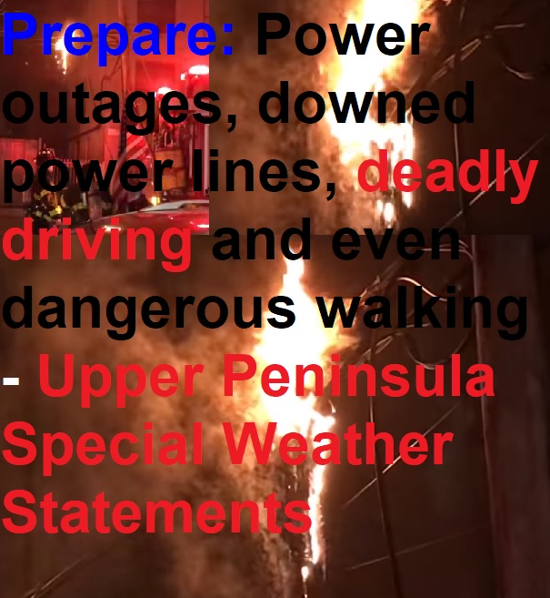
(Upper Peninsula of Michigan) – For the next 24-hours heavy lake effect snow will pound many areas of the U.P. – and creating deadly driving conditions.
Numerous power outages have been reported in the Escanaba area due to issues with a substation and with trees/powerlines. Several city of Escanaba line crews have been called out
Here are the latest warnings and advisories:
Winter Storm Warning
URGENT - WINTER WEATHER MESSAGE
National Weather Service Marquette MI
206 PM EST Mon Dec 11 2017

MIZ005-120315-
/O.CON.KMQT.WS.W.0007.171212T0000Z-171213T0000Z/
Marquette-
Including the cities of Gwinn and Marquette
206 PM EST Mon Dec 11 2017

...WINTER STORM WARNING REMAINS IN EFFECT FROM 7 PM THIS EVENING
TO 7 PM EST TUESDAY...

* WHAT...Heavy lake effect snow expected. Plan on difficult travel
  conditions, including during the morning commute on Tuesday.
  Total snow accumulations of 6 to 10 inches, except 12 to 19
  inches from near Marquette and Harvey to near McFarland,
  Carlshend and Skandia, are expected. Locations to the south and
  west of Champion to Ishpeming and Gwinn will see snow totals of
  1 to 3 inches.

* WHERE...Marquette County. Impacting portions of US-41, M-28,
  M-35 and M-94, especially south and east of Marquette.

* WHEN...From 7 PM this evening to 7 PM EST Tuesday.

* ADDITIONAL DETAILS...Winds gusting as high as 40 mph near Lake
  Superior and 30 mph inland will cause areas of blowing and
  drifting snow. This will lead to white-out conditions at times,
  especially along M-28 between Marquette and Munising.

PRECAUTIONARY/PREPAREDNESS ACTIONS...

A Winter Storm Warning for McFarland, Carlshend and Skandia means
significant amounts of lake effect snow are forecast that will
make travel very hazardous or impossible. If you must travel,
keep an extra flashlight, food, and water in your vehicle in case
of an emergency.

$$
Winter Storm Warning
URGENT - WINTER WEATHER MESSAGE
National Weather Service Marquette MI
206 PM EST Mon Dec 11 2017

MIZ005-120315-
/O.CON.KMQT.WS.W.0007.171212T0000Z-171213T0000Z/
Marquette-
Including the cities of Gwinn and Marquette
206 PM EST Mon Dec 11 2017

...WINTER STORM WARNING REMAINS IN EFFECT FROM 7 PM THIS EVENING
TO 7 PM EST TUESDAY...

* WHAT...Heavy lake effect snow expected. Plan on difficult travel
  conditions, including during the morning commute on Tuesday.
  Total snow accumulations of 6 to 10 inches, except 12 to 19
  inches from near Marquette and Harvey to near McFarland,
  Carlshend and Skandia, are expected. Locations to the south and
  west of Champion to Ishpeming and Gwinn will see snow totals of
  1 to 3 inches.

* WHERE...Marquette County. Impacting portions of US-41, M-28,
  M-35 and M-94, especially south and east of Marquette.

* WHEN...From 7 PM this evening to 7 PM EST Tuesday.

* ADDITIONAL DETAILS...Winds gusting as high as 40 mph near Lake
  Superior and 30 mph inland will cause areas of blowing and
  drifting snow. This will lead to white-out conditions at times,
  especially along M-28 between Marquette and Munising.

PRECAUTIONARY/PREPAREDNESS ACTIONS...

A Winter Storm Warning for heavy lake effect snow means
significant amounts of lake effect snow are forecast that will
make travel very hazardous or impossible. If you must travel,
keep an extra flashlight, food, and water in your vehicle in case
of an emergency.

$$
Hazardous Weather Outlook
Hazardous Weather Outlook
National Weather Service Marquette MI
430 PM EST Mon Dec 11 2017

MIZ001>007-009>014-084-085-122130-
Keweenaw-Ontonagon-Northern Houghton-Baraga-Marquette-Alger-Luce-
Gogebic-Iron-Dickinson-Menominee-Delta-Southern Schoolcraft-
Southern Houghton-Northern Schoolcraft-
430 PM EST Mon Dec 11 2017 /330 PM CST Mon Dec 11 2017/

This Hazardous Weather Outlook is for portions of western Upper
Michigan and central Upper Michigan.

.DAY ONE...Tonight

Tonight, moderate to heavy lake effect snow will develop from
west to east across the north wind snow belts. Strong and gusty
north winds to around 35 mph will create blowing and drifting
snow, which will restrict visibilities and create hazardous travel
conditions across the north wind snowbelts. Travel conditions
will deteriorate rapidly across eastern Marquette county and much
of Alger county during the overnight hours, with white-out
conditions possible at times along with significant snowfall. See
the latest Winter Weather Message for further details.

The strong and gusty northerly winds off of Lake Superior will
allow large waves to build along the Alger County shoreline. This
will lead to minor beach erosion and lakeshore flooding. See the
latest Lakeshore Hazard Message for further details.

.DAYS TWO THROUGH SEVEN...Tuesday through Sunday

Significant impacts to travel are expected to linger across
eastern Marquette county and much of Alger county, where
occasional white-out conditions and significant snowfall will last
through the day on Tuesday. Across the west and east, hazardous
travel will still be possible with light snow accumulations on
Tuesday. See the latest Winter Weather Message for further
details.

.SPOTTER INFORMATION STATEMENT...

Weather spotters are encouraged to submit reports of snowfall and
low visibilities to the National Weather Service in Marquette.
The public may also submit reports through our webpage, Facebook
page or on Twitter.

$$
Hazardous Weather Outlook
Hazardous Weather Outlook
National Weather Service Marquette MI
430 PM EST Mon Dec 11 2017

MIZ001>007-009>014-084-085-122130-
Keweenaw-Ontonagon-Northern Houghton-Baraga-Marquette-Alger-Luce-
Gogebic-Iron-Dickinson-Menominee-Delta-Southern Schoolcraft-
Southern Houghton-Northern Schoolcraft-
430 PM EST Mon Dec 11 2017 /330 PM CST Mon Dec 11 2017/

This Hazardous Weather Outlook is for portions of western Upper
Michigan and central Upper Michigan.

.DAY ONE...Tonight

Tonight, moderate to heavy lake effect snow will develop from
west to east across the north wind snow belts. Strong and gusty
north winds to around 35 mph will create blowing and drifting
snow, which will restrict visibilities and create hazardous travel
conditions across the north wind snowbelts. Travel conditions
will deteriorate rapidly across eastern Marquette county and much
of Alger county during the overnight hours, with white-out
conditions possible at times along with significant snowfall. See
the latest Winter Weather Message for further details.

The strong and gusty northerly winds off of Lake Superior will
allow large waves to build along the Alger County shoreline. This
will lead to minor beach erosion and lakeshore flooding. See the
latest Lakeshore Hazard Message for further details.

.DAYS TWO THROUGH SEVEN...Tuesday through Sunday

Significant impacts to travel are expected to linger across
eastern Marquette county and much of Alger county, where
occasional white-out conditions and significant snowfall will last
through the day on Tuesday. Across the west and east, hazardous
travel will still be possible with light snow accumulations on
Tuesday. See the latest Winter Weather Message for further
details.

.SPOTTER INFORMATION STATEMENT...

Weather spotters are encouraged to submit reports of snowfall and
low visibilities to the National Weather Service in Marquette.
The public may also submit reports through our webpage, Facebook
page or on Twitter.

$$
Winter Storm Warning
URGENT - WINTER WEATHER MESSAGE
National Weather Service Marquette MI
206 PM EST Mon Dec 11 2017

MIZ005-120315-
/O.CON.KMQT.WS.W.0007.171212T0000Z-171213T0000Z/
Marquette-
Including the cities of Gwinn and Marquette
206 PM EST Mon Dec 11 2017

...WINTER STORM WARNING REMAINS IN EFFECT FROM 7 PM THIS EVENING
TO 7 PM EST TUESDAY...

* WHAT...Heavy lake effect snow expected. Plan on difficult travel
  conditions, including during the morning commute on Tuesday.
  Total snow accumulations of 6 to 10 inches, except 12 to 19
  inches from near Marquette and Harvey to near McFarland,
  Carlshend and Skandia, are expected. Locations to the south and
  west of Champion to Ishpeming and Gwinn will see snow totals of
  1 to 3 inches.

* WHERE...Marquette County. Impacting portions of US-41, M-28,
  M-35 and M-94, especially south and east of Marquette.

* WHEN...From 7 PM this evening to 7 PM EST Tuesday.

* ADDITIONAL DETAILS...Winds gusting as high as 40 mph near Lake
  Superior and 30 mph inland will cause areas of blowing and
  drifting snow. This will lead to white-out conditions at times,
  especially along M-28 between Marquette and Munising.

PRECAUTIONARY/PREPAREDNESS ACTIONS...

A Winter Storm Warning for heavy lake effect snow means
significant amounts of lake effect snow are forecast that will
make travel very hazardous or impossible. If you must travel,
keep an extra flashlight, food, and water in your vehicle in case
of an emergency.


 In fact – he has been upgraded to the Most Wanted List available on phone and pad apps (see below).

