U.P. Winter Weather Warnings: Treacherous roads and snowmobile trails bring many accidents including snowmobiles and even burned sled

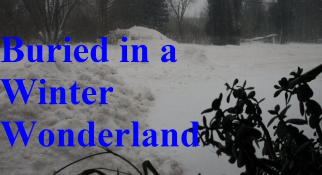
Beware on snowmobile trail and roads: Accidents, sliding cars and a jackknifed semi already reported this Tuesday morning (Feb. 7, 2017) and forebear bad driving for next day or more: Wreck and burned sleds, numerous serious traffic accidents

Scroll down to read latest U.P. weather warnings or click on the links – lots of bad weather will make roads very slippery

Hazardous Weather Conditions

Hazardous Weather Outlook


Winter Weather Advisory until February 8, 12:00 AM EST

Lake Effect Snow Advisory

Special Weather Statement

Heavy Freezing Spray Warning

Small Craft Advisory

tuesday-feb-7-2017-warnings

By Greg Peterson
U.P. Breaking News
Owner, News Director
906-273-2433

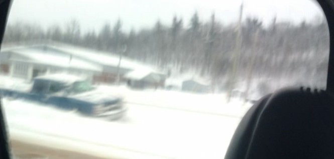
(Upper Peninsula of Michigan) – An accident that heavily damaged three vehicles in Negaunee was one of this morning’s accidents across northern Michigan as treacherous roads are expected from a storm that is walloping the Upper Peninsula.

Look out for blowing snow, snow heavy at times and freezing rain in some areas – see the list of warnings after this story

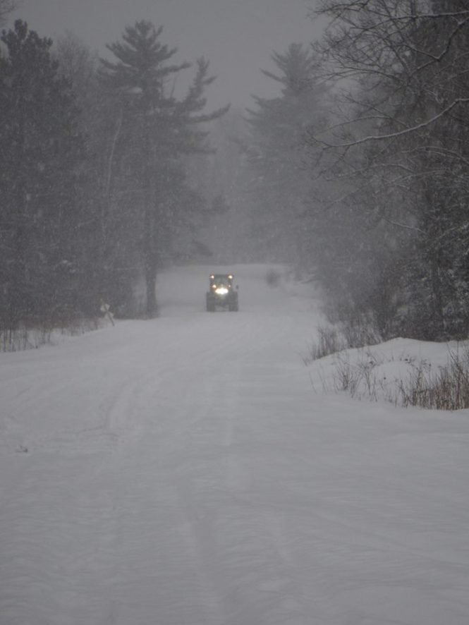
About a dozen motor vehicle rollovers have been reported since Saturday across the U.P. plus numerous snowmobile accidents and even a burned sled.

Only minor injuries were reported in the wreck that happened at abut 7:30 this morning at U.S.-41 and Baldwin Avenue in Negaunee, MI causing airbags t0o deploy – often resulting in a painful chest bruising – as airbags save your life (I know) but can cause also neck and spinal injuries.

The wreck caused a major morning commute traffic jam as did other accidents in Ishpeming and on M-94 in Marquette County and on the famous but slippery Quincy Hill in Hancock, MI in the Copper Country where cars were sliding this morning and a semi tractor trailer truck jackknifed.

There have been numerous snowmobile accidents across the U.P. in past three days including one in Alger County on Monday, Feb. 6, 2017 that sent a man to Marquette General Hospital with a broken armed and other injuries. The victim crashed his sled reportedly traveling about 55 to 60 miles per hour and hit a bad spot on the trail throwing the victim. His injuries were serious but not life-threatening.

Meanwhile, trail groomers in the Copper Country this morning are reporting a snowmobile burned to a crisp and the sled skeleton was left along the trail.

It’s not clear what trail the burned sled is on but Keweenaw-Houghton County trail system

“There is nothing left,” said one groomer this morning. “Looks like a rental.”

Blinding snow caused numerous accidents on Saturday, Feb. 4, 2017 after the snowmobile races in the Soo area. Chippewa County law enforcement was kept busy by at least two snowmobile accidents and other wrecks – including a woman who rolled her sled on top of her – and was taken to War Memorial Hospital with painful injuries including possible seriously broken bones

It was one of several accidents that occurred in whiteout conditions in the eastern U.P. on Saturday, Feb. 4, 2017. Another involved a man who was taken to the hospital after his vehicle flipped several times in Chippewa County during the storm.

The blinding whiteout conditions were in so bad that police had to drive a woman and her children back to Sault Ste. Maire, MI after the driver had a panic attack and did the smart ting – pulled over and called for help.

Several groomers in the Houghton/Keweenaw trail system reported that it was mainly rental sleds on Monday describing as all looking the same.

This weekend, near Boot Jack an accident involving a snowmobile trailer caused a mess but no serious injuries. Not clear if the sled inside the trailer were also destroyed.

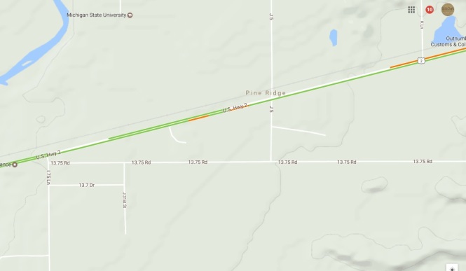
Meanwhile early yesterday morning (Mon., Jan. 6, 2017) ) a 54-year-old Escanaba women was transferred to a Marquette MI hospital after being seriously injured in a two-vehicle crash near the Highland Golf Club and railroad tracks on U.S.-2 in Ford River Township – that saw her SUV flip into numerous trees.

The Jaws of Life was used to extricate the woman and she was later transferred to U.P. Heath System in Marquette with numerous serious injuries. Police say the woman was eastbound when her SUV crossed the center line and struck an oncoming vehicle driven by a 21-year-old Bark River Man – who was fortunate to escape with only minor injuries.

The accident at about 11 p.m. Sunday night caused a major traffic jam. While authorities were extricating the victim – another rollover accident was reported nearby on one of the side streets. No one was found in that vehicle.

Here are the special weather statements:

Hazardous Weather Outlook

Hazardous Weather Outlook
National Weather Service Marquette MI
515 AM EST Tue Feb 7 2017

MIZ002-004>007-009-010-084-085-081015-
Ontonagon-Baraga-Marquette-Alger-Luce-Gogebic-Iron-
Southern Houghton-Northern Schoolcraft-
515 AM EST Tue Feb 7 2017 /415 AM CST Tue Feb 7 2017/

This Hazardous Weather Outlook is for portions of western Upper
Michigan and central Upper Michigan.

.DAY ONE...Today and Tonight

MODERATE TO HEAVY SNOW WILL CONTINUE TO DEVELOP THIS MORNING AND
SPREAD EASTWARD DURING THE MORNING AND AFTERNOON HOURS. THE SNOW
WILL LINGER INTO THE OVERNIGHT HOURS...ESPECIALLY ACROSS THE EAST.
EXPECT ROADS TO BECOME SNOW COVERED AND SLICK. SEE THE LATEST
WINTER WEATHER MESSAGE FOR MORE DETAILS.

.Days two through seven...Wednesday through Monday

LAKE EFFECT SNOW SHOWERS AND BLOWING SNOW WILL CONTINUE IN THE
SNOW BELTS FAVORED BY NORTHWEST WINDS WEDNESDAY THROUGH THURSDAY.

WAVES AS HIGH AS 10 FEET ON LAKE SUPERIOR TO THE EAST OF
MARQUETTE ON WEDNESDAY MAY PRODUCE MINOR BEACH EROSION.

SYSTEM SNOW WILL BE POSSIBLE WITH A QUICK MOVING SYSTEM LATE
FRIDAY NIGHT THROUGH SATURDAY MORNING

.SPOTTER INFORMATION STATEMENT...

WEATHER SPOTTERS ARE ENCOURAGED TO SUBMIT REPORTS TO THE NATIONAL
WEATHER SERVICE IN MARQUETTE. THE PUBLIC MAY ALSO SUBMIT REPORTS
AT OUR WEBPAGE...FACEBOOK PAGE...OR ON TWITTER.

$$

Winter Weather Advisory

URGENT - WINTER WEATHER MESSAGE
NATIONAL WEATHER SERVICE MARQUETTE MI
500 AM EST TUE FEB 7 2017

...MODERATE TO OCCASIONALLY HEAVY SNOW EXPECTED ACROSS THE
NORTHERN HALF OF UPPER MICHIGAN TODAY THROUGH THIS EVENING...

MIZ005>007-085-071800-
/O.CON.KMQT.WW.Y.0007.000000T0000Z-170208T0500Z/
MARQUETTE-ALGER-LUCE-NORTHERN SCHOOLCRAFT-
INCLUDING THE CITIES OF GWINN, MARQUETTE, GRAND MARAIS, MUNISING,
NEWBERRY, AND SENEY
500 AM EST TUE FEB 7 2017

...WINTER WEATHER ADVISORY REMAINS IN EFFECT UNTIL MIDNIGHT EST
TONIGHT...

HAZARDOUS WEATHER...

 * SNOW WILL DEVELOP EARLY THIS MORNING AND CONTINUE THROUGH THIS
   EVENING. MODERATE TO HEAVY SNOW WILL FALL AT TIMES THIS
   AFTERNOON INTO THIS EVENING.

 * GUSTY NORTH WINDS AS HIGH AS 25 MPH TONIGHT WILL CAUSE PATCHY
   BLOWING AND DRIFTING SNOW, ESPECIALLY IN OPEN AREAS.

 * WIDESPREAD SNOWFALL TOTALS OF 4 TO 9 INCHES ARE EXPECTED TODAY
   THROUGH THIS EVENING...HIGHEST ALONG AND NORTHWEST OF A LINE FROM
   NEGAUNEE TO CHAMPION IN MARQUETTE COUNTY.

IMPACTS...

 * THE COMBINATION OF SNOW AND BLOWING SNOW WILL REDUCE
   VISIBILITY TO A HALF MILE OR LESS AT TIMES.

 * THE SNOW WILL BE HEAVY AND WET, WHICH WILL MAKE SHOVELING AND
   PLOWING SNOW MORE DIFFICULT.

 * ROADS WILL BECOME SNOW COVERED AND SLIPPERY TODAY THROUGH LATE
   THIS EVENING.

PRECAUTIONARY/PREPAREDNESS ACTIONS...

 * A WINTER WEATHER ADVISORY FOR SNOW MEANS THAT PERIODS OF SNOW
   AND BLOWING SNOW WILL CAUSE PRIMARILY TRAVEL DIFFICULTIES.

Special Weather Statement


Special Weather Statement
National Weather Service Marquette MI
435 AM EST Tue Feb 7 2017

MIZ011>014-072200-
Dickinson-Menominee-Delta-Southern Schoolcraft-
Including the cities of Iron Mountain, Menominee, Escanaba,
Gladstone, and Manistique
435 AM EST Tue Feb 7 2017 /335 AM CST Tue Feb 7 2017/

...Wintry Mix Expected to Develop This Morning and then Linger
into This Evening...

Light snow and freezing drizzle is expected to develop early this
morning and then slowly transition to a mix of light freezing
rain, sleet and snow later this morning into the afternoon. While
the precipitation is expected to remain light, the wintry mix will
still make roads very slippery.

Please allow extra time to reach your destination this morning
into this evening.

Voss

Special Weather Statement
National Weather Service La Crosse WI
600 AM CST Tue Feb 7 2017

IAZ008>011-018-019-MNZ079-086>088-094>096-WIZ017-029-032>034-
041>044-053>055-071400-
Mitchell-Howard-Winneshiek-Allamakee-Floyd-Chickasaw-Wabasha-
Dodge-Olmsted-Winona-Mower-Fillmore-Houston-Taylor-Clark-Buffalo-
Trempealeau-Jackson-La Crosse-Monroe-Juneau-Adams-Vernon-Crawford-
Richland-
Including the cities of Osage, Cresco, Decorah, Waukon,
Charles City, New Hampton, Wabasha, Dodge Center, Rochester,
Winona, Austin, Preston, Caledonia, Medford, Neillsville, Alma,
Arcadia, Whitehall, Black River Falls, La Crosse, Sparta, Tomah,
Mauston, Friendship, Viroqua, Prairie Du Chien,
and Richland Center
600 AM CST Tue Feb 7 2017

...Patchy Dense Fog This Morning...

Patchy dense fog is possible this morning across portions of
southeast Minnesota, northeast Iowa and southwest Wisconsin,
potentially impacting the morning commute. Visibility may drop to
1/2 mile or less at times, especially across elevated terrain and
along ridge tops. Slow down and allow extra time to reach your
destination this morning as visibility may change rapidly.

$$

Heavy Freezing Spray Warning

URGENT - MARINE WEATHER MESSAGE
NATIONAL WEATHER SERVICE MARQUETTE MI
358 AM EST TUE FEB 7 2017

LSZ162-263-071700-
/O.NEW.KMQT.GL.W.0009.170207T0858Z-170208T0000Z/
/O.NEW.KMQT.UP.W.0009.170208T0100Z-170208T1900Z/
LAKE SUPERIOR WEST OF A LINE FROM SAXON HARBOR WI TO GRAND
PORTAGE MN BEYOND 5NM-
LAKE SUPERIOR FROM SAXON HARBOR WI TO UPPER ENTRANCE TO PORTAGE
CANAL MI 5NM OFF SHORE TO THE US/CANADIAN BORDER INCLUDING ISLE
ROYALE NATIONAL PARK-
358 AM EST TUE FEB 7 2017 /258 AM CST TUE FEB 7 2017/

...GALE WARNING IN EFFECT UNTIL 7 PM EST /6 PM CST/ THIS
EVENING...
...HEAVY FREEZING SPRAY WARNING IN EFFECT FROM 8 PM EST /7 PM
CST/ THIS EVENING TO 2 PM EST /1 PM CST/ WEDNESDAY...

THE NATIONAL WEATHER SERVICE IN MARQUETTE HAS ISSUED A GALE
WARNING...WHICH IS IN EFFECT UNTIL 7 PM EST /6 PM CST/ THIS
EVENING. A HEAVY FREEZING SPRAY WARNING HAS ALSO BEEN ISSUED.
THIS HEAVY FREEZING SPRAY WARNING IS IN EFFECT FROM 8 PM EST
/7 PM CST/ THIS EVENING TO 2 PM EST /1 PM CST/ WEDNESDAY.

* WIND AND WAVES DURING THE GALE WARNING: EXPECT SUSTAINED WINDS
  OF UP TO 31 KNOTS FROM THE NORTHEAST...WITH GUSTS UP TO 40
  KNOTS. THE LARGEST EXPECTED SIGNIFICANT WAVES WILL BE 10 FEET
  WITH A MAXIMUM WAVE HEIGHT OF UP TO 15 FEET POSSIBLE.

* TIMING: THE MAXIMUM WINDS ARE EXPECTED AROUND 7 AM EST TUESDAY
  WITH THE LARGEST WAVES EXPECTED AROUND 10 AM EST TUESDAY.

* TIMING: EXPECT HEAVY FREEZING SPRAY TO OCCUR FROM 8 PM EST /7
  PM CST/ THIS EVENING TO 2 PM EST /1 PM CST/ WEDNESDAY.

PLEASE SEE THE LATEST MARINE FORECASTS FOR MORE DETAILED
INFORMATION.

PRECAUTIONARY/PREPAREDNESS ACTIONS...

A GALE WARNING MEANS WINDS OF 34 TO 47 KNOTS ARE IMMINENT OR
OCCURRING. OPERATING A VESSEL IN GALE CONDITIONS REQUIRES
EXPERIENCE AND PROPERLY EQUIPPED VESSELS. IT IS HIGHLY
RECOMMENDED THAT MARINERS WITHOUT THE PROPER EXPERIENCE SEEK SAFE
HARBOR PRIOR TO THE ONSET OF GALE CONDITIONS.

A HEAVY FREEZING SPRAY WARNING MEANS HEAVY FREEZING SPRAY IS
EXPECTED TO RAPIDLY ACCUMULATE ON VESSELS. THESE CONDITIONS CAN
BE EXTREMELY HAZARDOUS TO NAVIGATION. IT IS RECOMMENDED THAT
MARINERS NOT TRAINED TO OPERATE IN THESE CONDITIONS OR VESSELS
NOT PROPERLY EQUIPPED TO DO SO...REMAIN IN PORT OR AVOID THE
WARNING AREA.


Hazardous Weather Outlook

Hazardous Weather Outlook
National Weather Service Marquette MI
515 AM EST Tue Feb 7 2017

LSZ162-240>251-263>267-081015-
Lake Superior west of a line from Saxon Harbor WI to Grand
Portage MN beyond 5NM-Saxon Harbor WI to Black River MI-
Black River to Ontonagon MI-
Ontonagon to Upper Entrance of Portage Canal MI-
Upper Entrance of Portage Canal to Eagle River MI-
Eagle River to Manitou Island MI-
Manitou Island to Point Isabelle MI-
Point Isabelle to Lower Entrance of Portage Canal MI-
Lower Entrance of Portage Canal To Huron Islands MI Including
Keweenaw and Huron Bays-Huron Islands to Marquette MI-
Marquette to Munising MI-Munising to Grand Marais MI-
Grand Marais to Whitefish Point MI-
Lake Superior from Saxon Harbor WI to Upper Entrance to Portage
Canal MI 5NM off shore to the US/Canadian border including Isle
Royale National Park-
Lake Superior from Upper Entrance to Portage Canal to Manitou
Island MI 5NM off shore to the US/Canadian Border-
Lake Superior West of Line from Manitou Island to Marquette MI
Beyond 5NM from shore-
Lake Superior East of a line from Manitou Island to Marquette MI
and West of a line from Grand Marais MI to the US/Canadian Border
Beyond 5NM from shore-
Lake Superior from Grand Marais MI to Whitefish Point MI 5NM off
shore to the US/Canadian border-
515 AM EST Tue Feb 7 2017 /415 AM CST Tue Feb 7 2017/

This Hazardous Weather Outlook is for portions of Eastern Lake
Superior...Central Lake Superior and Western Lake Superior.

.DAY ONE...Today and Tonight

NORTHWEST GALES OF 35 TO 40 KNOTS ARE EXPECTED ACROSS WESTERN
PORTIONS OF THE LAKE THIS MORNING AND AFTERNOON. TONIGHT...THESE
GALES WILL BECOME NORTH-NORTHWESTERLY AND TRANSITION TO CENTRAL
AND EASTERN PORTIONS OF THE LAKE.

HEAVY FREEZING SPRAY IS ALSO EXPECTED TODAY AND TONIGHT.

.Days two through seven...Wednesday through Monday

HEAVY FREEZING SPRAY IS EXPECTED TO LINGER THROUGH
THURSDAY...ESPECIALLY ACROSS EASTERN PORTIONS OF THE LAKE.

.SPOTTER INFORMATION STATEMENT...

THE NEED FOR WEATHER SPOTTER REPORTS IS NOT ANTICIPATED AT THIS
TIME.

$$


Gale Warning

URGENT - MARINE WEATHER MESSAGE
NATIONAL WEATHER SERVICE MARQUETTE MI
358 AM EST TUE FEB 7 2017

LSZ162-263-071700-
/O.NEW.KMQT.GL.W.0009.170207T0858Z-170208T0000Z/
/O.NEW.KMQT.UP.W.0009.170208T0100Z-170208T1900Z/
LAKE SUPERIOR WEST OF A LINE FROM SAXON HARBOR WI TO GRAND
PORTAGE MN BEYOND 5NM-
LAKE SUPERIOR FROM SAXON HARBOR WI TO UPPER ENTRANCE TO PORTAGE
CANAL MI 5NM OFF SHORE TO THE US/CANADIAN BORDER INCLUDING ISLE
ROYALE NATIONAL PARK-
358 AM EST TUE FEB 7 2017 /258 AM CST TUE FEB 7 2017/

...GALE WARNING IN EFFECT UNTIL 7 PM EST /6 PM CST/ THIS
EVENING...
...HEAVY FREEZING SPRAY WARNING IN EFFECT FROM 8 PM EST /7 PM
CST/ THIS EVENING TO 2 PM EST /1 PM CST/ WEDNESDAY...

THE NATIONAL WEATHER SERVICE IN MARQUETTE HAS ISSUED A GALE
WARNING...WHICH IS IN EFFECT UNTIL 7 PM EST /6 PM CST/ THIS
EVENING. A HEAVY FREEZING SPRAY WARNING HAS ALSO BEEN ISSUED.
THIS HEAVY FREEZING SPRAY WARNING IS IN EFFECT FROM 8 PM EST
/7 PM CST/ THIS EVENING TO 2 PM EST /1 PM CST/ WEDNESDAY.

* WIND AND WAVES DURING THE GALE WARNING: EXPECT SUSTAINED WINDS
  OF UP TO 31 KNOTS FROM THE NORTHEAST...WITH GUSTS UP TO 40
  KNOTS. THE LARGEST EXPECTED SIGNIFICANT WAVES WILL BE 10 FEET
  WITH A MAXIMUM WAVE HEIGHT OF UP TO 15 FEET POSSIBLE.

* TIMING: THE MAXIMUM WINDS ARE EXPECTED AROUND 7 AM EST TUESDAY
  WITH THE LARGEST WAVES EXPECTED AROUND 10 AM EST TUESDAY.

* TIMING: EXPECT HEAVY FREEZING SPRAY TO OCCUR FROM 8 PM EST /7
  PM CST/ THIS EVENING TO 2 PM EST /1 PM CST/ WEDNESDAY.

PLEASE SEE THE LATEST MARINE FORECASTS FOR MORE DETAILED
INFORMATION.

PRECAUTIONARY/PREPAREDNESS ACTIONS...

A GALE WARNING MEANS WINDS OF 34 TO 47 KNOTS ARE IMMINENT OR
OCCURRING. OPERATING A VESSEL IN GALE CONDITIONS REQUIRES
EXPERIENCE AND PROPERLY EQUIPPED VESSELS. IT IS HIGHLY
RECOMMENDED THAT MARINERS WITHOUT THE PROPER EXPERIENCE SEEK SAFE
HARBOR PRIOR TO THE ONSET OF GALE CONDITIONS.

A HEAVY FREEZING SPRAY WARNING MEANS HEAVY FREEZING SPRAY IS
EXPECTED TO RAPIDLY ACCUMULATE ON VESSELS. THESE CONDITIONS CAN
BE EXTREMELY HAZARDOUS TO NAVIGATION. IT IS RECOMMENDED THAT
MARINERS NOT TRAINED TO OPERATE IN THESE CONDITIONS OR VESSELS
NOT PROPERLY EQUIPPED TO DO SO...REMAIN IN PORT OR AVOID THE
WARNING AREA.

Winter Weather Advisory

URGENT - WINTER WEATHER MESSAGE
NATIONAL WEATHER SERVICE MARQUETTE MI
500 AM EST TUE FEB 7 2017

...MODERATE TO OCCASIONALLY HEAVY SNOW EXPECTED ACROSS THE
NORTHERN HALF OF UPPER MICHIGAN TODAY THROUGH THIS EVENING...

MIZ005>007-085-071800-
/O.CON.KMQT.WW.Y.0007.000000T0000Z-170208T0500Z/
MARQUETTE-ALGER-LUCE-NORTHERN SCHOOLCRAFT-
INCLUDING THE CITIES OF GWINN, MARQUETTE, GRAND MARAIS, MUNISING,
NEWBERRY, AND SENEY
500 AM EST TUE FEB 7 2017

...WINTER WEATHER ADVISORY REMAINS IN EFFECT UNTIL MIDNIGHT EST
TONIGHT...

HAZARDOUS WEATHER...

 * SNOW WILL DEVELOP EARLY THIS MORNING AND CONTINUE THROUGH THIS
   EVENING. MODERATE TO HEAVY SNOW WILL FALL AT TIMES THIS
   AFTERNOON INTO THIS EVENING.

 * GUSTY NORTH WINDS AS HIGH AS 25 MPH TONIGHT WILL CAUSE PATCHY
   BLOWING AND DRIFTING SNOW, ESPECIALLY IN OPEN AREAS.

 * WIDESPREAD SNOWFALL TOTALS OF 4 TO 9 INCHES ARE EXPECTED TODAY
   THROUGH THIS EVENING...HIGHEST ALONG AND NORTHWEST OF A LINE FROM
   NEGAUNEE TO CHAMPION IN MARQUETTE COUNTY.

IMPACTS...

 * THE COMBINATION OF SNOW AND BLOWING SNOW WILL REDUCE
   VISIBILITY TO A HALF MILE OR LESS AT TIMES.

 * THE SNOW WILL BE HEAVY AND WET, WHICH WILL MAKE SHOVELING AND
   PLOWING SNOW MORE DIFFICULT.

 * ROADS WILL BECOME SNOW COVERED AND SLIPPERY TODAY THROUGH LATE
   THIS EVENING.

PRECAUTIONARY/PREPAREDNESS ACTIONS...

 * A WINTER WEATHER ADVISORY FOR SNOW MEANS THAT PERIODS OF SNOW
   AND BLOWING SNOW WILL CAUSE PRIMARILY TRAVEL DIFFICULTIES.
VOSS


Hazardous Weather Outlook

Hazardous Weather Outlook
National Weather Service Marquette MI
515 AM EST Tue Feb 7 2017

MIZ002-004>007-009-010-084-085-081015-
Ontonagon-Baraga-Marquette-Alger-Luce-Gogebic-Iron-
Southern Houghton-Northern Schoolcraft-
515 AM EST Tue Feb 7 2017 /415 AM CST Tue Feb 7 2017/

This Hazardous Weather Outlook is for portions of western Upper
Michigan and central Upper Michigan.

.DAY ONE...Today and Tonight

MODERATE TO HEAVY SNOW WILL CONTINUE TO DEVELOP THIS MORNING AND
SPREAD EASTWARD DURING THE MORNING AND AFTERNOON HOURS. THE SNOW
WILL LINGER INTO THE OVERNIGHT HOURS...ESPECIALLY ACROSS THE EAST.
EXPECT ROADS TO BECOME SNOW COVERED AND SLICK. SEE THE LATEST
WINTER WEATHER MESSAGE FOR MORE DETAILS.

.Days two through seven...Wednesday through Monday

LAKE EFFECT SNOW SHOWERS AND BLOWING SNOW WILL CONTINUE IN THE
SNOW BELTS FAVORED BY NORTHWEST WINDS WEDNESDAY THROUGH THURSDAY.

WAVES AS HIGH AS 10 FEET ON LAKE SUPERIOR TO THE EAST OF
MARQUETTE ON WEDNESDAY MAY PRODUCE MINOR BEACH EROSION.

SYSTEM SNOW WILL BE POSSIBLE WITH A QUICK MOVING SYSTEM LATE
FRIDAY NIGHT THROUGH SATURDAY MORNING

.SPOTTER INFORMATION STATEMENT...

WEATHER SPOTTERS ARE ENCOURAGED TO SUBMIT REPORTS TO THE NATIONAL
WEATHER SERVICE IN MARQUETTE. THE PUBLIC MAY ALSO SUBMIT REPORTS
AT OUR WEBPAGE...FACEBOOK PAGE...OR ON TWITTER.


Three snowmobile accidents in western U.P. and NE Wisconsin show need for extra care including with the lake-effect and blowing snow after strange (so-called) winter weather in the Upper Peninsula of Michigan: Alcohol believed factor in snowmobile crash early today, Sat., Jan. 28, 2017

One early morning wreck in Houghton County already early today: Sat., Jan. 28, 2017

Take it easy on the trails: Speed, Alcohol and unpredictable Upper Peninsula snowmobile trails are bad mixture

By Greg Peterson
U.P. Breaking News
Owner, News Director
906-273-2433

1-28-17-lake-effect-snowmo-crashes

(Upper Peninsula of Michigan) – Three snowmobile accidents – including one this morning in Houghton County – have been reported since Friday afternoon in the western U.P. and N.E. Wisconsin as the erratic U.P. Weather has already led to the postponing of a U.P. dogsled race.

With the heavy lake-effect and blowing snow warnings up for today snowmobilers should take extra caution – and remember the weird weather has caused what”s below the blanket to be somewhat of a mystery.

Car rollover:

A rollover vehicle accident with no injuries was also reported this morning on S. Mackinac Trail near 6 Mile Rd.

Snowmobile accident:

Police believe alcohol played a factor in this morning’s (Sat., Jan. 28, 2017) crash on Canal Road.

The victim was with a group of snowmobilers from the Minneapolis area.

The injured sledder lost control when the trail cross the road. He was reported lying in the middle of the road – and apparently suffered minor to moderate injuries. He was taken to the Portage hospital.

Snowmobile accident:

A man was reportedly seriously injured when his sled hi a tree in Iron County, WI. A Beacon ambulance from ironwood was set – and Aspirus Ironwood Hospital was put on stand by.

The accident was reported around Time after a female caller reported a snowmobile had hit and tree – and the victim was breathing but not responsive.

Snowmobile accident:

Meanwhile, earlier Friday afternoon emergency officials in Houghton County were called after a snowmobiler received head and facial injuries when his sled hit a fence and possibly bleachers in Osceola Township, MI.

The victim was cared for by the nice folks in the kitchen at Quincy’s Restaurant in Dollar Bay, MI.

Thankfully, his injuries are not life-threatening and he was taken to the hospital for treatment of his injuries.

Other snowmobile incidents:

A snowmobile fire Friday night at a Houghton, MI motel

A 15-year-old boy causes incident early today, cops called, trying to get a snowmobile back from a Houghton County, MI towing company

1-28-17-lake-effect-snowmo-crashes

URGENT WEATHER BULLETIN – Gale force winds whip up Lake Superior snow storm: Heavy lake-effect snow and blowing snow expected in Marquette, Baraga, Alger, Luce, Gogebic, Ontonagon and Schoolcraft counties through the weekend – really entire U.P.

Heavy Snow: 10 inches to a foot or more

snow snow.jpg

HAZARDOUS WEATHER OUTLOOK
NATIONAL WEATHER SERVICE MARQUETTE MI
403 PM EST SAT JAN 28 2017

LSZ162-240>251-263>267-292115-
LAKE SUPERIOR WEST OF A LINE FROM SAXON HARBOR WI TO GRAND
PORTAGE MN BEYOND 5NM-SAXON HARBOR WI TO BLACK RIVER MI-
BLACK RIVER TO ONTONAGON MI-
ONTONAGON TO UPPER ENTRANCE OF PORTAGE CANAL MI-
UPPER ENTRANCE OF PORTAGE CANAL TO EAGLE RIVER MI-
EAGLE RIVER TO MANITOU ISLAND MI-
MANITOU ISLAND TO POINT ISABELLE MI-
POINT ISABELLE TO LOWER ENTRANCE OF PORTAGE CANAL MI-
LOWER ENTRANCE OF PORTAGE CANAL TO HURON ISLANDS MI INCLUDING
KEWEENAW AND HURON BAYS-HURON ISLANDS TO MARQUETTE MI-
MARQUETTE TO MUNISING MI-MUNISING TO GRAND MARAIS MI-
GRAND MARAIS TO WHITEFISH POINT MI-
LAKE SUPERIOR FROM SAXON HARBOR WI TO UPPER ENTRANCE TO PORTAGE
CANAL MI 5NM OFF SHORE TO THE US/CANADIAN BORDER INCLUDING ISLE
ROYALE NATIONAL PARK-
LAKE SUPERIOR FROM UPPER ENTRANCE TO PORTAGE CANAL TO MANITOU
ISLAND MI 5NM OFF SHORE TO THE US/CANADIAN BORDER-
LAKE SUPERIOR WEST OF LINE FROM MANITOU ISLAND TO MARQUETTE MI
BEYOND 5NM FROM SHORE-
LAKE SUPERIOR EAST OF A LINE FROM MANITOU ISLAND TO MARQUETTE MI
AND WEST OF A LINE FROM GRAND MARAIS MI TO THE US/CANADIAN BORDER
BEYOND 5NM FROM SHORE-
LAKE SUPERIOR FROM GRAND MARAIS MI TO WHITEFISH POINT MI 5NM OFF
SHORE TO THE US/CANADIAN BORDER-
403 PM EST SAT JAN 28 2017 /303 PM CST SAT JAN 28 2017/

THIS HAZARDOUS WEATHER OUTLOOK IS FOR PORTIONS OF EASTERN LAKE
SUPERIOR...CENTRAL LAKE SUPERIOR AND WESTERN LAKE SUPERIOR.

.DAY ONE...TONIGHT

NORTH TO NORTHWEST GALE FORCE WIND GUSTS TO 35 KNOTS ARE POSSIBLE
ACROSS CENTRAL LAKE SUPERIOR THIS MORNING.

.DAYS TWO THROUGH SEVEN...SUNDAY THROUGH FRIDAY

NO HAZARDOUS WEATHER IS EXPECTED AT THIS TIME.

.SPOTTER INFORMATION STATEMENT...

THE NEED FOR WEATHER SPOTTER REPORTS IS NOT ANTICIPATED AT THIS
TIME.

$$

HAZARDOUS WEATHER OUTLOOK
NATIONAL WEATHER SERVICE MARQUETTE MI
403 PM EST SAT JAN 28 2017

MIZ001>007-009>014-084-085-292115-
KEWEENAW-ONTONAGON-NORTHERN HOUGHTON-BARAGA-MARQUETTE-ALGER-LUCE-
GOGEBIC-IRON-DICKINSON-MENOMINEE-DELTA-SOUTHERN SCHOOLCRAFT-
SOUTHERN HOUGHTON-NORTHERN SCHOOLCRAFT-
403 PM EST SAT JAN 28 2017 /303 PM CST SAT JAN 28 2017/

THIS HAZARDOUS WEATHER OUTLOOK IS FOR PORTIONS OF WESTERN UPPER
MICHIGAN AND CENTRAL UPPER MICHIGAN.

.DAY ONE...TONIGHT

MODERATE LAKE EFFECT SNOWS WILL AT TIMES IMPACT THE NORTH TO
NORTHWEST SNOW BELTS NEAR LAKE SUPERIOR. SEE THE LATEST WINTER
WEATHER MESSAGE FOR FURTHER DETAILS.

.DAYS TWO THROUGH SEVEN...SUNDAY THROUGH FRIDAY

MODERATE LAKE EFFECT SNOWS WILL CONTINUE TO IMPACT THE NORTH TO
NORTHWEST WIND SNOW BELTS NEAR LAKE SUPERIOR ON SUNDAY. SEE THE
LATEST WINTER WEATHER MESSAGE FOR FURTHER DETAILS.

A WIDESPREAD LIGHT TO MODERATE SNOWFALL IS EXPECTED MONDAY
AFTERNOON INTO TUESDAY MORNING.

.SPOTTER INFORMATION STATEMENT...

WEATHER SPOTTERS ARE ENCOURAGED TO SUBMIT REPORTS TO THE NATIONAL
WEATHER SERVICE IN MARQUETTE. THE PUBLIC MAY ALSO SUBMIT REPORTS
AT OUR WEBPAGE, FACEBOOK PAGE, OR ON TWITTER.

$$

HAZARDOUS WEATHER OUTLOOK
NATIONAL WEATHER SERVICE DULUTH MN
348 PM CST SAT JAN 28 2017

MNZ010>012-018>021-025-026-033>038-WIZ001>004-006>009-291430-
KOOCHICHING-NORTH ST. LOUIS-NORTHERN COOK/NORTHERN LAKE-
NORTH ITASCA-CENTRAL ST. LOUIS-SOUTHERN LAKE/NORTH SHORE-
SOUTHERN COOK/NORTH SHORE-NORTH CASS-SOUTH ITASCA-SOUTH CASS-
CROW WING-NORTHERN AITKIN-SOUTH AITKIN-CARLTON/SOUTH ST. LOUIS-
PINE-DOUGLAS-BAYFIELD-ASHLAND-IRON-BURNETT-WASHBURN-SAWYER-PRICE-
348 PM CST SAT JAN 28 2017

THIS HAZARDOUS WEATHER OUTLOOK IS FOR PORTIONS OF NORTHEAST
MINNESOTA AND NORTHWEST WISCONSIN.

.DAY ONE...THIS AFTERNOON AND TONIGHT

LAKE EFFECT SNOW SHOWERS ARE EXPECTED TO DEVELOP THIS EVENING AND
CONTINUE THROUGH TONIGHT. THE LAKE EFFECT SNOW WILL INTENSIFY
OVERNIGHT...WITH THE HEAVIEST SNOWFALL EXPECTED AFTER MIDNIGHT
THROUGH SUNDAY MORNING. THERE IS A LAKE EFFECT SNOW ADVISORY FOR
IRON COUNTY IN EFFECT FROM TONIGHT INTO SUNDAY AFTERNOON. PLEASE
REFER TO THE LATEST WINTER WEATHER MESSAGE AND FORECAST INFORMATION
FOR ADDITIONAL DETAILS.

.DAYS TWO THROUGH SEVEN...SUNDAY THROUGH FRIDAY

LAKE EFFECT SNOW WILL CONTINUE SUNDAY BEFORE TAPERING OFF SUNDAY
AFTERNOON AND EVENING. TOTAL SNOW ACCUMULATIONS FROM TONIGHT
THROUGH THE DAY SUNDAY IN NORTHEASTERN IRON COUNTY...ALONG AND
NEAR THE GOGEBIC RANGE...ARE EXPECTED TO BE BETWEEN 3 TO 6 INCHES.
THERE COULD BE SOME ISOLATED HIGHER AMOUNTS.

A CANADIAN CLIPPER WILL MOVE THROUGH THE NORTHLAND MONDAY, AND
LIKELY BRING WIDESPREAD LIGHT TO MODERATE SNOWFALL, ABOUT 2 TO 5
INCHES, FROM THE MORNING THROUGH EVENING. THIS CLIPPER WILL LIKELY
AFFECT THE AFTERNOON AND EVENING WORK COMMUTES. MOTORISTS SHOULD
PREPARE FOR SLOWER TRAVEL, IF NOT DIFFICULT TRAVEL.

.SPOTTER INFORMATION STATEMENT...

SNOW SPOTTERS ARE REQUESTED TO REPORT THEIR SNOWFALL MEASUREMENTS
TO THE NATIONAL WEATHER SERVICE.

$$

JTS/G2

MORE INFORMATION MAY BE OBTAINED AT THE FOLLOWING WEB ADDRESS:
HTTP://WWW.WEATHER.GOV/DULUTH (ALL LOWER CASE)

HAZARDOUS WEATHER OUTLOOK
NATIONAL WEATHER SERVICE GAYLORD MI
335 PM EST SAT JAN 28 2017

LHZ345>349-LMZ323-341-342-344>346-LSZ321-322-MIZ008-015>036-041-
042-291100-
STRAITS OF MACKINAC WITHIN 5 NM OF MACKINAC BRIDGE INCLUDING
MACKINAC ISLAND-ST IGNACE TO FALSE DETOUR CHANNEL-
5NM EAST OF MACKINAC BRIDGE TO PRESQUE ISLE LIGHT MI INCLUDING
BOIS BLANC ISLAND-
PRESQUE ISLE LIGHT TO STURGEON PT MI INCLUDING THUNDER BAY
NATIONAL MARINE SANCTUARY-STURGEON PT TO ALABASTER MI-
GRAND TRAVERSE BAY SOUTH OF A LINE GRAND TRAVERSE LIGHT TO
NORWOOD MI-SEUL CHOIX POINT TO 5NM WEST OF MACKINAC BRIDGE-
NORWOOD MI TO 5NM WEST OF MACKINAC BRIDGE INCLUDING LITTLE
TRAVERSE BAY-SLEEPING BEAR POINT TO GRAND TRAVERSE LIGHT MI-
POINT BETSIE TO SLEEPING BEAR POINT MI-
MANISTEE TO POINT BETSIE MI-
WHITEFISH BAY (U.S. PORTION)/WHITEFISH POINT TO POINT IROQUOIS MI-
ST. MARYS RIVER POINT IROQUOIS TO E. POTAGANNISSING BAY-CHIPPEWA-
MACKINAC-EMMET-CHEBOYGAN-PRESQUE ISLE-CHARLEVOIX-LEELANAU-ANTRIM-
OTSEGO-MONTMORENCY-ALPENA-BENZIE-GRAND TRAVERSE-KALKASKA-CRAWFORD-
OSCODA-ALCONA-MANISTEE-WEXFORD-MISSAUKEE-ROSCOMMON-OGEMAW-IOSCO-
GLADWIN-ARENAC-
335 PM EST SAT JAN 28 2017

THIS HAZARDOUS WEATHER OUTLOOK IS FOR NORTHERN LOWER MICHIGAN...
EASTERN UPPER MICHIGAN...AND ADJACENT NEARSHORE WATERS OF LAKE
MICHIGAN...LAKE HURON AND LAKE SUPERIOR.

.DAY ONE...TONIGHT.

PERIODIC HEAVY SNOW SHOWERS...SOME BLOWING SNOW AND REDUCED
VISIBILITIES WILL CONTINUE TO IMPACT PRIMARILY THE SNOWBELTS OF
EASTERN UPPER AND NORTHERN LOWER MICHIGAN.

.DAYS TWO THROUGH SEVEN...SUNDAY THROUGH FRIDAY.

PERIODIC HEAVY SNOW SHOWERS WILL IMPACT PRIMARILY THE SNOWBELTS
OF EASTERN UPPER AND NORTHERN LOWER MICHIGAN THROUGH SUNDAY NIGHT.

ACCUMULATIONS ARE EXPECTED WITH AN ALBERTA CLIPPER MONDAY NIGHT
THROUGH TUESDAY. PERIODS OF LAKE EFFECT SNOW WILL OCCUR AFTER THE
CLIPPER...DIMINISHING BY THE END OF THE WEEK.

.SPOTTER INFORMATION STATEMENT...

SPOTTERS ARE ENCOURAGED TO REPORT SNOWFALL AMOUNTS TO THE
NATIONAL WEATHER SERVICE. REPORTS MAY BE MADE ONE OF THREE WAYS:

ONLINE:    WEATHER.GOV/GAYLORD
FACEBOOK: FACEBOOK.COM/NWSGAYLORD
TWITTER: TWITTER.COM/NWSGAYLORD

&&

FOR MORE INFORMATION VISIT HTTP://WEATHER.GOV/GAYLORD.

$$

HAZARDOUS WEATHER OUTLOOK
NATIONAL WEATHER SERVICE GREEN BAY WI
157 PM CST SAT JAN 28 2017

WIZ005-010>013-018>022-030-031-035>040-045-048>050-073-074-292000-
VILAS-ONEIDA-FOREST-FLORENCE-NORTHERN MARINETTE COUNTY-LINCOLN-
LANGLADE-MENOMINEE-NORTHERN OCONTO COUNTY-DOOR-MARATHON-SHAWANO-
WOOD-PORTAGE-WAUPACA-OUTAGAMIE-BROWN-KEWAUNEE-WAUSHARA-WINNEBAGO-
CALUMET-MANITOWOC-SOUTHERN MARINETTE COUNTY-
SOUTHERN OCONTO COUNTY-
157 PM CST SAT JAN 28 2017

THIS HAZARDOUS WEATHER OUTLOOK IS FOR NORTH-CENTRAL AND NORTHEAST
WISCONSIN.

.DAY ONE...TONIGHT

LAKE ENHANCED SNOW SHOWERS WILL INCREASE OVER FAR NORTH CENTRAL
WISCONSIN AFTER MIDNIGHT TONIGHT, WITH AN INCH OR TWO OF
ACCUMULATION EXPECTED IN VILAS COUNTY BY MORNING. ROADS WILL
BECOME SNOW COVERED AND SLIPPERY.

.DAYS TWO THROUGH SEVEN...SUNDAY THROUGH SATURDAY

LAKE EFFECT SNOW SHOWERS WILL CONTINUE OVER FAR NORTH CENTRAL
WISCONSIN THROUGH SUNDAY, WITH ANOTHER 1 TO 3 INCHES OF
POWDERY SNOW ANTICIPATED ACROSS VILAS COUNTY. A WINTER WEATHER
ADVISORY HAS BEEN ISSUED FOR VILAS COUNTY.

AN APPROACHING ALBERTA CLIPPER WILL BRING ACCUMULATING SNOW TO
THE AREA MONDAY AFTERNOON INTO MONDAY NIGHT. MOST LOCATIONS SHOULD
RECEIVE 2 TO 3 INCHES OF SNOW...BUT LOCALLY HIGHER AMOUNTS ARE
POSSIBLE.

COLDER AIR BEING PULLED INTO THE REGION BEHIND THIS CLIPPER MAY
ONCE AGAIN ALLOW FOR LAKE EFFECT SNOW SHOWERS TO DEVELOP OVER FAR
NORTH CENTRAL WISCONSIN FROM TUESDAY AFTERNOON THROUGH WEDNESDAY
NIGHT.

.SPOTTER INFORMATION STATEMENT...

SPOTTERS IN VILAS COUNTY ARE REQUESTED TO FORWARD SNOWFALL
MEASUREMENTS TO THE NATIONAL WEATHER SERVICE IN GREEN BAY LATE
TONIGHT INTO SUNDAY.


update 1-28-17 snow advisories.jpg

Lake effect snow and blowing advisory for entire U.P. – it’s gonna snow off and on – mainly on – in the snow belts all day:

Looks like Houghton and Keweenaw Counties are getting hit with snow – snowplow driver at 6:22 a.m. ET:

“I can’t hardly see where I am driving right now because the snow is so heavy.”

A snowplow driver in the Houghton/Keweenaw counties area of the Copper Country said it all at 6:15 a.m. this morning, Sat. Jan. 28, 2017:

“Holy crap is snowing here now – you can hardly see where you are driving”

URGENT WEATHER BULLETIN – Heavy lake effect snow and blowing snow expected in Marquette, Baraga, Alger, Luce and Schoolcraft counties through this Saturday afternoon – and overnight Sunday in Gogebic County and Ontonagon County

A lake-effect snow and blowing snow weekend: U.P. snow belts to be hit today and Sunday with Lake-effect snow – warnings issued at 3:45 a.m. ET today, Sat., Jan. 28, 2017

Winter Weather Advisory

Lake Effect Snow Advisory

Hazardous Weather Outlook

Small Craft Advisory

HAZARDOUS WEATHER OUTLOOK
NATIONAL WEATHER SERVICE MARQUETTE MI
517 AM EST SAT JAN 28 2017

MIZ001>007-009>014-084-085-291200-
KEWEENAW-ONTONAGON-NORTHERN HOUGHTON-BARAGA-MARQUETTE-ALGER-LUCE-
GOGEBIC-IRON-DICKINSON-MENOMINEE-DELTA-SOUTHERN SCHOOLCRAFT-
SOUTHERN HOUGHTON-NORTHERN SCHOOLCRAFT-
517 AM EST SAT JAN 28 2017 /417 AM CST SAT JAN 28 2017/

THIS HAZARDOUS WEATHER OUTLOOK IS FOR PORTIONS OF WESTERN UPPER
MICHIGAN AND CENTRAL UPPER MICHIGAN.

.DAY ONE...TODAY AND TONIGHT

MODERATE LAKE EFFECT SNOWS WILL AT TIMES IMPACT THE NORTH TO
NORTHWEST SNOW BELTS NEAR LAKE SUPERIOR. THERE WILL ALSO BE AREAS
OF BLOWING SNOW TODAY NEAR LAKE SUPERIOR. SEE THE LATEST WINTER
WEATHER MESSAGE FOR FURTHER DETAILS.

WAVES ON LAKE SUPERIOR AS HIGH AS 8 TO 10 FEET THIS AFTERNOON AND
EVENING MAY CAUSE MINOR BEACH EROSION ALONG THE SHORE OVER
PORTIONS OF THE NORTH CENTRAL.

.DAYS TWO THROUGH SEVEN...SUNDAY THROUGH FRIDAY

MODERATE LAKE EFFECT SNOWS WILL CONTINUE TO IMPACT THE NORTH TO
NORTHWEST WIND SNOW BELTS NEAR LAKE SUPERIOR ON SUNDAY. SEE THE
LATEST WINTER WEATHER MESSAGE FOR FURTHER DETAILS.

A WIDESPREAD LIGHT TO MODERATE SNOWFALL IS EXPECTED MONDAY
AFTERNOON AND MONDAY NIGHT.

.SPOTTER INFORMATION STATEMENT...

WEATHER SPOTTERS ARE ENCOURAGED TO SUBMIT REPORTS TO THE NATIONAL
WEATHER SERVICE IN MARQUETTE. THE PUBLIC MAY ALSO SUBMIT REPORTS
AT OUR WEBPAGE, FACEBOOK PAGE, OR ON TWITTER.

$$

HAZARDOUS WEATHER OUTLOOK
NATIONAL WEATHER SERVICE MARQUETTE MI
517 AM EST SAT JAN 28 2017

LSZ162-240>251-263>267-291200-
LAKE SUPERIOR WEST OF A LINE FROM SAXON HARBOR WI TO GRAND
PORTAGE MN BEYOND 5NM-SAXON HARBOR WI TO BLACK RIVER MI-
BLACK RIVER TO ONTONAGON MI-
ONTONAGON TO UPPER ENTRANCE OF PORTAGE CANAL MI-
UPPER ENTRANCE OF PORTAGE CANAL TO EAGLE RIVER MI-
EAGLE RIVER TO MANITOU ISLAND MI-
MANITOU ISLAND TO POINT ISABELLE MI-
POINT ISABELLE TO LOWER ENTRANCE OF PORTAGE CANAL MI-
LOWER ENTRANCE OF PORTAGE CANAL TO HURON ISLANDS MI INCLUDING
KEWEENAW AND HURON BAYS-HURON ISLANDS TO MARQUETTE MI-
MARQUETTE TO MUNISING MI-MUNISING TO GRAND MARAIS MI-
GRAND MARAIS TO WHITEFISH POINT MI-
LAKE SUPERIOR FROM SAXON HARBOR WI TO UPPER ENTRANCE TO PORTAGE
CANAL MI 5NM OFF SHORE TO THE US/CANADIAN BORDER INCLUDING ISLE
ROYALE NATIONAL PARK-
LAKE SUPERIOR FROM UPPER ENTRANCE TO PORTAGE CANAL TO MANITOU
ISLAND MI 5NM OFF SHORE TO THE US/CANADIAN BORDER-
LAKE SUPERIOR WEST OF LINE FROM MANITOU ISLAND TO MARQUETTE MI
BEYOND 5NM FROM SHORE-
LAKE SUPERIOR EAST OF A LINE FROM MANITOU ISLAND TO MARQUETTE MI
AND WEST OF A LINE FROM GRAND MARAIS MI TO THE US/CANADIAN BORDER
BEYOND 5NM FROM SHORE-
LAKE SUPERIOR FROM GRAND MARAIS MI TO WHITEFISH POINT MI 5NM OFF
SHORE TO THE US/CANADIAN BORDER-
517 AM EST SAT JAN 28 2017 /417 AM CST SAT JAN 28 2017/

THIS HAZARDOUS WEATHER OUTLOOK IS FOR PORTIONS OF EASTERN LAKE
SUPERIOR...CENTRAL LAKE SUPERIOR AND WESTERN LAKE SUPERIOR.

.DAY ONE...TODAY AND TONIGHT

NORTH TO NORTHWEST GALE FORCE WIND GUSTS TO 35 KNOTS ARE POSSIBLE
ACROSS CENTRAL LAKE SUPERIOR THIS MORNING.

.DAYS TWO THROUGH SEVEN...SUNDAY THROUGH FRIDAY

NO HAZARDOUS WEATHER IS EXPECTED AT THIS TIME.

.SPOTTER INFORMATION STATEMENT...

THE NEED FOR WEATHER SPOTTER REPORTS IS NOT ANTICIPATED AT THIS
TIME.

1-28-17 Lake effect and blowing snow.jpg

By Greg Peterson
U.P. Breaking News
Owner, News Director
906-273-2433

A lake effect snow advisory has been posted starting at 7 a.m. today for Baraga County, Marquette County, Luce County, Alger County and Schoolcraft County including the cities of L’Anse, Gwinn, Marquette, Seney, Grand Marais, Munising, and Newberry.

Lake effect snow warnings posted for tonight in Ontonagon County and Gogebic County in the western U.P. including cities of Ironwood and Ontonagon for Midnight, tonight Sat., Jan. 28, 2017  through 3 p.m. Central Time on Sunday

Lake-effect snow and blowing snow along Lake Superior snow belts – snow already falling in some areas – snowplows drivers in Copper Country say it is snowing one minute and not the next – but it will turn to all snow by 7 a.m. ET

Lake Effect Snow Advisory

Hazardous Weather Outlook

Small Craft Advisory

http://www.weather.gov/mqt/

“I’m going to call another guy in – this looks like it could get out of hand very quickly here,” said a snow plow driver at 5:06 a.m. ET in Houghton County, adding it looks like a mix of rain and snow.

“It’s almost like pellets,” said a snowplow operator in Houghton /Keweenaw county at 4:53 a.m. ET today. “I have to have my defrosters on because its like ice.”

“It’s wonder weather – you wonder what its going to do next,” the driver said.

“That’s a big 10-4 there,” said another driver with a understanding chuckle.

A lake effect snow advisory has been posted starting at 7 a.m. today for Baraga County, Marquette County, Luce County, Alger County and Schoolcraft County including the cities of L’Anse, Gwinn, Marquette, Seney, Grand Marais, Munising, and Newberry.

Lake effect snow warnings now [posted for tonight in Ontonagon County and Gogebic County in the western U.P. including cities of Ironwood and Ontonagon for Midnight, tonight Sat., Jan. 28, 2017  through 3 p.m. Central Time on Sunday

updated at 4:30 a.m.

URGENT - WINTER WEATHER MESSAGE
NATIONAL WEATHER SERVICE MARQUETTE MI
345 AM EST SAT JAN 28 2017

...LAKE EFFECT SNOW THROUGH SUNDAY...

MIZ006-007-085-281800-
/O.EXT.KMQT.LE.Y.0003.170128T1200Z-170130T0000Z/
ALGER-LUCE-NORTHERN SCHOOLCRAFT-
INCLUDING THE CITIES OF GRAND MARAIS, MUNISING, NEWBERRY,
AND SENEY
345 AM EST SAT JAN 28 2017

...LAKE EFFECT SNOW ADVISORY NOW IN EFFECT FROM 7 AM THIS MORNING
TO 7 PM EST SUNDAY...

HAZARDOUS WEATHER:

 * EXPECT FLUFFY LAKE EFFECT SNOW TO DEVELOP THIS MORNING. SNOW
   SHOWERS WILL BE MODERATE TO HEAVY AT TIMES INTO SUNDAY EVENING,
   BEFORE DIMINISHING BY MIDNIGHT SUNDAY NIGHT. THE HEAVIEST SNOW
   WILL OCCUR TODAY AND AGAIN LATE TONIGHT INTO SUNDAY AFTERNOON.

 * WINDS GUSTING AS HIGH AS 35 MPH WILL CAUSE AREAS OF BLOWING AND
   DRIFTING SNOW FROM 7 AM THIS MORNING INTO THIS EVENING, ESPECIALLY
   NEAR LAKE SUPERIOR.

 * TOTAL SNOW ACCUMULATIONS OF 6 TO 12 INCHES ARE EXPECTED TODAY
   THROUGH SUNDAY. THE MOST SNOW WILL OCCUR OVER THE SNOW BELTS OF
   ALGER COUNTY, INCLUDING FOREST LAKE, SHINGLETON AND MELSTRAND
   AND ALSO ALONG AND NORTH OF THE SENEY STRETCH IN SCHOOLCRAFT COUNTY.
   THE LEAST SNOW WILL FALL SOUTH OF M-28 IN LUCE COUNTY.
   ISOLATED HIGHER AMOUNTS OVER ONE FOOT ARE POSSIBLE.

IMPACTS:

 * PLAN ON DIFFICULT DRIVING CONDITIONS DUE TO SNOW COVERED ROADS
   AND LOW VISIBILITY.

PRECAUTIONARY/PREPAREDNESS ACTIONS:

 * A LAKE EFFECT SNOW ADVISORY MEANS LAKE EFFECT SNOW IS
   FORECAST THAT WILL MAKE TRAVEL DIFFICULT IN SOME AREAS. USE
   CAUTION WHEN TRAVELING.

 * PREPARE, PLAN, AND STAY INFORMED. VISIT WWW.WEATHER.GOV/MQT

$$

JLA

URGENT - WINTER WEATHER MESSAGE
NATIONAL WEATHER SERVICE MARQUETTE MI
345 AM EST SAT JAN 28 2017

...LAKE EFFECT SNOW THROUGH SUNDAY...

MIZ002-009-281800-
/O.NEW.KMQT.LE.Y.0004.170129T0500Z-170129T2100Z/
ONTONAGON-GOGEBIC-
INCLUDING THE CITIES OF ONTONAGON AND IRONWOOD
345 AM EST SAT JAN 28 2017 /245 AM CST SAT JAN 28 2017/

...LAKE EFFECT SNOW ADVISORY IN EFFECT FROM MIDNIGHT EST /11 PM
CST/ TONIGHT TO 4 PM EST /3 PM CST/ SUNDAY...

THE NATIONAL WEATHER SERVICE IN MARQUETTE HAS ISSUED A LAKE
EFFECT SNOW ADVISORY FOR LAKE EFFECT SNOW, WHICH IS IN EFFECT
FROM MIDNIGHT EST /11 PM CST/ TONIGHT TO 4 PM EST /3 PM CST/
SUNDAY.

HAZARDOUS WEATHER:

 * AFTER MAINLY LIGHT LAKE EFFECT SNOW DURING THE DAY TODAY,
   EXPECT HEAVIER FLUFFY LAKE EFFECT SNOW OVERNIGHT TONIGHT INTO
   SUNDAY MORNING, BEFORE DIMINISHING SUNDAY AFTERNOON. THE HEAVIEST
   SNOWFALL RATES WILL OCCUR FROM 4 AM EST SUNDAY THROUGH NOON
   EST SUNDAY.

 * SNOW ACCUMULATIONS TONIGHT INTO SUNDAY OF 6 TO 9 INCHES ARE
   EXPECTED ALONG AND NORTH OF M-28, INCLUDING AT IRONWOOD, BERGLAND,
   WHITE PINE AND ROCKLAND. SNOW ACCUMULATIONS OF 2 TO 4 INCHES
   WILL OCCUR FARTHER INLAND AT PAULDING AND WATERSMEET.

IMPACTS:

 * PLAN ON DIFFICULT DRIVING CONDITIONS DUE TO SNOW COVERED ROADS
   AND LOW VISIBILITY.

PRECAUTIONARY/PREPAREDNESS ACTIONS...

 * A LAKE EFFECT SNOW ADVISORY MEANS LAKE-EFFECT SNOW IS
   FORECAST THAT WILL MAKE TRAVEL DIFFICULT IN SOME AREAS.

 * PREPARE, PLAN, AND STAY INFORMED. VISIT WWW.WEATHER.GOV/MQT

&&

$$

URGENT - WINTER WEATHER MESSAGE
NATIONAL WEATHER SERVICE MARQUETTE MI
345 AM EST SAT JAN 28 2017

...LAKE EFFECT SNOW THROUGH SUNDAY...

MIZ004-005-281800-
/O.EXB.KMQT.LE.Y.0003.170128T1200Z-170128T2200Z/
BARAGA-MARQUETTE-
INCLUDING THE CITIES OF L`ANSE, GWINN, AND MARQUETTE
345 AM EST SAT JAN 28 2017

...LAKE EFFECT SNOW ADVISORY IN EFFECT FROM 7 AM THIS MORNING TO
5 PM EST THIS AFTERNOON...

THE NATIONAL WEATHER SERVICE IN MARQUETTE HAS ISSUED A LAKE
EFFECT SNOW ADVISORY FOR LAKE EFFECT SNOW AND BLOWING SNOW, WHICH
IS IN EFFECT FROM 7 AM THIS MORNING TO 5 PM EST THIS AFTERNOON.

HAZARDOUS WEATHER:

 * EXPECT FLUFFY LAKE EFFECT SNOW TO INCREASE THIS MORNING AND
   THEN TO DIMINISH LATE THIS AFTERNOON. THE HEAVIEST SNOWFALL
   RATES WILL OCCUR BETWEEN 7 AM THIS MORNING AND AND 1 PM THIS
   AFTERNOON.

 * WINDS GUSTING AS HIGH AS 30 MPH WILL CAUSE AREAS OF BLOWING AND
   DRIFTING SNOW, ESPECIALLY NEAR LAKE SUPERIOR FROM 7 AM THIS
   MORNING INTO EARLY THIS AFTERNOON.

 * TOTAL SNOW ACCUMULATIONS OF 2 TO 4 INCHES ARE EXPECTED WITH
   MOST OF THE SNOW ACCUMULATION OCCURRING FROM 7 AM THIS MORNING
   INTO EARLY THIS AFTERNOON. THE MOST SNOW IS EXPECTED OVER THE
   HIGHER TERRAIN AREAS FROM HERMAN IN BARAGA COUNTY, TO NEGAUNEE
   AND LITTLE LAKE IN MARQUETTE COUNTY. THE LEAST SNOW WILL OCCUR
   FROM WATTON TO REPUBLIC TO ARNOLD.

IMPACTS:

 * PLAN ON DIFFICULT DRIVING CONDITIONS DUE TO SNOW COVERED ROADS
   AND LOW VISIBILITY.

PRECAUTIONARY/PREPAREDNESS ACTIONS:

 * A LAKE EFFECT SNOW ADVISORY MEANS LAKE EFFECT SNOW IS
   FORECAST THAT WILL MAKE TRAVEL DIFFICULT IN SOME AREAS. USE
   CAUTION WHEN TRAVELING.

 * PREPARE, PLAN, AND STAY INFORMED. VISIT WWW.WEATHER.GOV/MQT

Previous alerts:

URGENT WEATHER BULLETIN – Heavy lake effect snow expected today, Sat., Jan. 28, 2017 between 7 a.m. and 1 p.m.:

ATTENTION Cities of Munising, Newberry and Seney – Lake effect snow expected in Alger, Luce and Schoolcraft counties

The National Weather Service office in Negaunee Township, MI issued this lake effect advisory for Saturday, Jan., 28, 2017:

URGENT - WINTER WEATHER MESSAGE
NATIONAL WEATHER SERVICE MARQUETTE MI
1132 PM EST FRI JAN 27 2017

...MODERATE LAKE EFFECT SNOW EXPECTED ON SATURDAY...

MIZ006-007-085-281100-
/O.CON.KMQT.LE.Y.0003.170128T1200Z-170128T2100Z/
ALGER-LUCE-NORTHERN SCHOOLCRAFT-
INCLUDING THE CITIES OF GRAND MARAIS, MUNISING, NEWBERRY,
AND SENEY
1132 PM EST FRI JAN 27 2017

...LAKE EFFECT SNOW ADVISORY REMAINS IN EFFECT FROM 7 AM TO 4 PM
EST SATURDAY...

HAZARDOUS WEATHER:

 * EXPECT LAKE EFFECT SNOW TO INTENSIFY AROUND 7 AM SATURDAY AND
   LINGER THROUGH 4 PM SATURDAY WITH PERIODS OF BLOWING SNOW.

 * THE HEAVIEST SNOWFALL RATES WILL OCCUR BETWEEN 7 AM AND 1 PM
   SATURDAY.

 * COMBINATION OF MODERATE SNOW AND WIND GUSTS OF 20 TO 25 MPH
   WILL CAUSE VISIBILITIES TO DROP BELOW ONE MILE AT TIMES.

 * TOTAL SNOW ACCUMULATIONS OF 4 TO 6 INCHES ARE EXPECTED
   SATURDAY MORNING THROUGH THE AFTERNOON HOURS.

IMPACTS:

 * PLAN ON WORSENING TRAVEL CONDITIONS WITH ROADS BECOMING SNOW
   COVERED AND SLIPPERY.

 * EXPECT REDUCED VISIBILITIES IN FALLING AND BLOWING SNOW.

PRECAUTIONARY/PREPAREDNESS ACTIONS:

 * A LAKE EFFECT SNOW ADVISORY MEANS LAKE EFFECT SNOW IS
   FORECAST THAT WILL MAKE TRAVEL DIFFICULT IN SOME AREAS. USE
   CAUTION WHEN TRAVELING.

 * PREPARE, PLAN, AND STAY INFORMED. VISIT WWW.WEATHER.GOV/MQT

“It’s a mess” – Beware Falling Limbs and Trees: Wind machine cranks up with safety and windchill warnings for south and western U.P. – expect 30 below in Iron River and Ironwood when you wake up

URGENT URGENT – U.P. BREAKING NEWS Public Safety Advisory and Weather Bulletin 1-12-17 7:25 p.m. ET – Limbs coming down in Keweenaw; Windchill bad in western U.P. and expected to spread – 30 below wind chills when Iron River and Ironwood residents wake up Friday – 14-foot Lake Superior waves

Tree limbs, trees falling in high winds – be careful – plus severe wind chill moving into U.P. starting at 10 p.m. Central time – beware in Iron County and Gogebic County – Wisconsin border counties

2017-freeze-wind-night

Plus Blowing Snow and Lake Effect Snow will make driving terrible at times

A Deadly Fitz Kind of Lake Superior Night – Mariners seek safe harbor: 14-foot Lake Superior Waves – Mariners be warned as shipping season comes to close on Lake Superior

By Greg Peterson
U.P. Breaking News
Owner, News Director
906-273-2433

(Houghton, MI) – Falling tees and limbs can kill – and the Houghton Fire Department was called out already tonight Thurs. Jan. 12, 2017 due to the high winds.

Meanwhile around 8 p.m. tonight, trail groomers in Keweenaw County reported limbs and trees on down on trails – so snowmobilers must use extra caution from wind, cold and fall objects.

“It’s really ugly out here,” the groomer said.

Just after 6 p.m., the city of Houghton firefighters were called to a downed tree limb that took down power lines on the 1000 block of Champion Street between Diamond and Agate streets.

Wind Chill Advisory

Hazardous Weather Outlook

Winter Weather Advisory

Heavy Freezing Spray Warning

Small Craft Advisory

Special Weather Statement

Winds gusts of 55 to 60 miles per hour have been recorded in the Copper Country – with the 55 mph gust at the airport.

With strong winds cranking up across the U.P., falling power lines and trees are a real concern and will likely keep firefighters busy. People have been killed sitting in cars when a trees unexpectedly comes down.

Copper Country snow plow drivers were commenting tonight on all the snow clinging to branches and the high winds.
“Its a mess,” said one drive. “I do not know how they are holding all that weight.”

The winds are also creating blowing snow that can cause visibility issues while driving. The National Weather Service has issued windchill warnings for the western U.P. – and a high wind advisory for the entire U.P.

Status: High Wind Warning

Thursday, Jan 12 – 7:25 PM

Currently we are experiencing winds of sufficient force in the Straits area to issue a warning to all motorists preparing to cross the Mackinac Bridge.

Examples of vehicles which are especially vulnerable to high winds are pickup trucks with campers, motor homes, vehicles pulling trailers and enclosed semi-truck trailers. Motorists are instructed to reduce their speed to a maximum of 20 miles per hour, turn on their four way flashers, and utilize the outside lane. Motorists are asked to exercise appropriate caution.

The Mackinac Bridge Authority is monitoring wind speeds at various points along the structure. Additional steps will be implemented if conditions change. If you are planning to travel to the Straits area, please tune to AM radio 530 or 1610 for updates.

ICY ROAD DECK DRIVE WITH CARE

Scary Fitz Night: With some of the final iron ore and coal hauling ships on Lake Superior – and the close of shipping in the U.P. usually around Jan 15 – ships should seek safe harbor.

HAZARDOUS WEATHER OUTLOOK
NATIONAL WEATHER SERVICE MARQUETTE MI
401 PM EST THU JAN 12 2017

MIZ001>007-009>014-084-085-131200-
KEWEENAW-ONTONAGON-NORTHERN HOUGHTON-BARAGA-MARQUETTE-ALGER-LUCE-
GOGEBIC-IRON-DICKINSON-MENOMINEE-DELTA-SOUTHERN SCHOOLCRAFT-
SOUTHERN HOUGHTON-NORTHERN SCHOOLCRAFT-
401 PM EST THU JAN 12 2017 /301 PM CST THU JAN 12 2017/

THIS HAZARDOUS WEATHER OUTLOOK IS FOR PORTIONS OF WESTERN UPPER
MICHIGAN AND CENTRAL UPPER MICHIGAN.

.DAY ONE...TONIGHT

ANOTHER ROUND OF GUSTY WEST TO NORTHWEST WINDS...BLOWING SNOW AND
LAKE EFFECT SNOW SHOWERS WILL IMPACT THE WEST TO NORTHWEST WIND SNOW
BELTS TONIGHT AS AN ARCTIC AIRMASS SURGES INTO THE AREA. SEE THE
LATEST WINTER WEATHER ADVISORY FOR FURTHER DETAILS.

WAVES BUILDING AS HIGH AS 14 FEET NEAR THE LAKE SUPERIOR SHORE EAST
OF MUNISING WILL CAUSE SOME MINOR FLOODING AND BEACH EROSION IN THAT
AREA.

WIND CHILLS WILL FALL AS LOW AS 30 BELOW ZERO NEAR THE WISCONSIN
BORDER OVERNIGHT. SEE THE LATEST WIND CHILL ADVISORY FOR FURTHER
DETAILS.

.DAYS TWO THROUGH SEVEN...FRIDAY THROUGH WEDNESDAY

WINDS CHILLS AS LOW AS 30 BELOW ZERO WILL PERSIST NEAR THE WISCONSIN
BORDER ON FRIDAY MORNING. SEE THE LATEST WIND CHILL ADVISORY FOR
FURTHER DETAILS.

DEPENDING ON THE TRACK OF A LOW PRESSURE SYSTEM MOVING THROUGH THE
GREAT LAKES EARLY NEXT WEEK...THERE COULD BE SOME FREEZING RAIN AND
SLEET OVER PORTIONS OF UPPER MICHIGAN MONDAY NIGHT INTO TUESDAY
NIGHT.

.SPOTTER INFORMATION STATEMENT...

WEATHER SPOTTERS ARE ENCOURAGED TO SUBMIT REPORTS TO THE NATIONAL
WEATHER SERVICE IN MARQUETTE. THE PUBLIC MAY ALSO SUBMIT REPORTS AT
OUR WEBPAGE...FACEBOOK PAGE...OR ON TWITTER.
URGENT - WINTER WEATHER MESSAGE
NATIONAL WEATHER SERVICE MARQUETTE MI
316 PM EST THU JAN 12 2017

...BLOWING SNOW THIS AFTERNOON AND TONIGHT WILL CAUSE REDUCED
VISIBILITIES AND DRIFTING SNOW...

MIZ009-010-130430-
/O.NEW.KMQT.WC.Y.0004.170113T0400Z-170113T1600Z/
GOGEBIC-IRON-
INCLUDING THE CITIES OF...IRONWOOD...IRON RIVER
216 PM CST THU JAN 12 2017

...WIND CHILL ADVISORY IN EFFECT FROM 10 PM THIS EVENING TO 10 AM
CST FRIDAY...

THE NATIONAL WEATHER SERVICE IN MARQUETTE HAS ISSUED A WIND CHILL
ADVISORY...WHICH IS IN EFFECT FROM 10 PM THIS EVENING TO 10 AM CST
FRIDAY.

HAZARDOUS WEATHER...

 * WIND CHILL READINGS WILL BE AS LOW AS 30 BELOW ZERO TONIGHT INTO
   FRIDAY MORNING.

IMPACTS...

 *  FROSTBITE CAN OCCUR ON EXPOSED SKIN IN AS LITTLE AS 30 MINUTES.

PRECAUTIONARY/PREPAREDNESS ACTIONS...

 * A WIND CHILL ADVISORY MEANS THAT VERY COLD AIR AND STRONG
   WINDS WILL COMBINE TO GENERATE LOW WIND CHILLS.

 * PREPARE...PLAN...AND STAY INFORMED. VISIT WWW.WEATHER.GOV/MQT

Hazardous Weather Outlook
Issued by NWS Marquette, MI


FLUS43 KMQT 122101
HWOMQT

HAZARDOUS WEATHER OUTLOOK
NATIONAL WEATHER SERVICE MARQUETTE MI
401 PM EST THU JAN 12 2017

MIZ001>007-009>014-084-085-131200-
KEWEENAW-ONTONAGON-NORTHERN HOUGHTON-BARAGA-MARQUETTE-ALGER-LUCE-
GOGEBIC-IRON-DICKINSON-MENOMINEE-DELTA-SOUTHERN SCHOOLCRAFT-
SOUTHERN HOUGHTON-NORTHERN SCHOOLCRAFT-
401 PM EST THU JAN 12 2017 /301 PM CST THU JAN 12 2017/

THIS HAZARDOUS WEATHER OUTLOOK IS FOR PORTIONS OF WESTERN UPPER
MICHIGAN AND CENTRAL UPPER MICHIGAN.

.DAY ONE...TONIGHT

ANOTHER ROUND OF GUSTY WEST TO NORTHWEST WINDS...BLOWING SNOW AND
LAKE EFFECT SNOW SHOWERS WILL IMPACT THE WEST TO NORTHWEST WIND SNOW
BELTS TONIGHT AS AN ARCTIC AIRMASS SURGES INTO THE AREA. SEE THE
LATEST WINTER WEATHER ADVISORY FOR FURTHER DETAILS.

WAVES BUILDING AS HIGH AS 14 FEET NEAR THE LAKE SUPERIOR SHORE EAST
OF MUNISING WILL CAUSE SOME MINOR FLOODING AND BEACH EROSION IN THAT
AREA.

WIND CHILLS WILL FALL AS LOW AS 30 BELOW ZERO NEAR THE WISCONSIN
BORDER OVERNIGHT. SEE THE LATEST WIND CHILL ADVISORY FOR FURTHER
DETAILS.

.DAYS TWO THROUGH SEVEN...FRIDAY THROUGH WEDNESDAY

WINDS CHILLS AS LOW AS 30 BELOW ZERO WILL PERSIST NEAR THE WISCONSIN
BORDER ON FRIDAY MORNING. SEE THE LATEST WIND CHILL ADVISORY FOR
FURTHER DETAILS.

DEPENDING ON THE TRACK OF A LOW PRESSURE SYSTEM MOVING THROUGH THE
GREAT LAKES EARLY NEXT WEEK...THERE COULD BE SOME FREEZING RAIN AND
SLEET OVER PORTIONS OF UPPER MICHIGAN MONDAY NIGHT INTO TUESDAY
NIGHT.

.SPOTTER INFORMATION STATEMENT...

WEATHER SPOTTERS ARE ENCOURAGED TO SUBMIT REPORTS TO THE NATIONAL
WEATHER SERVICE IN MARQUETTE. THE PUBLIC MAY ALSO SUBMIT REPORTS AT
OUR WEBPAGE...FACEBOOK PAGE...OR ON TWITTER.

$$

LSZ162-240>251-263>267-131200-
LAKE SUPERIOR WEST OF A LINE FROM SAXON HARBOR WI TO GRAND
PORTAGE MN BEYOND 5NM-SAXON HARBOR WI TO BLACK RIVER MI-
BLACK RIVER TO ONTONAGON MI-
ONTONAGON TO UPPER ENTRANCE OF PORTAGE CANAL MI-
UPPER ENTRANCE OF PORTAGE CANAL TO EAGLE RIVER MI-
EAGLE RIVER TO MANITOU ISLAND MI-
MANITOU ISLAND TO POINT ISABELLE MI-
POINT ISABELLE TO LOWER ENTRANCE OF PORTAGE CANAL MI-
LOWER ENTRANCE OF PORTAGE CANAL TO HURON ISLANDS MI INCLUDING
KEWEENAW AND HURON BAYS-HURON ISLANDS TO MARQUETTE MI-
MARQUETTE TO MUNISING MI-MUNISING TO GRAND MARAIS MI-
GRAND MARAIS TO WHITEFISH POINT MI-
LAKE SUPERIOR FROM SAXON HARBOR WI TO UPPER ENTRANCE TO PORTAGE
CANAL MI 5NM OFF SHORE TO THE US/CANADIAN BORDER INCLUDING ISLE
ROYALE NATIONAL PARK-
LAKE SUPERIOR FROM UPPER ENTRANCE TO PORTAGE CANAL TO MANITOU
ISLAND MI 5NM OFF SHORE TO THE US/CANADIAN BORDER-
LAKE SUPERIOR WEST OF LINE FROM MANITOU ISLAND TO MARQUETTE MI
BEYOND 5NM FROM SHORE-
LAKE SUPERIOR EAST OF A LINE FROM MANITOU ISLAND TO MARQUETTE MI
AND WEST OF A LINE FROM GRAND MARAIS MI TO THE US/CANADIAN BORDER
BEYOND 5NM FROM SHORE-
LAKE SUPERIOR FROM GRAND MARAIS MI TO WHITEFISH POINT MI 5NM OFF
SHORE TO THE US/CANADIAN BORDER-
401 PM EST THU JAN 12 2017 /301 PM CST THU JAN 12 2017/

THIS HAZARDOUS WEATHER OUTLOOK IS FOR PORTIONS OF EASTERN LAKE
SUPERIOR...CENTRAL LAKE SUPERIOR AND WESTERN LAKE SUPERIOR.

.DAY ONE...TONIGHT

EXPECT WEST TO NORTHWEST GALES TO 35 TO 45 KNOTS AND HEAVY FREEZING
SPRAY OVER MUCH OF LAKE SUPERIOR TONIGHT. THERE COULD BE SOME STORM
FORCE GUSTS TO 50 KNOTS OVER THE EAST HALF OF THE LAKE THIS EVENING.
SEE THE LATEST OPEN LAKE FORECAST AND MARINE WEATHER MESSAGE FOR
FURTHER DETAILS.

.DAYS TWO THROUGH SEVEN...FRIDAY THROUGH WEDNESDAY

HEAVY FREEZING SPRAY WILL LINGER OVER THE EAST HALF OF LAKE SUPERIOR
FRIDAY MORNING. SEE THE LATEST OPEN LAKE FORECAST AND MARINE WEATHER
MESSAGE FOR FURTHER DETAILS.

.SPOTTER INFORMATION STATEMENT...

THE NEED FOR WEATHER SPOTTER REPORTS IS NOT ANTICIPATED AT THIS
TIME.

$$

LMZ221-248-250-131200-
GREEN BAY NORTH OF LINE FROM CEDAR RIVER MI TO ROCK ISLAND
PASSAGE-SEUL CHOIX POINT TO POINT DETOUR MI-
5NM EAST OF A LINE FROM FAIRPORT MI TO ROCK ISLAND PASSAGE-
401 PM EST THU JAN 12 2017

THIS HAZARDOUS WEATHER OUTLOOK IS FOR PORTIONS OF NORTHERN LAKE
MICHIGAN.

.DAY ONE...TONIGHT

NO HAZARDOUS WEATHER IS EXPECTED AT THIS TIME.

.DAYS TWO THROUGH SEVEN...FRIDAY THROUGH WEDNESDAY

NO HAZARDOUS WEATHER IS EXPECTED AT THIS TIME.

.SPOTTER INFORMATION STATEMENT...

THE NEED FOR WEATHER SPOTTER REPORTS IS NOT ANTICIPATED AT THIS
TIME.

$$
URGENT - MARINE WEATHER MESSAGE
NATIONAL WEATHER SERVICE MARQUETTE MI
412 PM EST THU JAN 12 2017

LSZ248>250-265-266-130515-
/O.EXT.KMQT.GL.W.0006.000000T0000Z-170113T0900Z/
/O.CON.KMQT.UP.W.0006.000000T0000Z-170113T1600Z/
HURON ISLANDS TO MARQUETTE MI-MARQUETTE TO MUNISING MI-
MUNISING TO GRAND MARAIS MI-
LAKE SUPERIOR WEST OF LINE FROM MANITOU ISLAND TO MARQUETTE MI
BEYOND 5NM FROM SHORE-
LAKE SUPERIOR EAST OF A LINE FROM MANITOU ISLAND TO MARQUETTE MI
AND WEST OF A LINE FROM GRAND MARAIS MI TO THE US/CANADIAN BORDER
BEYOND 5NM FROM SHORE-
412 PM EST THU JAN 12 2017

...GALE WARNING NOW IN EFFECT UNTIL 4 AM EST FRIDAY...
...HEAVY FREEZING SPRAY WARNING REMAINS IN EFFECT UNTIL 11 AM EST
FRIDAY...

THE GALE WARNING IS NOW IN EFFECT UNTIL 4 AM EST FRIDAY.

* WIND AND WAVES DURING THE GALE WARNING: EXPECT SUSTAINED WINDS
  OF UP TO 37 KNOTS FROM THE WEST...WITH GUSTS UP TO 48 KNOTS.
  THE LARGEST EXPECTED SIGNIFICANT WAVES WILL BE 17 FEET WITH A
  MAXIMUM WAVE HEIGHT OF UP TO 25 FEET POSSIBLE.

* TIMING: THE MAXIMUM WINDS ARE EXPECTED AROUND 5 PM EST
  THURSDAY WITH THE LARGEST WAVES EXPECTED AROUND 9 PM EST
  THURSDAY.

A HEAVY FREEZING SPRAY WARNING REMAINS IN EFFECT UNTIL 11 AM EST
FRIDAY.

* TIMING: EXPECT HEAVY FREEZING SPRAY TO OCCUR UNTIL 11 AM EST
  FRIDAY.

PLEASE SEE THE LATEST MARINE FORECASTS FOR MORE DETAILED
INFORMATION.

PRECAUTIONARY/PREPAREDNESS ACTIONS...

A HEAVY FREEZING SPRAY WARNING MEANS HEAVY FREEZING SPRAY IS
EXPECTED TO RAPIDLY ACCUMULATE ON VESSELS. THESE CONDITIONS CAN
BE EXTREMELY HAZARDOUS TO NAVIGATION. IT IS RECOMMENDED THAT
MARINERS NOT TRAINED TO OPERATE IN THESE CONDITIONS OR VESSELS
NOT PROPERLY EQUIPPED TO DO SO...REMAIN IN PORT OR AVOID THE
WARNING AREA.

A GALE WARNING MEANS WINDS OF 34 TO 47 KNOTS ARE IMMINENT OR
OCCURRING. OPERATING A VESSEL IN GALE CONDITIONS REQUIRES
EXPERIENCE AND PROPERLY EQUIPPED VESSELS. IT IS HIGHLY
RECOMMENDED THAT MARINERS WITHOUT THE PROPER EXPERIENCE SEEK SAFE
HARBOR PRIOR TO THE ONSET OF GALE CONDITIONS.

&&
URGENT - WINTER WEATHER MESSAGE
NATIONAL WEATHER SERVICE MARQUETTE MI
316 PM EST THU JAN 12 2017

...BLOWING SNOW THIS AFTERNOON AND TONIGHT WILL CAUSE REDUCED
VISIBILITIES AND DRIFTING SNOW...

MIZ001-003-130430-
/O.CON.KMQT.WW.Y.0004.000000T0000Z-170113T0600Z/
KEWEENAW-NORTHERN HOUGHTON-
INCLUDING THE CITIES OF...COPPER HARBOR...HOUGHTON...HANCOCK
316 PM EST THU JAN 12 2017

...WINTER WEATHER ADVISORY REMAINS IN EFFECT UNTIL 1 AM EST
FRIDAY...

HAZARDOUS WEATHER...

 * WEST WINDS 25 TO 30 MPH WITH GUSTS APPROACHING 40 MPH WILL OCCUR INTO
   THE OVERNIGHT HOURS. EXPECT REDUCED VISIBILITIES DOWN TO A QUARTER
   OF A MILE DUE TO BLOWING SNOW...AND ADDITIONAL LAKE EFFECT SNOW.

 * DRIFTING SNOW IS ALSO EXPECTED.

 * SNOWFALL ACCUMULATIONS FROM LATE THIS AFTERNOON INTO TONIGHT
   ARE EXPECTED TO RANGE FROM 1 TO 3 INCHES.

IMPACTS...

 * REDUCED VISIBILITIES AND DRIFTING SNOW WILL MAKE FOR
   HAZARDOUS TRAVEL.

 * ROADS WILL BECOME SNOW COVERED AND SLICK...ESPECIALLY LATER
   THIS AFTERNOON AND OVERNIGHT AFTER LAKE EFFECT SNOW DEVELOPS.

PRECAUTIONARY/PREPAREDNESS ACTIONS...

 * A WINTER WEATHER ADVISORY FOR BLOWING SNOW MEANS THAT
   VISIBILITIES WILL BE LIMITED DUE TO STRONG WINDS BLOWING SNOW
   AROUND.

 * PREPARE...PLAN...AND STAY INFORMED. VISIT WWW.WEATHER.GOV/MQT

Truck vs Train Delta County – 3rd U.P. train weather-related Crash in 2017

Train/Truck Crash in Delta County, MI – third in U.P. in past 10 days

3rd-train-wreck-13rd-train-wreck-2By Greg Peterson
U.P. Breaking News
Owner, News Director
906-273-2433

(Delta County, MI) – For the third time in less than 10 days, a train and a vehicle crash has been reported in the Upper Peninsula.

For the second time the accident is in Delta County.

Numerous emergency and law enforcement agencies are responding

The wreck is reported to be between a “truck” and a train – however the kind of truck involved is unclear.

The the crash apparently is on  J.5 Road (Pine Ridge area) and U.S. 2/41. At first extrication was called, but was not needed.

The driver reportedly exited his vehicle under his own power an apparently injured his head. The injuries are thought to be relatively minor – considering his truck crashed with a train.

We will pass along more details if we get them. Please contact U.P. Breaking News if you have a photo of information.


U.P. rush hour drive home will be dangerous – then snow ending: Horrendous driving in Marquette County leads to numerous wrecks and semis could not get up hills on U.S.-41

Snow-way in Schoolcraft County, MI and across U.P. – wrecker drivers met lots of folks all over the northland

This vehicle off road was on H-42 between Curtis and Germfask, MI in Schoolcraft County.

Photo courtesy Pedro Morales

Schoolcraft County Wreck by Pedro Morales.jpg

Hot and Cold – the snow can make ya freezing but shovel a bit and see if it doesn’t get you warm – same thing for splitting firewood in da U.P. of Michigan

Snow shoveling by Raquel Ken Musselman
Photo shows Mr. Eric Yuhas of Negaunee, MI

snow-shoveling-by-raquel-ken-musselman

Not fit for man nor semi

Photos courtesy Lindsay Jo

wreck-2-by-lindsay-jo-2wreck-2-by-lindsay-jo-3wreck-3-by-lindsay-jo

semi-trouble-lindsay-jo-2

Numerous semis into ditches – having trouble with hills – please take extra caution tonight

Photos courtesy Wade Martin

semi-2-by-wade-martin-2semi-5-by-wade-martin-2semi-1-by-wade-martin-2

semi-3-by-wade-martin-2Photos courtesy Wade Martin

By Greg Peterson
U.P. Breaking News
Owner, News Director
906-273-2433

(Upper Peninsula of MI) – The drive home this evening promises to be bad – but snow will diminish this evening from west to east, says the National Weather Service.

At least 20 semis – and likely more – ran into trouble today across the U.P. with many wrecks – including the third train/vehicle accident in past 10 days – being reported in staggering numbers almost every minute.

Plow drivers in the Copper Country estimated it was snowing two inches per hour at time this morning. Meanwhile semi tractor trailer trucks across the U.P. were sliding off the roads and it was especially bad on U.S. 41 in Marquette County where numerous semis ran into trouble.

Roads are terrible from Gogebic County to Copper County to Seney (Alger County) to Chippewa County to Delta County (Train wreck).

Numerous wrecks in Alger County – as U.P. Breaking News reader Gretch Green reported “a huge wreck and a big mess (on the Seney stretch earlier this afternoon) – there’s an ambulance, fire truck and about six cars plus a semi in the ditch,” she said. “There was also about 7 cars in the ditch between Chatham and Munising.”

Semis had to back down the Shiras Hill and the Teal Lake Hill. There were at least a dozen rollovers in the U.P. and countless cars sliding into snowbanks. Police urge people to drive slower and use extra caution. People die in this kind of weather, so U.P. Breaking News hopes you will call a loved one at work and make them promise to drive slow.

Numerous accidents were reported on CR-553 near K.I. Sawyer. Drivers who contacted U.P. Breaking News described driving in Marquette County as horrendous this afternoon with whiteouts especially along the lakefront.

Meanwhile on U.S.-41 in Marquette Township a semi had to be winched up the hill by wreckers after sliding on the slippery highway – unable to get up the hill.

Special weather statements from National Weather Service:

http://www.weather.gov/mqt/

Winter Storm Warning

Special Weather Statement

Gale Warning

Winter Weather Advisory

Heavy Freezing Spray Warning

Small Craft Advisory

High Wind Watch

Hazardous Weather Outlook

Winter Weather Advisory


URGENT - WINTER WEATHER MESSAGE
NATIONAL WEATHER SERVICE MARQUETTE MI
200 PM EST WED JAN 11 2017

...MODERATE TO HEAVY SNOW WILL DIMINISH FROM WEST TO EAST INTO THIS
EVENING...

MIZ004-010-120000-
/O.EXT.KMQT.WW.Y.0003.000000T0000Z-170112T0000Z/
BARAGA-IRON-
INCLUDING THE CITIES OF...L`ANSE...IRON RIVER
200 PM EST WED JAN 11 2017 /100 PM CST WED JAN 11 2017/

...WINTER WEATHER ADVISORY NOW IN EFFECT UNTIL 7 PM EST /6 PM
CST/ THIS EVENING...

 * SNOW WILL DIMINISH THIS EVENING.

 * ADDITIONAL SNOW ACCUMULATIONS OF 1 TO 3 INCHES ARE EXPECTED FROM
   MID AFTERNOON INTO THIS EVENING.

IMPACTS:

 * PLAN ON SLIPPERY ROAD CONDITIONS...INCLUDING DURING THE
   EVENING COMMUTE.

PRECAUTIONARY/PREPAREDNESS ACTIONS:

 * A WINTER WEATHER ADVISORY FOR SNOW MEANS PERIODS OF SNOW WILL
   CAUSE PRIMARILY TRAVEL DIFFICULTIES. BE PREPARED FOR SNOW
   COVERED ROADS AND LIMITED VISIBILITIES... AND USE CAUTION
   WHILE DRIVING.

 * PREPARE...PLAN...AND STAY INFORMED. VISIT WWW.WEATHER.GOV/MQT

$$

URGENT - WINTER WEATHER MESSAGE
NATIONAL WEATHER SERVICE MARQUETTE MI
200 PM EST WED JAN 11 2017

...MODERATE TO HEAVY SNOW WILL DIMINISH FROM WEST TO EAST INTO THIS
EVENING...

MIZ009-084-112100-
/O.CON.KMQT.WW.Y.0003.000000T0000Z-170111T2100Z/
GOGEBIC-SOUTHERN HOUGHTON-
INCLUDING THE CITIES OF...IRONWOOD...KENTON...SIDNAW
200 PM EST WED JAN 11 2017 /100 PM CST WED JAN 11 2017/

...WINTER WEATHER ADVISORY REMAINS IN EFFECT UNTIL 4 PM EST /3 PM
CST/ THIS AFTERNOON...

 * SNOW WILL CONTINUE TO DIMINISH FROM WEST TO EAST.

 * ADDITIONAL SNOW ACCUMULATIONS OF 1 TO 2 INCHES ARE EXPECTED
   THROUGH THIS AFTERNOON OVER EASTERN GOGEBIC COUNTY. THE LEAST
   SNOW IS EXPECTED FARTHER WEST NEAR IRONWOOD.

IMPACTS:

 * PLAN ON SLIPPERY ROAD CONDITIONS...INCLUDING DURING THE
   EVENING COMMUTE.

PRECAUTIONARY/PREPAREDNESS ACTIONS:

 * A WINTER WEATHER ADVISORY FOR SNOW MEANS PERIODS OF SNOW WILL
   CAUSE PRIMARILY TRAVEL DIFFICULTIES. BE PREPARED FOR SNOW
   COVERED ROADS AND LIMITED VISIBILITIES... AND USE CAUTION
   WHILE DRIVING.

 * PREPARE...PLAN...AND STAY INFORMED. VISIT WWW.WEATHER.GOV/MQT

$$

TITUS

URGENT - WINTER WEATHER MESSAGE
NATIONAL WEATHER SERVICE MARQUETTE MI
200 PM EST WED JAN 11 2017

...MODERATE TO HEAVY SNOW WILL DIMINISH FROM WEST TO EAST INTO THIS
EVENING...

MIZ005-011-012-120000-
/O.EXT.KMQT.WW.Y.0003.000000T0000Z-170112T0000Z/
MARQUETTE-DICKINSON-MENOMINEE-
INCLUDING THE CITIES OF...GWINN...MARQUETTE...IRON MOUNTAIN...
MENOMINEE
200 PM EST WED JAN 11 2017 /100 PM CST WED JAN 11 2017/

...WINTER WEATHER ADVISORY NOW IN EFFECT UNTIL 7 PM EST /6 PM
CST/ THIS EVENING...

 * SNOW WILL DIMINISH THIS EVENING.

 * ADDITIONAL SNOW ACCUMULATIONS OF 2 TO 3 INCHES ARE EXPECTED FROM
   MID AFTERNOON INTO THIS EVENING.

IMPACTS:

 * ROADS ARE EXTREMELY SLIPPERY AND HAZARDOUS. NUMEROUS ACCIDENTS
   HAVE BEEN REPORTED ACROSS MARQUETTE COUNTY. AVOID TRAVEL.

PRECAUTIONARY/PREPAREDNESS ACTIONS:

 * A WINTER WEATHER ADVISORY FOR SNOW MEANS PERIODS OF SNOW WILL
   CAUSE PRIMARILY TRAVEL DIFFICULTIES. BE PREPARED FOR SNOW
   COVERED ROADS AND LIMITED VISIBILITIES... AND USE CAUTION
   WHILE DRIVING.

 * PREPARE...PLAN...AND STAY INFORMED. VISIT WWW.WEATHER.GOV/MQT

$$

URGENT - WINTER WEATHER MESSAGE
NATIONAL WEATHER SERVICE MARQUETTE MI
200 PM EST WED JAN 11 2017

...MODERATE TO HEAVY SNOW WILL DIMINISH FROM WEST TO EAST INTO THIS
EVENING...

MIZ001>003-120000-
/O.CON.KMQT.WW.Y.0003.000000T0000Z-170112T0000Z/
KEWEENAW-ONTONAGON-NORTHERN HOUGHTON-
INCLUDING THE CITIES OF...COPPER HARBOR...ONTONAGON...HOUGHTON...
HANCOCK
200 PM EST WED JAN 11 2017

...WINTER WEATHER ADVISORY REMAINS IN EFFECT UNTIL 7 PM EST THIS
EVENING...

 * ADDITIONAL SNOW ACCUMULATIONS OF 1 TO 2 INCHES ARE EXPECTED
   INTO THIS EVENING.

IMPACTS:

 * PLAN ON SLIPPERY ROAD CONDITIONS...INCLUDING DURING THE
   EVENING COMMUTE.

PRECAUTIONARY/PREPAREDNESS ACTIONS:

 * A WINTER WEATHER ADVISORY FOR SNOW MEANS PERIODS OF SNOW WILL
   CAUSE PRIMARILY TRAVEL DIFFICULTIES. BE PREPARED FOR SNOW
   COVERED ROADS AND LIMITED VISIBILITIES... AND USE CAUTION
   WHILE DRIVING.

 * PREPARE...PLAN...AND STAY INFORMED. VISIT WWW.WEATHER.GOV/MQT

$$

URGENT - WINTER WEATHER MESSAGE
NATIONAL WEATHER SERVICE MARQUETTE MI
200 PM EST WED JAN 11 2017

...MODERATE TO HEAVY SNOW WILL DIMINISH FROM WEST TO EAST INTO THIS
EVENING...

MIZ006-007-013-014-085-120000-
/O.CON.KMQT.WW.Y.0003.000000T0000Z-170112T0000Z/
ALGER-LUCE-DELTA-SOUTHERN SCHOOLCRAFT-NORTHERN SCHOOLCRAFT-
INCLUDING THE CITIES OF...GRAND MARAIS...MUNISING...NEWBERRY...
ESCANABA...GLADSTONE...MANISTIQUE...SENEY
200 PM EST WED JAN 11 2017

...WINTER WEATHER ADVISORY REMAINS IN EFFECT UNTIL 7 PM EST THIS
EVENING...

 * SNOW WILL DIMINISH THIS EVENING.

 * ADDITIONAL SNOW ACCUMULATIONS OF 2 TO 5 INCHES ARE EXPECTED
   FROM MID AFTERNOON INTO THIS EVENING.

IMPACTS:

 * ROADS ARE EXTREMELY SLIPPERY AND HAZARDOUS. NUMEROUS ACCIDENTS
   HAVE BEEN REPORTED ACROSS THE AREA. AVOID TRAVEL.

PRECAUTIONARY/PREPAREDNESS ACTIONS:

 * A WINTER WEATHER ADVISORY FOR SNOW MEANS PERIODS OF SNOW WILL
   CAUSE PRIMARILY TRAVEL DIFFICULTIES. BE PREPARED FOR SNOW
   COVERED ROADS AND LIMITED VISIBILITIES... AND USE CAUTION
   WHILE DRIVING.

 * PREPARE...PLAN...AND STAY INFORMED. VISIT WWW.WEATHER.GOV/MQT

$$

URGENT - WINTER WEATHER MESSAGE
NATIONAL WEATHER SERVICE GREEN BAY WI
1211 PM CST WED JAN 11 2017

...SNOW TO START TAPERING OFF BETWEEN 200 PM AND 300 PM...

.AN UPPER LEVEL DISTURBANCE TRACKING OVER NORTHERN WISCONSIN WILL
CONTINUE TO BRING SNOW TO THE AREA FOR FEW MORE HOURS. THE SNOW
WILL RESULT IN ADDITIONAL TRAVEL DIFFICULTIES.

WIZ005-010>013-018-019-112100-
/O.CON.KGRB.WW.Y.0003.000000T0000Z-170111T2100Z/
VILAS-ONEIDA-FOREST-FLORENCE-NORTHERN MARINETTE COUNTY-LINCOLN-
LANGLADE-
INCLUDING THE CITIES OF...EAGLE RIVER...LAC DU FLAMBEAU...
RHINELANDER...CRANDON...AURORA...COMMONWEALTH...SPREAD EAGLE...
NIAGARA...WAUSAUKEE...MERRILL...TOMAHAWK...ANTIGO
1211 PM CST WED JAN 11 2017

...WINTER WEATHER ADVISORY REMAINS IN EFFECT UNTIL 3 PM CST THIS
AFTERNOON...

* TIMING...SNOW...MODERATE AT TIMES...WILL BEGIN TO TAPER OFF
  BETWEEN 200 PM AND 300 PM.

* SNOW ACCUMULATIONS...MOST LOCATIONS CAN EXPECT SNOW ACCUMULATION
  OF 2 TO 4 INCHES IN THE ADVISORY AREA. A NARROW BAND OF LOCALLY
  HIGHER SNOW AMOUNTS NEAR 6 INCHES CAN BE EXPECTED FROM WESTERN
  ONEIDA COUNTY TO THE EAGLE RIVER AREA TO FLORENCE COUNTY.
  LOCATIONS SOUTH OF A LINE FROM MERRILL TO ANTIGO TO CRIVITZ MAY
  SEE LESS THAN 2 INCHES OF SNOW.

* IMPACTS...PLAN ON SLIPPERY ROAD CONDITIONS...INCLUDING DURING
  THE MORNING COMMUTE.

PRECAUTIONARY/PREPAREDNESS ACTIONS...

A WINTER WEATHER ADVISORY FOR SNOW MEANS THAT SNOW WILL CAUSE
TRAVEL DIFFICULTIES. BE PREPARED FOR SNOW COVERED ROADS AND
LIMITED VISIBILITIES...AND USE CAUTION WHILE DRIVING. THE LATEST
WISCONSIN ROAD CONDITIONS CAN BE OBTAINED BY CALLING 511.

&&

$$

URGENT - WINTER WEATHER MESSAGE
NATIONAL WEATHER SERVICE GAYLORD MI
1005 AM EST WED JAN 11 2017

MIZ008-015-112315-
/O.CON.KAPX.WW.Y.0005.000000T0000Z-170112T0500Z/
CHIPPEWA-MACKINAC-
INCLUDING THE CITIES OF...SAULT STE. MARIE...ST. IGNACE
1005 AM EST WED JAN 11 2017

...WINTER WEATHER ADVISORY REMAINS IN EFFECT UNTIL MIDNIGHT EST
TONIGHT...

* EXPECT SNOW TO CONTINUE THROUGH THE AFTERNOON AND THEN DIMINISH
  LATE THIS EVENING.

* THE HEAVIEST SNOWFALL RATES WILL OCCUR BETWEEN 1 PM AND 7 PM
  THIS AFTERNOON.

* TOTAL SNOW ACCUMULATIONS OF 3 TO 6 INCHES ARE EXPECTED.

* LOOK FOR REDUCED VISIBILITIES AT TIMES.

* PLAN ON SLIPPERY ROAD CONDITIONS....INCLUDING DURING THE
  EVENING COMMUTE.

PRECAUTIONARY/PREPAREDNESS ACTIONS...

A WINTER WEATHER ADVISORY FOR SNOW MEANS PERIODS OF SNOW WILL
CAUSE PRIMARILY TRAVEL DIFFICULTIES. BE PREPARED FOR SNOW COVERED
ROADS AND LIMITED VISIBILITIES...AND USE CAUTION WHILE DRIVING.
FOR THE LATEST ROAD CONDITIONS...GO TO THE MDOT WEBSITE AT
MICHIGAN.GOV.

$$

URGENT - WINTER WEATHER MESSAGE
NATIONAL WEATHER SERVICE GAYLORD MI
1005 AM EST WED JAN 11 2017

MIZ016-017-019>021-112315-
/O.CON.KAPX.WW.Y.0005.170111T1700Z-170112T0500Z/
EMMET-CHEBOYGAN-CHARLEVOIX-LEELANAU-ANTRIM-
INCLUDING THE CITIES OF...PETOSKEY...CHEBOYGAN...CHARLEVOIX...
NORTHPORT...MANCELONA
1005 AM EST WED JAN 11 2017

...WINTER WEATHER ADVISORY REMAINS IN EFFECT UNTIL MIDNIGHT EST
TONIGHT...

* EXPECT SNOW INCREASE BY EARLY AFTERNOON AND THEN DIMINISH LATE
  THIS EVENING.

* THE HEAVIEST SNOWFALL RATES WILL OCCUR BETWEEN 3 PM AND 9 PM
  THIS AFTERNOON.

* TOTAL SNOW ACCUMULATIONS OF 3 TO 5 INCHES ARE EXPECTED.

* LOOK FOR REDUCED VISIBILITIES AT TIMES.

* PLAN ON SLIPPERY ROAD CONDITIONS....INCLUDING DURING THE
  EVENING COMMUTE.

PRECAUTIONARY/PREPAREDNESS ACTIONS...

A WINTER WEATHER ADVISORY FOR SNOW MEANS PERIODS OF SNOW WILL
CAUSE PRIMARILY TRAVEL DIFFICULTIES. BE PREPARED FOR SNOW COVERED
ROADS AND LIMITED VISIBILITIES...AND USE CAUTION WHILE DRIVING.
FOR THE LATEST ROAD CONDITIONS...GO TO THE MDOT WEBSITE AT
MICHIGAN.GOV.

$$

U.S. Dept. of Commerce
NOAA National Weather Service
1325 East West Highway
Silver Spring, MD 20910
E-mail: w-nws.webmaster@noaa.gov
Page last modified: June 2, 2009
 
NATIONAL WEATHER SERVICE: for Safety, for Work, for Fun – FOR LIFE

From Hell’s Highway to Powder Heaven; “Winter Wonderland” was once on Michigan license plates – Its now Snowier and Colder in da U.P. than a Witch’s Bippy – But remember sometimes snowmobile speed kills – AND THE UNHEEDED DNR WARNING

U.P. Now!

u-p-thunder-riders-snowmobile-club-1

U.P. Before!

groomeru-p-snowmo-troubles

So, Snowmobilers were warned by the DNR about the bad trails last month that resulted in numerous crashes – the question is was it used much by TV, radio and newspaper – and apparently it did not get around as much as it should have within the snowmobiling community

dnr-warning

Talk about the weather changing in 15 minutes – Upper Peninsula snowmobile trails have gone from treacherous over the New Years – to snow-covered and perfect

Speed will always be a controversial issue – causing Blood on the Trails

buried-winter-wonderland

By Greg Peterson
U.P. Breaking News
Owner, News Director
906-273-2433

(Upper Peninsula of Michigan) – Slam Slam. Piles of snow!!

Today, one trail groomer in the Copper Country saw over 65 sleds this morning along.

Conditions have changed for the better and at lightening speed on the U.P. snowmobile trails, but the speed of today’s machines will always be controversial.

Snowstorm after storm this week has battered the Upper Peninsula snow belts with foot after foot of snow in some areas. These storms over past week or so – and today – were thrilling to kids as school was closed, and sent skiers and snowmobilers into that snowy fun they expect from thew U.P. Winter.

However, a horrendous and deadly snowmobile crashes marred the usually cold transition into January – as dozens of snowmobiles crashed during a week to 10-day period – roughly the last week or so of December through the New Year holiday. Victims who spoke to U.P. Breaking News insisted they were not criticizing the snowmobile groomer groups in Luce and Alger Counties. But they did not have proper warning – whether it be several stop signs or a media alert.

However, the controversy has shown that a better warning system needs to be developed after a certain number of wrecks are reported – and there should be immediate reporting to respective groups. U.P. Breaking News can be called anytime of the day or night to issue a warning – and the rest of the media would likely make sure the info got out far and wide.

So, nobody feels worse than snowmobile officials in the U.P. about the terrible injuries caused recently on the trails. In fact the trails were also terrible in northern Wisconsin – where there were numerous bad accidents – those areas along the U.P. border.

Hopefully this type of lousy, melting snowmobile conditions will never happened again – and at least be identified quicker (thru an immediate central reporting system). One place to count accidents immediately and quickly lists locations – soon later put out warnings like causes/trail issues.

U.P. Breaking News was the only media in the Upper Midwest reporting the horror on the trails between Christmas and New Years. However nobody notified us that it was because of the trails being mushy- and almost mini-lakes in some areas.

You can believe U.P. Breaking News because if we thought the trails were bad now – we’d tell ya.

Fatal Houghton County crash injures at least four seriously near Dollar Bay, MI closes highway for hours; Calumet man hurt after jack slips and car falls on him

URGENT URGENT 1-9-17  5 p.m. ET – U.P. Breaking News Bulletin:

Dollar Bay Fatal Crash Update: One Dead – four others seriously injured but properly restrained boy spared in child seat

By Greg Peterson
U.P. Breaking News
Owner, News Director
906-273-2433

(Dollar Bay, MI) – A 21-year-old Chassel man was killed – plus four others were seriously injured but a properly restrained child was spared – in a fatal head-on accident in Houghton County that closed M-26 near Dollar Bay, MI for several hours this morning during terrible weather conditions.

A Michigan State Police Accident Investigator and the Houghton County Sheriff’s department are investigating the crash that occurred about 7:50 this morning ET Mon. Jan. 9, 2017 on M-26 at Coal Dock Road in Franklin Township, MI.

The 21-year-old male victim was driving a 2002 Honda Accord that collided head-on with a 2005 Chevy Pick truck driven by a 63-year-old Dollar Bay man.

That 21-year-old male victim was pinned beneath that pickup truck and was found laying in a snowstorm in the middle of M-26 trapped – until a group of people lifted the pickup truck off the victim. The elderly driver of the pickup – who had three passengers including a child – was pinned while this was happening to free the other driver.

That child was miraculously spared injuries – a 6-year-old boy – as he was properly restrained in a child seat – and placed in a fire truck to keep warm waiting for his father to arrive. His father and the boy then drove to the hospital to check on loved ones seriously injured.

The 21-year-old man and his 21-year-old girlfriend were both eje4cted and received critical injuries. They were first transported to Aspirus Keweenaw Hospital by Mercy Ambulance Service and and later flown by Medivac helicopter to Aspirus Wausau Hospital in Wausau, WI. The young woman is in critical condition with multiple injuries.

The 63-year-old pickup truck driver was extricated using the “Jaws of Life” from the Hurontown Volunteer Fire Department.

The pickup driver and two adult passengers were rushed to Aspirus Keweenaw Hospital.
The injured pick passengers are a 61-year-old woman and a 34-year-old man, both Dollar Bay residents. The woman was later transported by ambulance with serious injuries to U.P. Health System – Marquette. That third passenger, – 6-year-old boy – was uninjured in the crash.

Assisting on the scene were the Dollar Bay First responders, the Hancock Police Department, the Houghton Police Department, the Hurontown Volunteer Fire Department, several ambulances and paramedics from the Mercy Ambulance Service and Superior Towing.

Weather likely contributes to accident near Dollar Bay, MI; and jack slips with Calumet man under car

2017-serious-dollar-bay-wreck

By Greg Peterson
U.P. Breaking News
Owner, News Director
906-273-2433

(Houghton County, MI) – A Michigan State Police Accident Investigator is probing this morning’s serious crash near Dollar Bay, MI that caused at least four injuries including at least one victim who was ejected was pinned underneath a pickup truck. A second incident seriously injured a Calumet man when a car fell off a jack

A serious accident was reported about 7:30 this morning, January 9, 2017 on M-26 at Union Coal Dock Road -just south of Dollar Bay, MI. The MSP Calumet will likely issue a press release on the wreck – and if it is sent to us we will pass it along (some MSP posts are better than others sending news releases to us). Among the contributing factors in the accident will likely be weather and road conditions that were miserable at the time.

Emergency officials on the scene reporting three critical injuries and a fourth person with lesser injuries. The first officials on the scene reported a man was lying on M-26 pinned under the wheels of a pickup truck – and it would take four people to lift it off the man (scroll down to read more). Officials reported the impact speed was approximately 45 miler per hour. Numerous emergency agencies responded to the crash.


2017-calumet-jack-slips-on-man

Meanwhile a Calumet man was rushed to the hospital late this morning (1-9-17) after a car fell on him.

The emergency  call was dispatched as “major injuries” after a car he had jacked up slipped off the mount and fell on him. He was rescued from underneath the vehicle by heroic witnesses. Initial reports indicated the injuries were not life threatening but serious.

The incident was reported at or near – 433 Pine St. in Calumet, MI. Emergency officials  were told to approach through an back way on River Street.


While multiple broken bones and other injuries were reported – two of the critical victims did not appear to have life-threatening injuries.The status of the third critical person (man who was pinned) was not confirmed. The victims were brought to U.P. health System Portage and Aspirus Keweenaw hospitals.

It is known that at least one of the victims was transferred by ambulance to Marquette (the paramedics were advised to beware of black ice and snowy highways in the Baraga area) – and another may have been choppered to a trauma hospital but that was not confirmed – as weather conditions may have played a factor in the timing of an airlift – although a medivac crew was sent to the airport..

M-26 was closed for about three hours as state police accident reconstruction experts investigated the wreck. There were reports of a child involved in the accident. Emergency officials on the scene reported the child had been put in a fire truck to be warmed – and was apparently saved by a child seat. That child was reportedly pickup up  at the scene by his father and they both went to the hospital to check on other victims.


Where and how are the Mackinaw Island horses in the winter? The Pride of Mackinaw Island – treated like gold”? Or the “Shame of Mackinaw Island” left in the cold? You be the judge – U.P. Breaking only poses the questions

Mackinaw Island Horses – They are hot attractions in the summer – but are they left out in the cold in the winter? You decide!

When is it too cold?  What does the winter wind have to be? What does the January temp have to be – to say enough is enough?

2017-mackinac-horses-jan-2017-2-copy

We are posing questions about the care of the horses that make hundreds of thousands of dollars each year for the rich folks at Mackinaw Island – Are They Surviving? Are They Thriving? Can better conditions be afforded for these money makers??

“The doors are open so you can see inside of them it is 9 degrees out with and chill is -16 they have no trees they have stumps and very little in the field.”

“No shelter absolutely no protection the ‘barns’ are full of hay and machinery the doors are open so you can see inside of them.”

2017-mackinac-horses-jan-2017-1mackinac-horses-1-2015

By Greg Peterson
U.P. Breaking News
Owner, News Director / 1-906-273-2433

Editor’s Note – We think these are very serious questions – and hope that the officials from the carriage tours, the farm and the Mackinac County human society type folks will respond. We are easy to reach.

(Mackinac Island/Mackinaw Island, Michigan) – Seems few can agree on the exact temperature a horse should be put inside rather than be exposed to the double digit below zero temps and even colder wind chills of the Upper Peninsula of Michigan’s coldest months

When is it too cold to keep horses, dogs and other animals outside during the frozen days of January and February in the Upper Peninsula of Michigan?  U.P. Breaking News posed that question to the public – and besides sarcasm – the most responses seemed to be in favor of horses being left outside in the coldest winter months – but only if they have an indoor place to escape the brutal winds.

It seems to be a question of whether a horse is merely surviving or is actually comfortable in the U.P. outdoors during the worst months of winter.  Some say that human emotions can not be placed on dogs and horses in the winter – as some “prefer” to be outside – and do better outside.

U.P. Breaking News wonders if those on Mackinac Island associated with the horses can afford to provide even better conditions for its prized horses that make a fortune for the Island.

2017-mackinac-horses-jan-2017-3
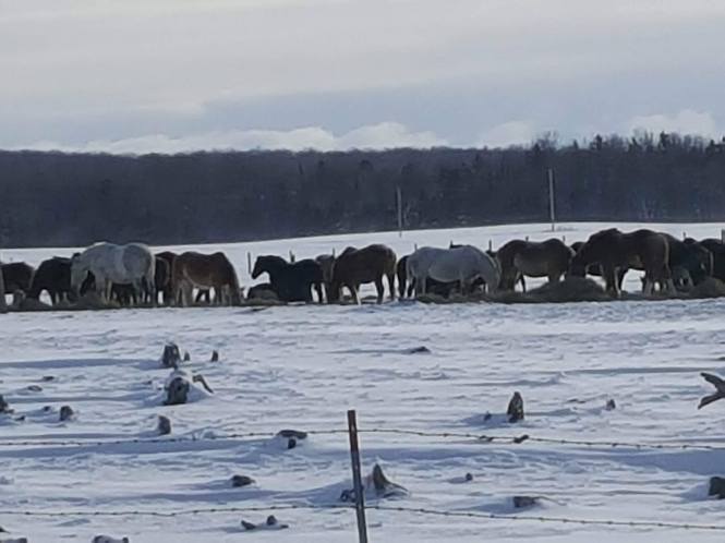
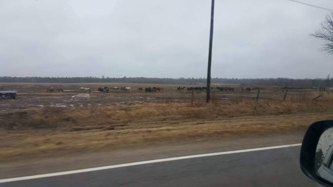
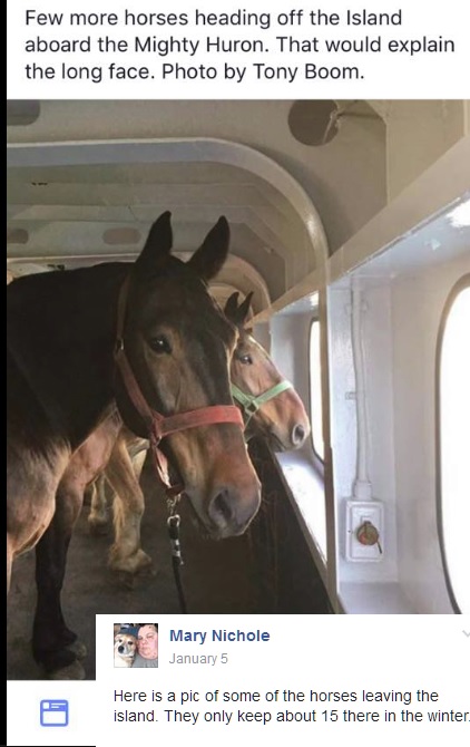
Our sources say that the farm caring for the horses is doing the bare minimum – if  that – some say they are warned in advance about inspections.

Since we have not been able to reach the Mackinaw Island big wigs – we presume they will say we are nuts.

In an effort to bend over backwards to be fair, U.P. Breaking News is issuing a blanket denial for all those involved with Mackinac island horses (meaning the horses are treated well – maybe fantastic – and this topic is not an issue) – We issue the denial on their behalf until we hear from them.

You see, they already do not like this reporter on Mackinac Island – because back in the day – while working at TV6 – several of us were invited to a writer’s conference on the Island.

I had the unmitigated gall to question the treatment of the workers – at least then paid less than minimum wage – with questionable housing quarters.
These summer employees are shipped in from the poor islands in the warmer climates – but many are dressed like the old south.

If you own this farm – please contact U.P. Breaking News – that goes for the same for Mackinac islands officials – call us. You are welcome to make a response and/or write your own opinion editorial. U.P. Breaking News wants to hear from Island officials, carriage tours officials, farm officials, and those who police this kind of thing in Mackinac and Chippewa counties.

U.P. Breaking News has been contacted by U.P. residents who say they are opposed to the way Mackinaw island horses are treated during the winter – while revered during the summer at the island that is like the Antebellum South (like one of those old Disney cartoons from way back) and popular with Michigan’s richest residents.

2017-mackinac-horses-jan-2017-1Whether you call it “Mackinac Island” or “Mackinaw Island” – it is a place that can truly claim to be “someplace special” – like no other in the Upper Peninsula where the poverty and unemployment rate have reached staggering proportions – and even people are freezing to death in the cold.

There was a time when our forefathers migrated to the U.P. – when people had the guts to question things. Not sure much of that spirit exists. What do you think Yoopers? Our sources say U.P. residents do not want to ask questions – but some newcomers are shocked at some of the realities of the U.P. compared to how this area has been viewed elsewhere.

One sources said that many U.P. residents are looking for “someone who is willing to ask questions without a negative effect on us or our children.” Well, U.P. Breaking News is broaching this and other questions never before asked by the media.

One example provided to U.P. Breaking News is a farm on 15 Mile Road in Barbaeu, MI.

“It is a house with 2 large pole barns used for storage. In the mass fields sprawling behind it, are about 80% of Mackinac islands horses,” sources say

The following photographs – was provided by several sources – the photos with snow were just taken – and the others in the fall of 2015

2017-mackinac-horses-jan-2017-32017-mackinac-horses-jan-2017-22017-mackinac-horses-jan-2017-1mackinac-horses-4-2015mackinac-horses-3-2015mackinac-horses-2-2015mackinac-horses-1-2015

“This place has been investigated, with (forewarning) notice, allowing the owners to move the machinery out if the barns, put the horses in the barns and they pass,” The reality is however, these horses don not have shelter. Of any kind.”

This despite “recent wind storm, recent ice storm, and recent drop in temperatures,” a source says.

“Perhaps you could bring this to the public eye. Have a light shed to let visitors” of Mackinac island just “knew these horses are not on ‘vacation.” But merely trying to survive their elements.”

“They are not relaxing, or even have blankets. They are knee deep in their feces, mid, and snow, huddling, trying to not die.”

The photos from the fall of 2015 “show their fields, and the three out buildings.”

“Even if they used the outbuildings for the horses, it big enough for the amount they have.

“As you can see, no leantos, no nothing,” our sources said.

“We think its important to know, that the price each tourist pays for carriage rides, and carriage tours,.”

The profits “clearly does not go towards the horses well being, but into the company’s pocket.

“These horses are mascots for Mackinac Island, and are continuously highlighted in all publishing, commercials and other public media, however are not taken care of,” sources asks and tells U.P Breaking News.

wx-temps-at-time

The most recent photos – January 2017 – show the horses outside in a “wind chill of -7.” and “again with no shelter.”

“One horse trough for water. No shelter absolutely no protection the barns are full of hay and machinery.”

“The doors are open so you can see inside of them it is 9 degrees out with and chill is -16 they have no trees they have at stumps and very little in the field.”

“No shelter absolutely no protection the ‘barns’ are full of hay and machinery the doors are open so you can see inside of them.”

“Yet it is 9 degrees out side with a wind chill of -16.”

“They have no trees all they have a stumps and very little hay.”

“These horses are owned by Mackinaw Carriage Tours and the farm who is supposed to be taken care of them is Atkins farms”

“Their coat is isn’t the issue here … the issue is, they have NO shelter, no windscreen, no blankets, no lean-toes.”

We “just want people to know that carriage tours” make a lot of money for the Mackinaw Island – hundreds of thousands of dollars annually just from rider fees.

mackinac-horses-leaving-the-island

Scroll down to see public comment when we posed question on Facebook:

Related info:

Just surviving or comfortable (from google search)?
How do horses tolerate the cold?

In the absence of wind and moisture, horses tolerate temperatures at or slightly below 0°F. If horses have access to a shelter, they can tolerate temperatures as low as -40°F. However, horses are most comfortable at temperatures between 18 and 59°F, depending on their hair coat.

http://www.extension.umn.edu/agriculture/horse/care/equine-winter-care/

https://www.mackinacisland.org

https://www.mackinacisland.org/visit/activities/horses-tours-bikes/

http://www.farmandranchguide.com/news/livestock/tips-to-help-cattle-cope-with-cold-weather/article_28d62f6a-74c7-11e3-8b8a-001a4bcf887a.html

http://www.vetwholesaler.co.uk/weather-warning-for-livestock-owners/

http://www.freep.com/story/news/local/michigan/2014/11/05/macknac-island-horses/18551913/

http://www.saintignace.org/gallery/horses-off-the-island/

http://www.cindysridingstable.com/


U.P. Breaking News Mackinac Island Horses – and all U.P. horses – Advisory/Expose – when is it cruelty – what temp?
When we publish these photos – we want to include experts on the topic – are you one?
1-5-17 1 p.m. ET Mackinac shows off horses in the summer and leaves them outside in below zero weather in winter – why why??
We will be publishing the photos today or tomorrow – as we are working on numerous other new stories at this hour.
U.P. Breaking News wants experts to tell us – when is it too cold for horses to be outside?
Same for other animals like dogs
It seems there is no law that exactly says when it is cruel to leave animals outside. You see they show off these horses in the summer – and throw them to elements in the winter. We will be showing some shocking photos from two years of this.

Responses included:

Angela Kiviniemi – Horses can stay outside in the winter. As long as they’re being fed, the water isn’t frozen over, and they haven’t been shaved. They actually grow a winter coat that keeps them warm during inclement weather. All it took was Google for me to find out this information.

Message · 12 · January 5 at 1:40pm

Ed Nephler – Wow, reporting that horses stay outside in the winter. Really? You call that news? lol Damn! They are different than dogs, most are draft horses and use to being outside all the time. They grow heavy coats for protection. It’s no wonder why you have been fired from most your jobs…all you do is hype bullshit.

Message · 6 · January 5 at 2:59pm · Edited

Brant G Haynes – They stay outside here in Alaska as well. Maybe this dude needs to bone up on his equine studies.

Message · 3 · January 5 at 3:46pm

Rebecca Oberstar – horses can still get frostbite in winter. They should have some sort of windbreak.

January 5 at 11:08pm

Amanda Rose – There are at least 3 huge barns on the island that stay well stocked. The island also has 4 full time vets there year round as opposed to one human doctor year round.

Message · 13 hrs

ice-on-lashes-but-says-horse-is-warm

Sarah Toutant – There is literally ice on her eyelashes and she is still warm. You have to understand the coats a horse has to understand It is not cruel. Also, they will shelf themselves from the wind by going into a shelter,trees,or by standing closely to one another. I promise you if these horses are fed,this isn’t abuse.

Message · 5 · January 5 at 5:54pm

——-

Rodney Riesland There he goes again reporting on something he has no idea about and without doing basic research. Just trying to stir up some DRAMA!

Sarah Toutant – Horses stay outside year round. Their hair acts an insulation. They eat all day because it helps keep them warm. Most get blanketed but not all need it.
They don’t shave the horses on the island, they get very fuzzy.
Horses that are shaved usually go…See More – (Go to our News/Personal FB pages)

January 5 at 5:51pm

Christine Corp Arbib Just like all news reporting. When there is nothing, you have to make something up. You have to be kidding or apologize on this one. Should the horses be sent to FL or brought in the house? Seriously – I want to know what your solution is. Think I will let you go. It’s just gotten tabloid ridiculous.

January 5 at 2:25pm · Edited

Christine Corp Arbib On second thought I think I’ll stick around to see what asinine “news” you will next be reporting.

January 5 at 2:21pm

Natalie Irene Christine Corp Arbib Provides good entertainment

January 5 at 4:33pm

Jane Rogers Shocking photos of horses outside in the winter? They grow under coats that keep them warm in the winter, in extreme temperatures owners will put blankets on them or try to keep them in barns.

Do your shocking photos include these horses next to the…See More (Go to our news/personal FB pages to read more)

20 hrs

Karen Waite:
http://www.extension.umn.edu/agriculture/horse/care/equine-winter-care/

Message · 6 · Yesterday at 5:18am

Mary Nichole Where did you get that info. They ship most of the horses off the island in the winter. And they have coats/ blankets for the horses in the winter.

January 5 at 2:38pm

Mary Nichole – Here is a pic of some of the horses leaving the island. They only keep about 15 there in the winter.

January 5 at 3:07pm

mackinac-horses-leaving-the-island

Bobbi Jo – Do you people know how to say anything nice ever? Same bitchers all the time. Must be your life’s journey. Sad

January 5 at 5:36pm

Tony Kulie – I smell award winning Journalism on this one!

Message · January 5 at 3:36pm · Edited

Judy Hutnik Bonello – The horses are sent to a farm in the U. P. where they are fed, etc. Who runs this site!?!?

8 hrs

Nathan Larsh Google. – Use it.

January 5 at 2:28pm

Kami Batho – Hmmm…I guess we should bring the cows in as wel

Pamela Ekdahl – Heifers no. Cows yes. You will not get milk production from a cow left outside vs one kept in

Message · 14 hrs

Amanda Rose – Chickens, pigs, goats…. They all need their own rooms too

Also posted the question on my personal Facebook page and received these comments:

Tod Poirier – Animals are adapted better to survive cold weather than we are. Just because you or I are cold doesn’t mean the animals are suffering. If the animals have some sort of shelter they can use to get out of the elements they’re typically fine – a windbre…See More

January 5 at 1:18pm

Dean M Dove – Horses and other animals eat hay, Hay will keep them warm from the inside out.We put hay on a side walk to keep the warm so it can harden. It keeps them warm and with the thick skin they have.The hide of an animal was made to keep them warm, that’s why we make Coats out of the hide.

January 5 at 10:17pm

Alicia Guiliani Diane Peppler – do you have any input? Tammy Collins?

January 5 at 1:27pm

Greg John Peterson – Thank you Tod Poirier – That is the info I am trying to find out – when should horses be required to be inside? I am not an expert. I can react more as a sympathetic human – like telling people take a blanket and spend a night in your dog’s outdoor house. See if ya like it? It is more of a gut reaction.

January 5 at 1:29pm

Greg John Peterson Wish that Dr. Pol guy could tell us. My girlfriend loves that show. I have watched it a few times.

January 5 at 1:30pm

Greg John Peterson Tod Poirier Sounds like the human emotion versus reality are two different things – certain animals (dogs) are better adapted than others. I can not help but feel for a horse standing outside in below zero weather – but maybe that is truly OK and not …See More

1 · January 5 at 1:34pm

Tod Poirier I haven’t.
I think a person should provide an animal with some kind of shelter, but most animals have survived in the wild long before we got to them.

January 5 at 1:36pm

Sadie Mae – Cold Weather Tips for Horse Owners

http://www.thehorse.com/articles/35015/cold-weather-tips-for-horse-ownershttp://www.thehorse.com/articles/35015/cold-weather-tips-for-horse-owners

Cold Weather Tips for Horse Owners

Here are six important tips to help owners keep horses healthy and safe during the cold days of winter.

http://www.thehorse.com

http://www.thehorse.com/articles/35015/cold-weather-tips-for-horse-owners

January 5 at 1:40pm

Sadie Mae – In the absence of wind and moisture, horses tolerate temperatures at or slightly below 0°F. If horses have access to a shelter, they can tolerate temperatures as low as -40°F. However, horses are most comfortable at temperatures between 18 and 59°F, depending on their hair coat.

January 5 at 1:41pm

Linnea Kelly Danielle Sawyers I bet you’d have something to say about this.

January 5 at 1:43pm

Kylie Gearhart – Now it’s been a while since I have been to mackinaw island but I recall taking a carriage tour and they showed us the winter stables. I’m pretty sure they aren’t just left out in the winter. And it’s not like they are alone all winter there are people on the island that would take them out and let them in.

January 5 at 1:58pm

Patti Ness My horses are outside during the day and stabled at night. They have quality hay all day. Everyone is fine. If it’s excessively brutal, the come in early and get extra hay. I have winter blankets for them but rarely need them. My senior stallion (29 yr…See More

January 5 at 2:15pm

Alicia Guiliani – I was just going to ask how can you tell if they are cold lol, I didn’t know they shiver. Do their hooves protect them from the cold ground?

January 5 at 3:02pm

Patti Ness – Yes their hooves do a good job 🙂

January 5 at 3:47pm

Danielle Sawyers – Our horses are outside during the day and in the barn at night during the winter months. Some nights we have to catch them as they don’t want to come in. Some horses prefer being outside. From experience it needs to be consistent, they can’t be brought in once and a while then left out again as they will get sick. They can adapt to weather conditions easily. We don’t use blankets because of sweating issues, as that leads to other problems. Some breeds of horses get very thick winter coats and would not do well in a barn all night. Horses in the wild adapt to the changing seasons and survive some brutal winters.

January 5 at 2:41pm

John R. Manninen – K WHAT NEXT ?? IS IT TO COLD FOR WHITETAIL DEER? I can understand how people feel, as I also do for animals. But where does reasoning and common scense fit it. WHAT NEXT Rabbits, birds ??

January 5 at 9:45pm

Jill L. Fries – Depends on the breed but I had horses for several years in Marquette County. They had a shelter to block the wind but even on the coldest days and I would check on them several times a day they were always plenty warm

January 5 at 9:56pm

Anthony Fortunato – Most of the horses used are not on the island in the winter they winter in farms downstate and some in the U.P.

2017-mackinac-horses-jan-2017-32017-mackinac-horses-jan-2017-22017-mackinac-horses-jan-2017-2-copy2017-mackinac-horses-jan-2017-1